 MineArchive
Bronfloyd Mine
| Also known as | Bron Floyd Mine, Bryn Llwyd Mine, Bronllwyd Mine |
|---|---|
| Location | Penrhyncoch, Trefeurig, east of Bow Street, Ceredigion — 52.4331, -3.9724 (exact) |
| Commodities | Lead, Copper, Silver |
| Type | Metal |
| Worked | c. 1600–1892 |
| Maximum depth | About 104 fathoms (No. 3 shaft, about 190 m) |
| Operators | Thomas Bushell (1640–1645) — Bought the mine from Lady Myddelton; working it about 1645. John Barton Balcombe (1854–?) — Developed the mine from 1854 and introduced new dressing machinery; one of the cross-cuts carries his name. Sir Hugh Myddelton — Presumed to have worked it about 1600; it passed from Lady Myddelton to Thomas Bushell. Company of Mine Adventurers — Worked the mine after Myddelton and Bushell. Lewis Morris — Worked it through levels and an opencast in the mid-eighteenth century. |
Bronfloyd, a corruption of Bryn Llwyd, is a lead mine on the slope south of Nant Silo near Penrhyncoch, east of Bow Street. It is one of the oldest mines in Cardiganshire, worked by Thomas Bushell in the 1640s and probably by Sir Hugh Myddelton before him, and it had a long second life from 1851 to 1892 that returned more than 6,400 tons of lead ore. The scheduled remains show every stage of lead mining within a single field.
Location
Recorded location. The large pin is this mine; the small round markers are the nearest mines on record. Click one for its page. View on full map
History
Bronfloyd ranks with Goginan, Talybont and Darren among the oldest mines in the county. Thomas Bushell was certainly working it about 1645, having bought it from Lady Myddelton, to whom it had been granted with those other mines by James I. It is presumed from this that it was one of the mines Sir Hugh Myddelton worked about 1600. Working continued under the Mine Adventurers, and in the middle of the eighteenth century Lewis Morris worked it through levels and an opencast.
The modern mine dates from 1851, when it reopened and the lodes were followed down from four shafts. From 1854 it was developed with great success by J. B. Balcombe, who brought in new dressing machinery and methods of his own. Ore was returned in 36 years between 1851 and 1892, to a total of 6,423 tons of lead ore, which yielded 4,714 tons of lead and 35,024 ounces of silver. The best year was 1871, with 550 tons. A single parcel of copper ore, 23 and a half tons, was sold in 1865.
These are large figures for a mine that had already been picked over for two centuries and more. The ground stoped on the two productive lodes is put at about 4,000 square fathoms, which means the lodes yielded over two tons of ore to the square fathom. Production stopped in 1892.
Geology
There are three lodes, of which only the north and middle lodes proved productive; the south lode, seen in a shallow adit, is hard and brecciated with much quartz and spots of galena. At the 70-fathom level the two worked lodes are 28 to 30 fathoms apart. The ore in each lay in a shoot 30 to 40 fathoms long dipping westward at about 20 degrees from the vertical, with a further bunch stoped above the old adit west of No. 1 shaft.
Geological setting: Veins and Lodes (well documented example)
Workings
The old mine was drained by an adit about 280 feet above sea level, begun as a cross-cut east of the dressing floors and carried west on the middle lode. A newer adit cross-cut, driven south from the mine buildings, did away with the upkeep of the long old one. No. 2 shaft, beside the track south of the dressing floors, went down 50 to 52 fathoms on the middle lode, with a winze below to the 70. No. 3 shaft met the north lode about 80 fathoms down and was continued vertically to about 104, with levels at 52, 62, 73, 84, 96 and 104 fathoms; cross-cuts named Barton's, Lewis's, Lloyd's and Balcombe's joined the two lodes. Before 1922 a run in the stope above the 50-fathom level destroyed No. 3 shaft below the 80 and broke through to the surface, leaving a deep hollow with the lode showing in its sides. No. 4 shaft was only a few fathoms deep.
Closure
Production ceased in 1892, the last year for which ore was returned.
What remains
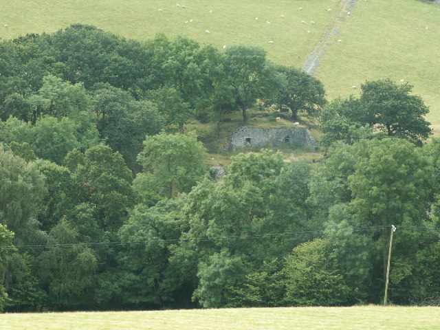
The site is a scheduled monument, designated on 28 June 1993, and is remarkably well preserved. The scheduling describes it as the only place in Wales that shows the full range of lead-mining processes in so small an area.
Within one field are an opencast pit, levels, shafts and an adit; a large building complex with two wheelpits that formed the dressing floors; a further wheelpit with a winding drum; and the leat that linked them. Two pump-rod tracks and a tramway run up the hill from the dressing floors to the workings. Buddles, ore hoppers and tramways are well preserved.
Related mines
- Cwmsymlog Mine — Sir Hugh Myddelton and Thomas Bushell worked both mines in the seventeenth century.
- Goginan Mine — Myddelton, Bushell and the Company of Mine Adventurers each worked both mines.
- Llywernog Mine — John Barton Balcombe, who developed Bronfloyd from 1854, also ran Llywernog, and Lewis Morris had worked both a century earlier.
Nearby mines
- Great Darren Mine — 1.0 miles (1.7 km) SE
- Court Grange Mine — 1.3 miles (2.1 km) N
- South Darren Mine — 1.5 miles (2.4 km) E
- Elgar Mine — 1.6 miles (2.5 km) N
- Mynydd Gorddu Mine — 1.6 miles (2.5 km) N
Straight-line distance, within 9 miles (15 km). Show on the map.
People
- Thomas Bushell · proprietor, 1640–1645 — via the operator record
- Sir Hugh Myddelton (d. 1631) · proprietor — via the operator record
Further reading
The Royal Commission's site record, with survey drawings and photographs of the wheelpits, hoppers and dressing floors.
View sourceCadw's description of the scheduled remains and the reason for designation.
View sourceSources
- (primary) Lead and Zinc: The Mining District of North Cardiganshire and West Montgomeryshire (Special Reports on the Mineral Resources of Great Britain, vol. XX), O. T. Jones, 1922 — Memoirs of the Geological Survey
- (primary) Bronfloyd Lead Mine; Bryn Llwyd (NPRN 33805) — Coflein, Royal Commission on the Ancient and Historical Monuments of Wales
- (primary) Scheduled Monument CD152: Bronfloyd Leadmine — Cadw
- (primary) Mine plan: Bronfloyd Mine, SN68SE 1; location, notes, letters and history of mines 1852-1910 (KP16928) — British Geological Survey
Record created: 18 November 2026 · Last researched: 18 November 2026