 MineArchive
Blackhall Colliery
| Location | Blackhall Colliery, near Peterlee, County Durham — 54.7461, -1.2884 (exact) |
|---|---|
| Commodity | Coal |
| Type | Coal |
| Worked | From 1909 (sinking)–16 April 1981 |
| Maximum depth | Twin shafts, 22 ft diameter, 193 fathoms (about 1,158 ft / 353 m) deep |
| Operators | Horden Collieries Ltd (1909–1947) |
Overview
A Durham coastal colliery whose conveyor once tipped tons of waste straight onto the beach below it, staining the sand black enough to serve as the setting for Get Carter's climactic chase — and whose closure triggered one of the North East's most thorough beach clean-up operations.
History
Blackhall Colliery was sunk from 1909 by Horden Collieries Ltd on the County Durham coast, with coal drawing beginning in 1914 and output eventually exceeding 3,350 tons a day. Its twin shafts, each 22 feet in diameter, reached 193 fathoms (roughly 1,158 feet); the colliery worked the Main, Low Main, Hutton, Five Quarter and, later, Harvey and Yard seams at different periods, producing household, gas, coking, manufacturing and steam coal. Employment grew rapidly from 240 (mostly still sinking) in 1910 to a peak of 2,490 in 1950, before a long, slow decline to 1,353 by 1980. The colliery passed to the National Coal Board at nationalisation in 1947 and closed on 16 April 1981.
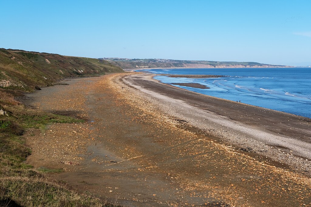
For decades, waste from the colliery was carried out along an aerial conveyor and tipped directly onto Blackhall's beach, staining the sand black with colliery spoil; it was this coal-strewn beach, rather than the colliery itself, that gave Blackhall its most famous cultural appearance, as the setting for the climactic beach chase in the 1971 film Get Carter. After closure, around £10 million was spent removing the conveyor and its concrete tower and clearing tons of coal waste from the beach, which has since been restored.
Geology
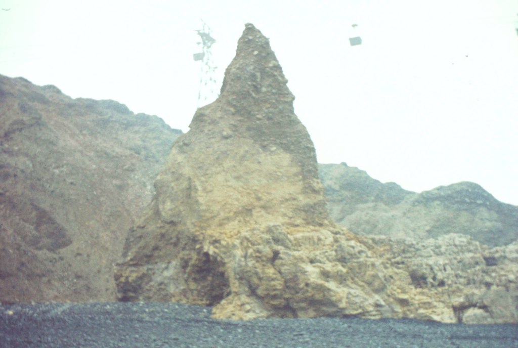
Blackhall worked the Durham Coal Measures out under the North Sea, taking the Five Quarter, Hutton, Main, Low Main, Top Hutton, Harvey and Yard seams at various times, in thicknesses the colliery's own description gives as three to six feet. The coast here is magnesian limestone, the Permian rock that gives Blackhall Rocks their cliffs, sea caves and orange beach cobbles and carries the grassland and cliff flora the coast is now protected for; the Coal Measures lie beneath it, which is why the colliery had to sink 193 fathoms to reach coal at the shore.
Geological setting: Sedimentary Beds and Seams (well documented example)
Workings
Worked from twin shafts, each 22 feet in diameter and 193 fathoms deep, through a sequence of seams that changed over the colliery's working life: Five Quarter and Low Main from 1915; Hutton, Main and Low Main added through the 1920s-30s; Harvey introduced by 1965; narrowing back to Hutton and Low Main alone by the colliery's final years.
Closure
Closed on 16 April 1981. Its neighbours on the Durham coast followed within a decade, the last of them, Easington, in 1993, ending the coastal coalfield that had begun in the 1840s and had employed some 26,000 people in the district of Easington.
What remains
The colliery site and its former waste conveyor were cleared after closure; around £10 million was spent removing the conveyor's concrete tower and clearing coal waste from the beach, which has since been restored.
Blackhall was one of four collieries tipping on the Durham coast, with Easington, Horden and Noses Point. At its height the coast took 2.5 million tonnes of waste a year, and over 40 million tonnes in all, blackening 12.27 km of a 17.12 km coastline. The Turning the Tide project, running most intensively from 1997 to 2002, removed or dispersed 1.3 million tonnes of debris, created 80 hectares of regenerated land and 225 hectares set aside for wildlife, and installed or improved 17.5 km of coastal footpath. Natural erosion has carried off much of the rest over the twenty years since. Blackhall Rocks is now a nature reserve and a Site of Special Scientific Interest, and the coast has taken a UK Landscape Award; divers and beachcombers record cuttlefish, squat lobsters, sea slugs and, in 2023, an octopus in the rock pools, on a beach that within living memory was described as an industrial wasteland.
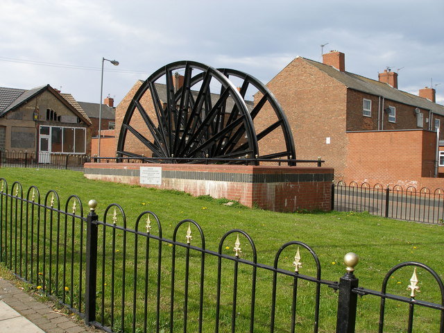
No specific surviving colliery structures are recorded; a preserved pit wheel from the colliery is documented in a public photograph.
Related mines
- Horden Colliery — Both were sunk and worked by Horden Collieries Ltd, and both tipped their waste onto the same stretch of Durham coast until the Turning the Tide clean-up.
Nearby mines
- Castle Eden Colliery — 1.5 miles (2.5 km) SW
- Horden Colliery — 1.9 miles (3.0 km) NW
- Hutton Henry Colliery — 3.2 miles (5.1 km) SW
- Easington Colliery — 3.2 miles (5.2 km) NW
- Wingate Grange Colliery — 3.9 miles (6.3 km) W
Straight-line distance, within 9 miles (15 km). Show on the map.
Culture
- Blackhall Colliery Welfare F.C. (Sports)
The colliery the club was founded to serve and named for. - Durham Miners' Gala (Labour)
Blackhall Lodge's banner carries the motto 'Need before greed'. - Get Carter (1971) (Screen)
The film's final scenes were shot on the beach below Blackhall Colliery, black with the colliery's spoil, and use its aerial conveyor to dispose of a body.
What's uncertain
Points where sources disagree or the record could not be settled; both accounts are kept. All open questions in the archive.
- Wikipedia's account states that the first coal was drawn in 1913, a year earlier than the Durham Mining Museum's own 1914 commencement date. (disputed) 2
- The blackened beach was used for the climactic chase in Get Carter (1971) and, according to a 2023 account of the site's recovery, also as a location for Alien 3. (uncertain) 4
- The BGS mine-plans catalogue holds a Mining Remediation Authority abandonment plan titled 'Blackhall' (catalogue D1360, Hutton 'L', dated 1974); the catalogue gives no location and the plan's details do not clearly tie it to this working, so it may belong to another of the same name. (uncertain) 5
Recorded claims
Individual factual claims, each attached to the source(s) that support it below. Where sources disagree, both are kept.
- Blackhall Colliery was sunk from 1909 by Horden Collieries Ltd; its twin shafts, each 22 feet in diameter, reached 193 fathoms, and coal drawing commenced in 1914 with output eventually exceeding 3,350 tons a day. 1
- Wikipedia's account states that the first coal was drawn in 1913, a year earlier than the Durham Mining Museum's own 1914 commencement date. (disputed) 2
- Employment grew from 240 (mostly sinking) in 1910 to a peak of 2,490 in 1950, before declining to 1,353 by 1980. 1
- Blackhall's coal-blackened beach, fed by the colliery's own waste conveyor, was used for the climactic beach chase in the 1971 film Get Carter. 2
- Around £10 million was spent after closure removing the waste conveyor and its concrete tower and clearing tons of coal waste from the beach, which has since been restored. 2
- Blackhall was one of four collieries tipping waste on the Durham coast. At its height the coast received 2.5 million tonnes a year and more than 40 million tonnes in total, affecting 12.27 km of a 17.12 km coastline. 3
- The Turning the Tide project removed or dispersed 1.3 million tonnes of debris, regenerated 80 hectares and set aside 225 hectares for wildlife habitat along the Durham coast. 3
- Blackhall Rocks is now a nature reserve and Site of Special Scientific Interest whose marine life has been documented by volunteer divers; the coast has received a UK Landscape Award. 4
- The blackened beach was used for the climactic chase in Get Carter (1971) and, according to a 2023 account of the site's recovery, also as a location for Alien 3. (uncertain) 4
- The BGS mine-plans catalogue holds a Mining Remediation Authority abandonment plan titled 'Blackhall' (catalogue D1360, Hutton 'L', dated 1974); the catalogue gives no location and the plan's details do not clearly tie it to this working, so it may belong to another of the same name. (uncertain) 5
- Located at about 54.746 N, 1.288 W. 2
Photographs & further reading
The regeneration project's own figures for the coast Blackhall tipped on: tonnages, the four tipping collieries, the length of coast affected and the habitat created.
View sourceShaft dimensions, owners, the seams worked year by year from 1915 to 1980 and the employment table from 1910 to closure, with the colliery's own description of its output.
View sourceSources
- (primary) Durham Mining Museum - Blackhall Colliery — Durham Mining Museum
- (secondary) Blackhall Colliery — Wikipedia
- (primary) Durham Coastline Facts and Figures — Turning the Tide, Durham Heritage Coast
- (observational) From Industrial Wasteland to Nature Reserve: The Amazing Recovery of Blackhall Rocks — Harry Linley
- (primary) BGS / Mining Remediation Authority mine plans: BLACKHALL — British Geological Survey / Mining Remediation Authority
Record created: 27 August 2026 · Last researched: 11 September 2026