 MineArchive
Auckland Park Colliery
| Location | Coundon Grange, Bishop Auckland, County Durham — 54.6519, -1.6501 (approximate) |
|---|---|
| Commodities | Coal, Fireclay |
| Type | Coal |
| Worked | 1864–1946 |
| Maximum depth | 150 fathoms (900 feet) to the Brockwell seam |
| Operators | Black Boy Coal Company (1863–1872), Bolckow, Vaughan and Company (1872–1929), Dorman, Long and Company (1929–1947), National Coal Board (1947–1946) |
Overview
A County Durham coking colliery at Coundon Grange, south-east of Bishop Auckland, created in 1864 when the Black Boy Coal Company renamed its Machine Pit. Under Bolckow, Vaughan & Co. from 1872 it worked the Harvey and Brockwell seams at 110 and 150 fathoms and turned its entire output into coke in 430 ovens for the company's own ironworks, employing some 1,200 men and boys in the 1890s and 1,377 by 1910. Four sinkers were killed in 1863 when the cradle they were working from overbalanced and dropped them 51 fathoms down the shaft. The colliery closed in 1946 and the site was kept on as a pumping station.
History
The Black Boy Coal Company was working the Machine Pit at Coundon Grange when, in 1864, it renamed the pit Auckland Park Colliery; a North and a South Pit followed. In September 1863, during the sinking, four men were killed in the South Pit shaft (see Disasters, below). Bolckow, Vaughan & Co. took the colliery over on 1 April 1872, Dorman, Long & Co. Ltd on 1 November 1929, and the National Coal Board at nationalisation.
Whellan's 1894 Directory of County Durham describes the colliery at its height: the Harvey seam, 3 feet 8 inches thick at 110 fathoms, and the Brockwell, 4 feet 9 inches at 150 fathoms, together producing 1,500 tons a day; 430 coke ovens converting the whole of that output into coke for Bolckow, Vaughan's own ironworks, with the waste gas from the ovens used to heat the boilers; a firebrick works; coking coal washed by patent machinery; ventilation by a fan 45 feet in diameter; and 1,200 men and boys employed. The colliery owners had built the school in 1859 — enlarged three times, by the 1890s taking 700 children — and provided and supported the reading room and library opened in 1868, whose 500 volumes and newspapers served the villages of Auckland Park, Brickyard, Black Boy and Close House, inhabited entirely by the men employed at the collieries.
Employment peaked at 1,377 in 1910 and then fell sharply, to 529 by 1925 and 118 by 1930, when the pit reopened in April on the Brockwell and Harvey alone. The Iron & Coal Trades Review found in 1937 that the whole of the coal was still hand-won, that the pumping duty was 1,600 gallons a minute, that the lower measures were being worked out deliberately to reduce the water to be pumped, and that a heading was being driven to connect with Leasingthorne Colliery three miles away, partly through coal and partly through a fault of 120 feet. The Brockwell seam's abandonment plan, deposited for 1943, is among the colliery's plans held by the Mining Remediation Authority.
Geology
The colliery worked the Coal Measures of south-west Durham. Whellan's 1894 Directory gives the Harvey seam 3 feet 8 inches thick at 110 fathoms and the Brockwell 4 feet 9 inches at 150 fathoms, both high-class coking and house coals; over its life the colliery also worked the Busty, Low Main, Three Quarter, Five Quarter, Main, Hutton and Park seams, and raised fireclay from the North Pit between the 1890s and 1910. Water was the standing problem — the 1930s pumping duty was 1,600 gallons a minute, and the lower measures were worked out deliberately to reduce it. A fault of 120 feet lay between the colliery and Leasingthorne, three miles off.
Geological setting: Sedimentary Beds and Seams (well documented example)
Workings
Three pits — the Machine, the North and the South — with the North and South worked as separate returns for much of the colliery's life, the North on the Brockwell and Busty and the South on the Harvey and Park. Ventilation was by a fan 45 feet in diameter. The whole output went into 430 coke ovens on the site, the waste gas from which heated the boilers, with a firebrick works alongside and the coking coal washed by patent machinery. Coal was hand-won to the end. The inspectors' accounts of deaths at the colliery turn repeatedly on falls in the broken workings, where juds were drawn and the roof over a wide area could come away at once.
Closure
The Three Quarter, Five Quarter, Main, Low Main, Hutton, Harvey, Busty and Brockwell seams were abandoned on 25 June 1929, the plan lodged as no. 9,943 under Auckland Park and Black Boy, Gurney and Pasture, across the parishes of Coundon Grange, Coundon, Pollard's Lands and Westerton. The pit reopened in April 1930 on the Brockwell and Harvey with about a hundred men, and closed in 1946. The site was then used as a pumping station, still employing a handful of men into the 1960s.
What remains
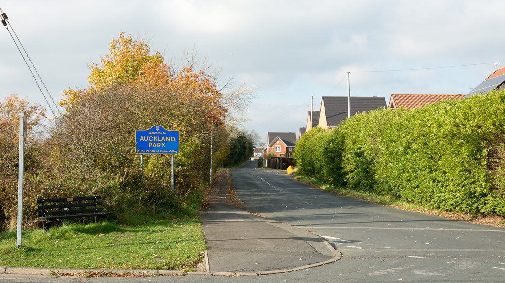
Nothing is recorded of what survives on the colliery site. The villages it was sunk for — Auckland Park, Coundon Grange, Black Boy and Close House, now within the parish of Dene Valley — remain.
Redevelopment
The colliery was kept on as a pumping station after production ended in 1946; no later redevelopment of the site is recorded.
Related mines
- Black Boy Colliery — Auckland Park Colliery was Black Boy's Machine Pit until it was renamed in 1864; both were later worked by Bolckow, Vaughan.
- Dean and Chapter Colliery — Both passed through the same two ironmaking owners: Bolckow, Vaughan & Co. and then Dorman, Long & Co. Ltd.
- Eldon Colliery — From 1950 Eldon's pumping was returned with Auckland Park Colliery.
Nearby mines
- Black Boy Colliery — 0.1 miles (0.1 km) W
- Adelaide Colliery — 0.8 miles (1.2 km) S
- Eldon Colliery — 0.9 miles (1.4 km) SE
- Etherley Dene Colliery — 1.4 miles (2.2 km) W
- Princes Street Drift — 1.4 miles (2.3 km) S
Straight-line distance, within 9 miles (15 km). Show on the map.
Disasters & major incidents
-
Auckland Park Colliery Shaft Accident, 1863
12 September 1863 · Winding / Shaft Accident · 4 fatalities
Four sinkers were killed at the South Pit of Auckland Park Colliery on 12 September 1863 when the half cradle they were working from overbalanced. Seven men were on it, connecting cast-iron pipes to the tubbing; several went to one side to lift a heavy pipe, their weight tipped the cradle, and four of them fell about 51 fathoms into five feet of water at the bottom of the shaft. The cradle swung back level and the other three were unhurt. -
Auckland Park Colliery fall, 1906
2 August 1906 · Collapse / Roof Fall · 2 fatalities
On 2 August 1906 a hewer and a pony putter were killed by the same fall of stone in the Harvey Seam at Auckland Park Colliery, near Bishop Auckland in County Durham. -
Auckland Park Colliery fall, 1907
3 May 1907 · Collapse / Roof Fall · 2 fatalities
On 3 May 1907 an extraordinary fall of stone in the Harvey Seam killed two hewers and injured a third at Auckland Park Colliery, near Bishop Auckland in County Durham.
Recorded claims
Individual factual claims, each attached to the source(s) that support it below. Where sources disagree, both are kept.
- The Machine Pit of Black Boy Colliery was renamed Auckland Park Colliery in 1864. 1
- Whellan's 1894 Directory gives the Harvey seam 3 feet 8 inches thick at 110 fathoms and the Brockwell 4 feet 9 inches at 150 fathoms, together producing about 1,500 tons a day. 1
- There were 430 coke ovens on the site converting the whole of the output into coke for Bolckow, Vaughan & Co.'s own ironworks, the waste gas from them heating the boilers, with a firebrick works alongside and the coking coal washed by patent machinery; the pits were ventilated by a fan 45 feet in diameter and employed 1,200 men and boys. 1
- The colliery owners built the school in 1859, enlarged three times to take 700 children by the 1890s, and provided and supported the reading room and library opened in 1868 with 500 volumes. 1
- Employment peaked at 1,377 in 1910, fell to 529 by 1925 and 118 by 1930, and the pit reopened in April 1930 on the Brockwell and Harvey alone. 1
- The Three Quarter, Five Quarter, Main, Low Main, Hutton, Harvey, Busty and Brockwell seams were abandoned on 25 June 1929, the plan lodged as no. 9,943 under Auckland Park and Black Boy, Gurney and Pasture. 2
- The Iron & Coal Trades Review found in 1937 that the whole of the coal was hand-won, that the pumping duty was 1,600 gallons a minute, and that a heading was being driven to connect with Leasingthorne Colliery three miles away through a fault of 120 feet. 1
- The Mining Remediation Authority holds abandonment plan D634 for the Brockwell seam at Auckland Park, abandoned in 1943, with two further Auckland Park plans beside it. 3
Photographs & further reading
Pits, owners, seams and employment returns from 1883 to 1961, Whellan's 1894 and the Iron & Coal Trades Review's 1937 descriptions of the colliery, and the museum's list of men killed there with the inspectors' notes on each death.
View sourceJohn J. Atkinson's account of the accident that killed four sinkers, with his analysis of why a half cradle was used and what should be done to prevent a repeat.
View sourceSources
- (primary) Auckland Park Colliery — Durham Mining Museum
- (primary) Catalogue of Plans of Abandoned Mines for Auckland Park Colliery — Coal Authority catalogue, via the Durham Mining Museum
- (primary) AUCKLAND PARK (Mine Remediation Authority abandonment plan D634, BGS mine plans catalogue) — British Geological Survey / Mining Remediation Authority
Record created: 3 September 2026 · Last researched: 24 September 2026