 MineArchive
Ankness Colliery
| Location | Ankness, Bransdale, near Fadmoor, North Yorkshire — 54.3303, -1.0264 (exact) |
|---|---|
| Commodity | Coal |
| Type | Coal |
| Worked | By 1715–c. 1799 |
| Maximum depth | Unknown. |
| Operators | Matthew Foord (1715–1718), Luke and William Normington (1786–1799), Christopher Slingsby Duncombe |
Overview
A scatter of ten or so shafts on the east bank of Hodge Beck at the lower end of Bransdale, where the Duncombes of Helmsley were leasing coal already opened by December 1715, and which the Normingtons of the dale worked on a rent reckoned by the acre and the inch of seam until output stopped in 1799.
History
Ankness is the earliest dated coal working on the North York Moors. On 16 December 1715 the trustees of Thomas Duncombe of Helmsley Castle let to Matthew Foord, a Fadmoor yeoman, all the veins of coal already opened at Ankness at the lower end of Bransdale, with liberty to sink three new shafts on the moor and full rights of way for men, corves, wains and carts. The term was three years, the rent £100 a year paid quarterly, and Duncombe was to have forty chaldrons of coal a year free at the pit head whenever he chose. The wording shows that pits were already open and seams already worked, so mining had begun before 1700; nothing of those earlier workings is recorded.
In November 1780 James Gowlan and William Normington took the colliery from Christopher Slingsby Duncombe, paying £100 for each acre of coal worked at a thickness of 30 inches, more or less as the seam varied. By 1786 the lessees were Luke and William Normington, who held it until 1799. The estate agent D. Seaton measured the workings each year: in September 1787 1,920 square yards had been wrought in a seam between 10 and 17.5 inches thick, mean 14.5 inches, at £48 6s 8d an acre, and £19 3s 6d was due. In 1792 he reported very bad roads to the pits but a mine in other respects well managed; the Normingtons offered to make the rest of the road themselves if the estate mended Ellergate Bank above Sleightholmedale, and said they could then get as many coals as would serve half the country. In 1793 they were working northward for a new pit where the seam was nearly two feet thick, and the rate rose to £70 to £80 an acre.
Seaton's returns for 1786 to 1801 are the only run of output figures for a moorland colliery. The area worked each year, from 155 to 1,920 square yards at 14 to 21 inches, suggests between about 185 and 1,060 tons a year, the best years 1791 and 1794. Nothing was measured in 1786, when new pits were presumably being sunk, nor from 1796 to 1798, and after 1799 the colliery was no longer listed, which is taken as its closure.
Geology
A thin moorland coal: the seam measured at Ankness between 1787 and 1799 ran from 10 to 21 inches, averaging 14 to 15 inches in the early years and thickening northward, where a seam nearly two feet thick was reported in 1793. A borehole at Ankness proved a 0.3 m seam at a depth of 54.4 m.
Geological setting: Sedimentary Beds and Seams (historical documentary reference)
Workings
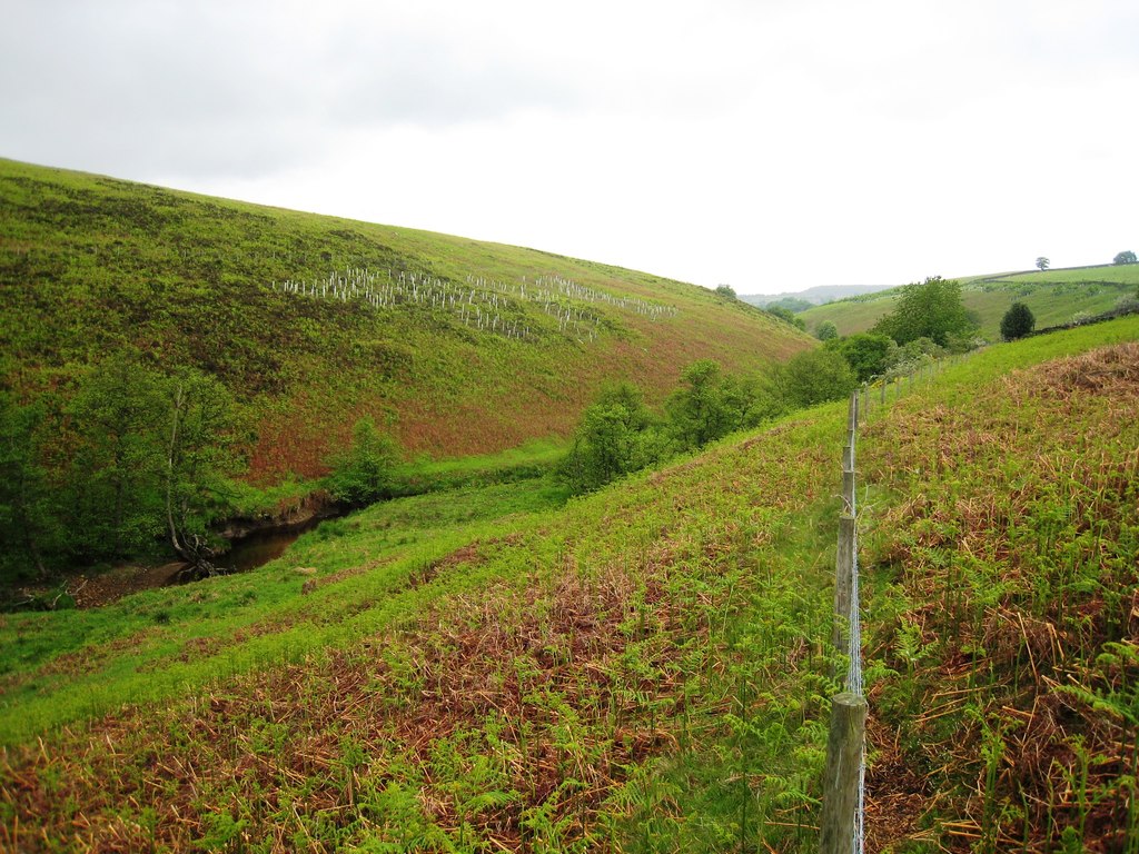
A group of about ten shafts on the east bank of Hodge Beck near Ankness Farm, sunk to a seam a foot or so thick and worked by the acre; in 1793 the lessees were driving northward for a new pit. The 1715 lease allowed three new shafts and provided for soughing, or draining by adit.
Closure
Output stopped from 1796 to 1798, resumed briefly in 1799 and was never listed again; the thin seam and the bad roads out of the dale, complained of in 1792, are the only reasons the records give.
What remains
The shaft mounds survive as earthworks on the moorland bank above the beck.
A scatter of shaft hollows and spoil on the east bank of Hodge Beck.
Redevelopment
None.
Nearby mines
- Rudland Colliery — 0.9 miles (1.5 km) E
- Sled Shoe Colliery — 4.2 miles (6.8 km) NE
- Weather Cote Colliery — 4.7 miles (7.5 km) W
- Blakey Colliery — 4.9 miles (7.9 km) NE
- Rosedale Ironstone Mines — 7.6 miles (12.2 km) E
Straight-line distance, within 9 miles (15 km). Show on the map.
What's uncertain
Points where sources disagree or the record could not be settled; both accounts are kept. All open questions in the archive.
- The 1780 lessee is given as William Normanton by the NMRS and William Normington by the moorland collieries survey. (disputed) 1,2
Recorded claims
Individual factual claims, each attached to the source(s) that support it below. Where sources disagree, both are kept.
- On 16 December 1715 the trustees of Thomas Duncombe of Helmsley Castle let the coal already opened at Ankness to Matthew Foord of Fadmoor for three years at £100 a year and forty chaldrons of coal, with liberty to sink three new shafts. 1,2
- In November 1780 James Gowlan and William Normington took the colliery from Christopher Slingsby Duncombe at £100 per acre of coal worked at 30 inches. 1,2
- Luke and William Normington leased the colliery from 1786 until 1799, after which it was no longer listed. 1,2
- In September 1787 the estate agent measured 1,920 square yards of coal wrought in a seam of 10 to 17.5 inches, mean 14.5 inches, at £48 6s 8d an acre, with £19 3s 6d due to the estate. 1,2
- In 1792 the agent reported very bad roads to the pits but a mine otherwise well managed, and the lessees offered to make the road if the estate repaired Ellergate Bank above Sleightholmedale. 1,2
- In 1793 the Normingtons were working northward for a new pit where the seam was nearly two feet thick. 1,2
- Output between 1787 and 1799, estimated from the area and thickness of coal measured each year, ran from about 185 to 1,060 tons a year, with no production in 1786 or from 1796 to 1798. 1
- The colliery is a scatter of about ten shafts on the east bank of Hodge Beck near Ankness Farm. 1
- A borehole at Ankness proved a 0.3 m coal seam at a depth of 54.4 m. 2
- The 1780 lessee is given as William Normanton by the NMRS and William Normington by the moorland collieries survey. (disputed) 1,2
Photographs & further reading
The Northern Mine Research Society's page, with the 1715 and 1780 leases and the agent's output table for 1786 to 1799.
View sourceA survey of the North York Moors coal workings, quoting the 1715 Ankness lease in full.
View sourceSources
- (secondary) Ankness Colliery, Bransdale — Northern Mine Research Society
- (secondary) The Moorland Collieries of North Yorkshire — North York Moors Caving Club
- (observational) Hodge Beck near Ankness (photograph, 2010) — Geograph
Record created: 16 October 2026 · Last researched: 21 October 2026