 MineArchive
Rosedale Ironstone Mines
| Location | Rosedale, North Yorkshire — 54.3395, -0.8395 (approximate) |
|---|---|
| Commodity | Iron |
| Type | Metal |
| Worked | 1857 (west side)–1929 |
| Operators | Rosedale Ironstone Mining Company (1861–?) |
Overview
A remote North York Moors ironstone field that grew, almost overnight, into an industrial settlement of several thousand people, its output hauled out over one of the most dramatic mineral railways ever built in Britain.
History
Ironstone was found near Hollins Farm and mining began in 1857 at Sheriff's Pit on the west side of the dale; the richer East Mines followed from about 1859. The Rosedale branch of the North Eastern Railway, engineered to climb the moor at a ruling gradient of 1 in 5 via a rope-worked incline at Ingleby, opened to the west side on 27 March 1861 at a cost of around £24,500; a further branch from Blakey Junction reached the east side in August 1865. Calcining kilns were built at both mines to roast the raw ironstone before it was hauled away, reducing its weight and driving off moisture and carbon dioxide. Output grew fast: around 200,000 tons of calcined ore left Rosedale in the railway's first full year, rising to roughly 300,000 tons a year by 1864, at the field's peak. Working and living conditions on an exposed, isolated moor were hard, and the surviving record of the period includes routine industrial accidents alongside the boom itself: a fatal roof fall in the mines killed 19-year-old miner Thomas Taylor of Low Row on 24 August 1868, only about ten minutes into his shift, when several tons of ironstone fell from the roof.
Geology
The Rosedale ironstone lies within the Middle Jurassic Cleveland Ironstone Formation, and its ore was notably richer in iron content than most of the deposits worked further north around Cleveland, which helped the field remain competitive despite its remoteness and the cost of the railway needed to reach it.
Geological setting: Sedimentary Beds and Seams (historical documentary reference)
Workings
Ore was won mainly by adit and shallow shaft working into the hillside on both the west and east sides of the dale, then calcined on site at purpose-built kiln batteries before being hauled up to the railway for the journey out over the moor. Sheriff Pit was the only shaft mine in the dale; the rest were drifts driven into the valley sides, and it alone had sidings directly onto the standard-gauge running line, the others being reached by tramways and narrow-gauge lines.
Closure
The original operator, the Rosedale and Ferryhill Iron Company, failed and closed the mines in March 1879; the West Mines were reopened shortly after by the West Rosedale Ironstone Company and worked until 1881, and some later reopened again under the Carlton Iron Company. The main mines finally closed in 1911. The East Mines saw one further, shorter revival during and just after the First World War, when wartime demand for iron — for shells and barbed wire among other uses — brought them back into production before final closure in 1926, and the railway itself closed in 1929. In total, more than 10 million tonnes of ironstone are estimated to have passed through Rosedale's calcining kilns over the life of the field.
What remains
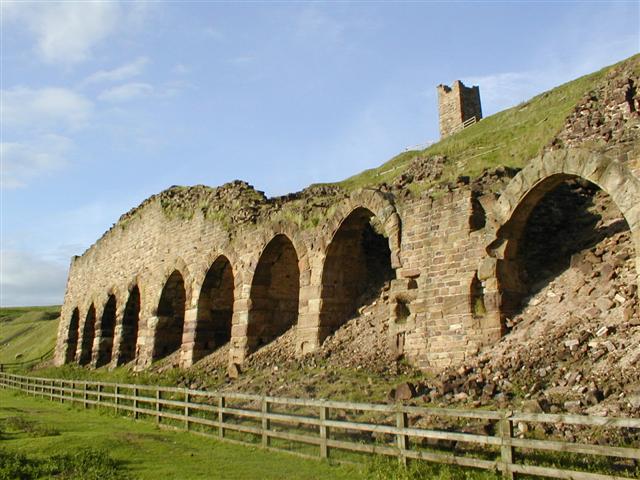
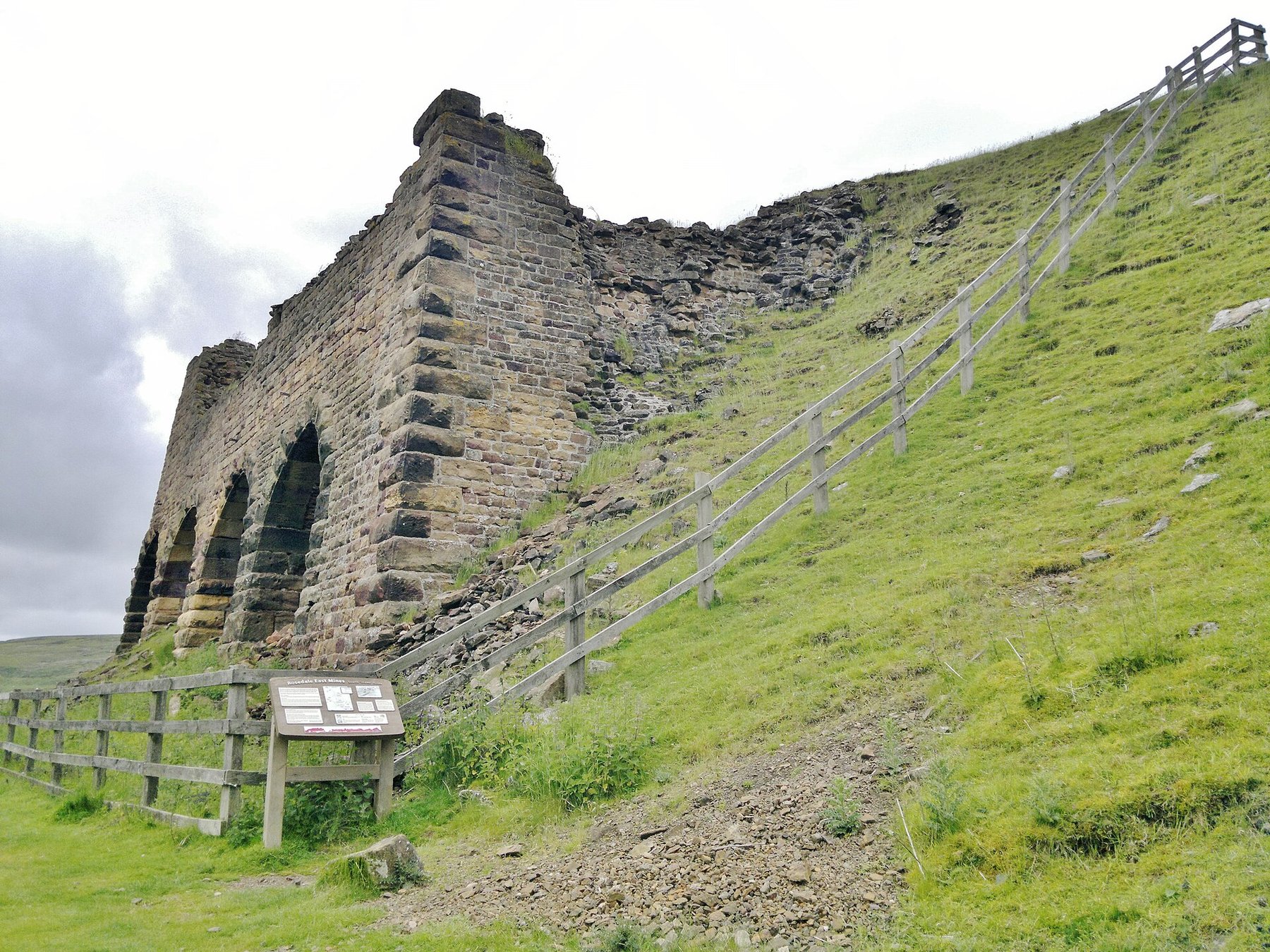
The dale has reverted to quiet moorland farming and grouse-moor country, walked today largely along the route of the old railway, now a popular long-distance path. Two distinct sets of calcining kilns survive at Rosedale East and remain the most visible structures in the dale: a group of three later iron kilns, of which the northern one is the best preserved, and a more conventional set of stone kilns to the south.
The most visible remains are the two ranges of calcining kilns on the East Mines side, the chimney at Bank Top (which stood until it was demolished in 1972), the old railway goods shed — still in agricultural use by a local farmer — and a former mine depot cottage that remains inhabited. Sections of the railway trackbed, including its dramatic contouring around the head of the dale, survive as a walking route.
Nearby mines
- Grosmont Ironstone Mines — 4.7 miles (7.6 km) E
- Goathland Whinstone Mine — 5.5 miles (8.8 km) NE
- Glaisdale Ironstone Mine — 7.0 miles (11.2 km) N
- Sil Howe Whinstone Mine — 7.4 miles (11.9 km) NE
- Egton Quarry — 7.4 miles (12.0 km) NE
Straight-line distance, within 9 miles (15 km). Show on the map.
What's uncertain
Points where sources disagree or the record could not be settled; both accounts are kept. All open questions in the archive.
- This record dates the east-side workings 1859 to 1929, with a brief reopening from 1919; a 2015 field observation gives the east-side working life as 1860 to 1926. The difference is small and neither source explains it. (uncertain) 4
Recorded claims
Individual factual claims, each attached to the source(s) that support it below. Where sources disagree, both are kept.
- Ironstone found near Hollins Farm in 1853 by Matthew Snowdon of Whitby and William Thompson of Staithes; mining began 1857 at Sheriff's Pit on the west side. 1,2
- The Rosedale branch railway opened to the west side on 27 March 1861, costing around £24,500; a branch from Blakey Junction reached the east side mines in August 1865. 1,2
- Around 200,000 tons of calcined ore moved by rail in the line's first full year, rising to roughly 300,000 tons annually by 1864 at the field's peak; over 10 million tonnes of ironstone in total passed through the kilns over the mines' working life. 1,2
- Rosedale and Ferryhill Iron Company failed and closed the mines in March 1879; West Mines reopened under West Rosedale Ironstone Co. until 1881, later worked again by Carlton Iron Company; main closure 1911, with a further East Mines revival 1919-26 for wartime and post-war iron demand. 1,2
- A fatal roof fall killed 19-year-old miner Thomas Taylor of Low Row on 24 August 1868, about ten minutes into his shift, when several tons of ironstone fell from the roof — one of a number of accidents recorded during the mines' working life on this physically hard, isolated site. 3
- Rosedale East retains two sets of calcining kilns, three iron kilns and a conventional stone group to the south; a 2015 observation records the northernmost iron kiln as the best preserved of its group. 4
- This record dates the east-side workings 1859 to 1929, with a brief reopening from 1919; a 2015 field observation gives the east-side working life as 1860 to 1926. The difference is small and neither source explains it. (uncertain) 4
- All the Rosedale workings but Sheriff Pit were drift mines driven into the sides of the dale rather than shafts, which is why no single shaft depth describes the field. 5
Photographs & further reading
Short exploration/history video covering the East Mines kiln remains and site today.
View sourceLonger video covering the mines and the route of the old mineral railway.
View sourceSources
- (secondary) Rosedale Mines and Tramway — Subterranea Britannica
- (secondary) Ironstone mining in Rosedale — Wikipedia
- (secondary) Reading the Past: 'Snapshots' of Ironstone Life in Rosedale — North York Moors National Park (official blog)
- (observational) Rosedale East — calcining kilns — Geograph Britain and Ireland
- (secondary) Rosedale Railway — Wikipedia
- (primary) BGS mine plans catalogue: Rosedale East — British Geological Survey
Record created: 20 August 2026 · Last researched: 9 September 2026