 MineArchive
Warsop Main Colliery
| Location | Warsop Vale, near Shirebrook and Mansfield, Nottinghamshire — 53.2081, -1.1825 (exact) |
|---|---|
| Commodity | Coal |
| Type | Coal |
| Worked | 1898–25 August 1989 |
| Maximum depth | Unknown. |
| Operators | Staveley Coal and Iron Company (1893–1947) |
Overview
A Nottinghamshire colliery sunk from 1893 by the Staveley Coal and Iron Company of Derbyshire, two miles south of Langwith, to reach the Top Hard seam that had made the Langwith mine pay — six feet of high-quality coal. Staveley leased the ground from the Fitzherbert estate on a 99-year lease and built the village of Warsop Vale to house the workforce. The pit became productive around 1898, employed some 2,500 men and boys in 1935 and was then among the most proficient in the country, was reorganised at a cost of £2 million between 1953 and 1960, and closed on 25 August 1989 after a hundred years of the company’s presence in the parish.
History
In 1893 the Staveley Coal and Iron Company, a large and successful coal and steel combine from Staveley in Derbyshire, decided to sink a colliery about two miles south of Langwith to supplement its existing works. The choice of ground followed the success of the Langwith mine in the Top Hard seam, six feet thick and of high quality. Staveley leased the land from the Fitzherbert estate for ninety-nine years and sank Warsop Main; sinking ran from 1893 to 1895 and the mine became productive around 1898. Warsop Vale was purpose-built by the company to house the workforce. The colliery returned manufacturing and steam coal from 1896, and by 1935 it employed some 2,500 men and boys and produced about 21,000 tons of saleable coal a week — one of the most proficient mines in the country, by the reckoning of the village’s own history society. It passed to the National Coal Board at nationalisation in 1947, when it raised 535,000 tons of coking, gas, household, manufacturing and steam coal. A detailed reorganisation of surface and underground was drawn up in 1953, including tower-mounted electrically powered winding, at a cost of some £2,060,000; the work was finished by 1960 and further projects followed. Four other seams were worked over the mine’s life — the High Hazel, Main Bright, Clowne and Deep Soft — but none matched the Top Hard for quality or quantity. A cost-cutting exercise in 1985 lost 200 jobs, after which the manager announced that the pit’s future was secure. By 1989 it was reported to be losing £200,000 a week and had to close. The last shifts were worked around 25 August; demolition began on 25 September, and on 28 November 1989 the second headgear came down.
Geology
Coal Measures of the Nottinghamshire concealed coalfield. The Top Hard — six feet of high-quality coal, and the seam whose success at Langwith prompted the sinking here — carried the colliery throughout. Four other seams were worked over its life: the High Hazel, Main Bright, Clowne and Deep Soft, none of which matched the Top Hard for quality or quantity.
Workings
Two shafts, sunk between 1893 and 1895. The 1953 reorganisation, completed by 1960, replaced the winding arrangements with tower-mounted electrically powered systems and rebuilt much of the surface and underground layout at a cost of about £2,060,000.
Closure
The colliery closed on 25 August 1989, reported to be losing £200,000 a week, four years after a cost-cutting exercise had shed 200 jobs and the manager had told the workforce its future was secure. Demolition began on 25 September and the second headgear fell on 28 November 1989.
What remains
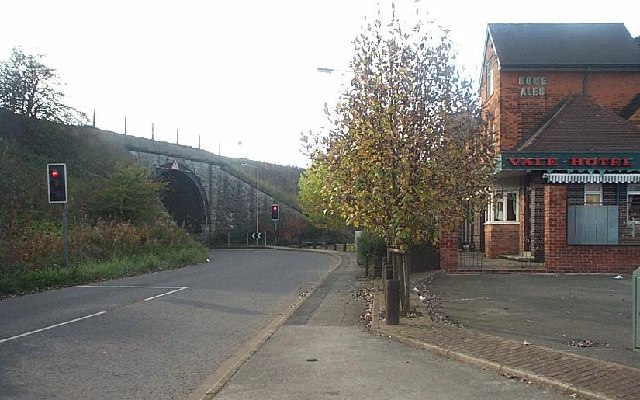
The colliery site has been cleared. Warsop Vale, the village Staveley built for the workforce, remains, with the Vale Hotel — known locally as "The Swing" — on the road towards Shirebrook.
None of the colliery; the company village at Warsop Vale survives.
Nearby mines
- Shirebrook Colliery — 1.3 miles (2.1 km) SW, Derbyshire
- Langwith Colliery — 1.9 miles (3.0 km) NW, Derbyshire
- Welbeck Colliery — 2.5 miles (3.9 km) NE
- Creswell Colliery — 3.6 miles (5.9 km) NW, Derbyshire
- Sherwood Colliery — 3.7 miles (5.9 km) S
Straight-line distance, within 9 miles (15 km). Show on the map.
Disasters & major incidents
-
Warsop Main Colliery outburst, 1902
7 March 1902 · Gas / Asphyxiation · 2 fatalities
Gas under great pressure burst coal out of the face of a heading approaching a fault at Warsop Main Colliery on 7 March 1902, burying and suffocating the header and his loader.
Recorded claims
Individual factual claims, each attached to the source(s) that support it below. Where sources disagree, both are kept.
- The Staveley Coal and Iron Company chose the ground two miles south of Langwith because of the success of the Langwith mine in the Top Hard seam, six feet thick and of high quality, and leased the land from the Fitzherbert estate for ninety-nine years. 1
- Sinking ran from 1893 to 1895 under the Staveley Coal and Iron Co., the mine became productive around 1898, and it passed to the National Coal Board in 1947. 1,2
- In 1935 the colliery employed some 2,500 men and boys and produced about 21,000 tons of saleable coal a week; in 1947 it raised 535,000 tons. 1,2
- A detailed proposal drawn up in 1953 reorganised the mine above and below ground, including tower-mounted electrically powered winding, at a cost of some £2,060,000; the work was completed by 1960. 1
- After a 1985 cost-cutting exercise had lost 200 jobs and the manager had announced the pit’s future secure, it was reported in 1989 to be losing £200,000 a week; the last shifts were worked around 25 August 1989, demolition began on 25 September and the second headgear fell on 28 November. 1
- The Top Hard carried the colliery throughout; four other seams were worked over its life — the High Hazel, Main Bright, Clowne and Deep Soft — but none surpassed the Top Hard for quality or quantity of output. 1
- The BGS mine-plans catalogue holds a Mining Remediation Authority abandonment plan titled 'Warsop Main' (catalogue EM1382, Deep Soft, dated 1989). 3
Photographs & further reading
Location, owners, output and employment year by year, and the museum’s collected list of men killed at the colliery.
View sourceThe village’s own account of the pit it was built for: why Staveley sank it, the seams it worked, the 1953 reorganisation and the week-by-week end in 1989.
View sourceSources
- (secondary) Warsop Main Colliery — Warsop Vale History Society — Warsop Vale History Society
- (primary) Warsop Main Colliery — Durham Mining Museum
- (primary) BGS / Mining Remediation Authority mine plans: WARSOP MAIN — British Geological Survey / Mining Remediation Authority
- (observational) Reliving the closure of Warsop Main Colliery — 30 years on — Chad (Mansfield & Ashfield Chad)
Record created: 6 September 2026 · Last researched: 6 September 2026