 MineArchive
Stewartfield No. 1 Mine
| Location | Stewartfield, Broxburn, beside the Union Canal, Uphall parish, West Lothian — 55.9396, -3.4658 (approximate) |
|---|---|
| Commodity | Oil Shale |
| Type | Mineral |
| Worked | By 1883–1923 |
| Maximum depth | 78 feet (shafts, 1883) |
| Operators | Broxburn Oil Company Ltd (?–1923, owner) — Owned the mine and the Broxburn oil works it supplied |
An inclined shale mine beside the Union Canal at Broxburn, worked by the Broxburn Oil Company from before 1883 to reach the Broxburn Shale south-west of its oil works through a long roadway in older workings, and stopped in 1923 because of the cost of pumping.
Location
Approximate location. The large pin is this mine; the small round markers are the nearest mines on record. Click one for its page. View on full map
History
The early history of the shale workings at Stewartfield is unclear. Stewartfield Nos 1 to 4 Pits seem to have been early, shallow shafts that were later joined up underground, and Stewartfield No. 1 and No. 2 mines were then developed, following the Broxburn Shale from its outcrop near Broxburn Oil Works. No. 1 reached the reserves south-west of the works by a long roadway through earlier workings. Its hutches came out of the adit into an opencast area and were hauled onto staging, shared with No. 2 Mine, before crossing the canal to the works.
In 1883 the mine worked the 4½-foot Broxburn Shale by stoop and room under Alex Kennedy, employing 8 on the surface and 86 underground. The workings were not fiery and were ventilated by a fan, in 1884 one at No. 3 Stewartfield. Its workings in the Broxburn and Curly Shales were abandoned in 1903; later workings, abandoned in 1923, reached the Grey, Fells and Dunnet Shales as well. No. 2 Mine was abandoned in October 1914. Stewartfield No. 1 employed 50 in 1915 and 109 in 1923.
In September 1923 it was decided to stop No. 1 because of the cost of pumping. The plant was taken out, the men were moved elsewhere and its output was made up from Dunnet and Newliston; the arrangements for abandonment were complete by November.
Geology
The Broxburn Shales: the 4½-foot Broxburn Shale and the Curly Shale, and later the Grey, Fells and Dunnet Shales.
Workings
An inclined adit at about 1 in 15 with a long roadway through earlier workings; downcast and upcast shafts 10 by 8 and 9 by 6 feet, 78 feet deep; stoop and room; staging shared with No. 2 Mine carried the hutches across the canal to the works.
Closure
Stopped in September 1923 because of the cost of pumping; the plant was removed and the abandonment arranged by November 1923. Earlier workings in the Broxburn and Curly Shales had been abandoned in 1903.
What remains
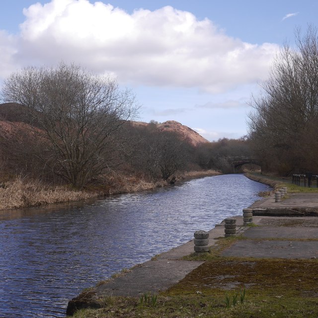
Public woodland beside the Union Canal.
Related mines
- Broxburn Oil Works — Stewartfield No. 1 supplied shale to the Broxburn Oil Company's works, its hutches crossing the canal to them.
Nearby mines
- Dunnet Mine — 0.2 miles (0.3 km) NE
- Broxburn Oil Works — 0.4 miles (0.6 km) S
- Greendykes South Mine — 0.4 miles (0.7 km) N
- Pyothall No. 5 Pit — 0.5 miles (0.7 km) W
- Hopetoun No. 44 Mine — 0.6 miles (0.9 km) N
Straight-line distance, within 9 miles (15 km). Show on the map.
Recorded claims
Individual factual claims, each attached to the source(s) that support it below. Where sources disagree, both are kept.
- No. 1 Mine reached the Broxburn Shale south-west of Broxburn Oil Works by a long roadway through earlier workings. 1
- In 1883 it worked the 4½-foot Broxburn Shale by stoop and room, employing 8 on the surface and 86 underground, with shafts 78 feet deep. 1
- Stewartfield No. 1 employed 50 in 1915 and 109 in 1923. 2
- Its workings in the Broxburn and Curly Shales were abandoned in 1903. 1,3
- In September 1923 it was decided to stop No. 1 because of the cost of pumping, and the abandonment was complete by November 1923. 1,4
Photographs & further reading
The Museum of the Scottish Shale Oil Industry's page for the mine, with site photographs, the 1923 board reports and the abandonment references.
View sourceSources
- (secondary) Stewartfield No.1 mine (Scottish Shale) — Scottish Shale (Museum of the Scottish Shale Oil Industry)
- (primary) Broxburn (Oil Shale) (Durham Mining Museum) — Durham Mining Museum
- (primary) BGS mine plan: STEWARTFIELD NO.1, Broxburn and Curly seams, abandoned 1903 — British Geological Survey
- (primary) BGS mine plan: STEWARTFIELD NO.1, Broxburn, Curly, Grey, Fells and Dunnet seams, abandoned 1923 — British Geological Survey
Record created: 3 November 2026 · Last researched: 3 November 2026