 MineArchive
South Cwmystwyth Mine
| Also known as | Cwmystwyth South Mine |
|---|---|
| Location | South bank of the Ystwyth, opposite the Cwmystwyth mine, Ceredigion — 52.3541, -3.7601 (exact) |
| Commodity | Lead |
| Type | Metal |
| Worked | 1870s–1884 |
| Maximum depth | 24 fathoms (about 44 m) |
| Operators | John Kitto (manager) — Managed the development of the mine in the 1870s. |
South Cwmystwyth was a lead mine on the south bank of the Ystwyth, facing the great Cwmystwyth mine across the river, developed in the 1870s under the mining engineer John Kitto. The hope was to match its neighbour, and it failed quickly: the only return is 40 tons of lead ore in 1878, and the longest cross-cut was abandoned in 1884. Because it was given up so soon and is hard to reach, much of it survives, and the site is a scheduled monument.
Location
Recorded location. The large pin is this mine; the small round markers are the nearest mines on record. Click one for its page. View on full map
History
The mine was an act of hope. Across the river the Cwmystwyth mine had been paying for generations, and in the 1870s John Kitto set out to find the same wealth on the south bank. Money went into the surface as well as underground, with an office, a magazine, ore bins, buddles and a pair of waterwheels.
Three sets of workings were opened. The longest was a cross-cut from the foot of the slope east of Bwlchgwynt, driven 140 fathoms south-east and then 200 more south-south-east. It cut the only lode of any size 30 fathoms in, about three fathoms wide, and followed it east for 110 fathoms. Opposite the Cwmystwyth dressing floors three more cross-cuts were driven into a south-dipping lode, and 200 yards further east a fifth adit and a shaft 24 fathoms deep tried it again.
The ore ran out almost at once. Forty tons of lead ore were returned in 1878 and nothing after, and the long cross-cut was abandoned in 1884.
Geology
The workings lie south of the Ystwyth fault, in rocks a few hundred feet below the base of the Cwmystwyth formation, somewhat harder and less pyritous than those north of it. The chief lode is about three fathoms wide and dips south at about 75 degrees, with blende on its dumps. It may be the eastward run of the Logaulas lode. The cross-cuts show plainly that no such lode exists further south.
Geological setting: Veins and Lodes (well documented example)
Workings
The western cross-cut, at 777 feet above sea level, runs 140 fathoms south-east and 200 fathoms south-south-east, with a drive of 110 fathoms east on the lode. The central group has three adit cross-cuts, at about 1,010, 920 and 860 feet. The eastern group is an adit cross-cut at 767 feet, driven 95 fathoms south, with a shaft sunk 24 fathoms on the lode.
Closure
The only return of ore is for 1878; the western cross-cut was abandoned in 1884.
What remains
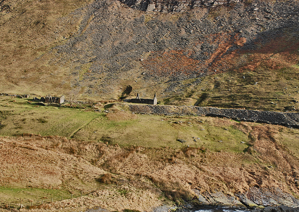
The two wheelpits have been removed altogether, but shafts, levels, tips, leats and trackways survive largely undisturbed. The office and the magazine still stand; two roofless buildings were to be seen at the foot of the scree in 2009.
The mine office, the magazine, part of the ore bins and the faint outline of the buddle pits close to the river, with the sites of shafts and levels, spoil heaps, leats and trackways.
Nearby mines
- Cwmystwyth Mines — 0.5 miles (0.8 km) NE
- Mynach Vale Mine — 2.7 miles (4.4 km) NW
- Bodcoll Mine — 2.9 miles (4.7 km) NW
- Nant y Creiau Mine — 3.7 miles (6.0 km) N
- Glogfach Mine — 4.0 miles (6.4 km) SW
Straight-line distance, within 9 miles (15 km). Show on the map.
Further reading
The Royal Commission's site record, from a field survey of 2012, on the mine's short life and what survives.
View sourceSources
- (primary) South Cwmystwyth Lead Mine; Copa Hill Lead Mine (NPRN 522719) — Coflein, Royal Commission on the Ancient and Historical Monuments of Wales
- (primary) Lead and Zinc: The Mining District of North Cardiganshire and West Montgomeryshire (Special Reports on the Mineral Resources of Great Britain, vol. XX), O. T. Jones, 1922 — Memoirs of the Geological Survey
- (observational) Cwm Ystwyth mine buildings (Geograph photograph 1142848, 2009) — Wikimedia Commons
- (primary) Mine plan: Cwmystwyth South Mine, SN87SW 2 (KP17103) — British Geological Survey

Record created: 18 November 2026 · Last researched: 18 November 2026