 MineArchive
Savile Colliery
| Location | Mickletown, Methley, between Leeds and Castleford, West Yorkshire — 53.7409, -1.4123 (approximate) |
|---|---|
| Commodity | Coal |
| Type | Coal |
| Worked | 1874–1985 |
| Maximum depth | 143 yards to the Haigh Moor seam in 1874; the upcast shaft was deepened to the Beeston seam in 1909. |
| Operators | Henry Briggs, Son and Company Limited (1874–1947, owner) National Coal Board (1947–1985) |
The Methley pit sunk in 1874 at the west end of Mickletown's Main Street to work the Haigh Moor seam, which turned a farming village into a mining one; reprieved by the 1984 strike, it stopped coaling in August 1985 after more than a century.
Location
Approximate location. The large pin is this mine; the small round markers are the nearest mines on record. Click one for its page. View on full map
History
Two shafts, each 14 feet in diameter, were sunk at the west end of Main Street, Mickletown, in 1874 to develop the Haigh Moor seam, 143 yards down, linking with the former Whitwood Pit in the Earl of Mexborough's royalty, and full-scale working had begun by 1878. The mine, owned until nationalisation by Henry Briggs, Son and Company, transformed Methley: families came for work, the village changed from agricultural to semi-industrial, and the population grew to over 4,000 by 1901. In 1909 the upcast shaft was deepened to the Beeston seam, known locally as the Savile Park, to ventilate Whitwood Colliery's Silkstone and Beeston workings on the Methley side.
Around 1900 a tall chimney dominated the pit yard and Main Street, blackening everything nearby; the winding gear and workshops ran on steam, and the pit's own railway carried coal to the landsale depot, to a canal basin and to the LMS main line. After 1947 the yard was extended with new workshops and a canteen, pithead baths were built around 1955 and the winding was electrified in 1958, making the chimney obsolete. It completed a reconstruction begun in 1956, which deepened the downcast shaft from the Haigh Moor to the Flockton horizon, opened up the Flockton seam and brought in two-ton mine cars; the boiler chimney was taken down brick by brick in 1958-59.
The colliery was scheduled for closure in 1983, but the 1984-85 strike extended its life; the Coal Board said the workable seams were exhausted and there were geological problems. Still producing 5,000 tonnes a week, it stopped coaling on 23 August 1985; the remaining 270 men, of 415, went to Selby or nearby pits, clearance ended on 14 October, and the site was empty by the end of November.
Geology
The Haigh Moor seam of the Yorkshire Coal Measures, the seam the shafts were sunk to develop, 143 yards down; below it the Flockton, opened up in 1956-58, and the Beeston, known locally as the Savile Park seam.
Workings
Two 14-foot shafts (1874) linked to the former Whitwood Pit, with steam winding until electrification in 1958, coal washing and screening plant, and a pit railway to the canal basin and the main line. The upcast, deepened to the Beeston in 1909, served Whitwood's workings and was part-filled to the Flockton horizon in 1970 after Whitwood closed; the downcast was deepened to the Flockton in 1956-58.
Closure
Scheduled for closure in 1983, reprieved by the 1984-85 strike; coaling ended on 23 August 1985 with seams exhausted and geological problems, and all work on site ceased by 30 November 1985.
What remains
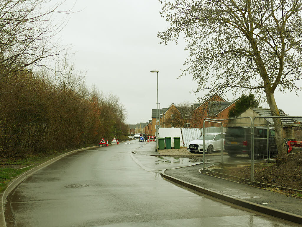
The colliery has been cleared. Houses stood on part of the site, off Station Road, Mickletown, by 2019.
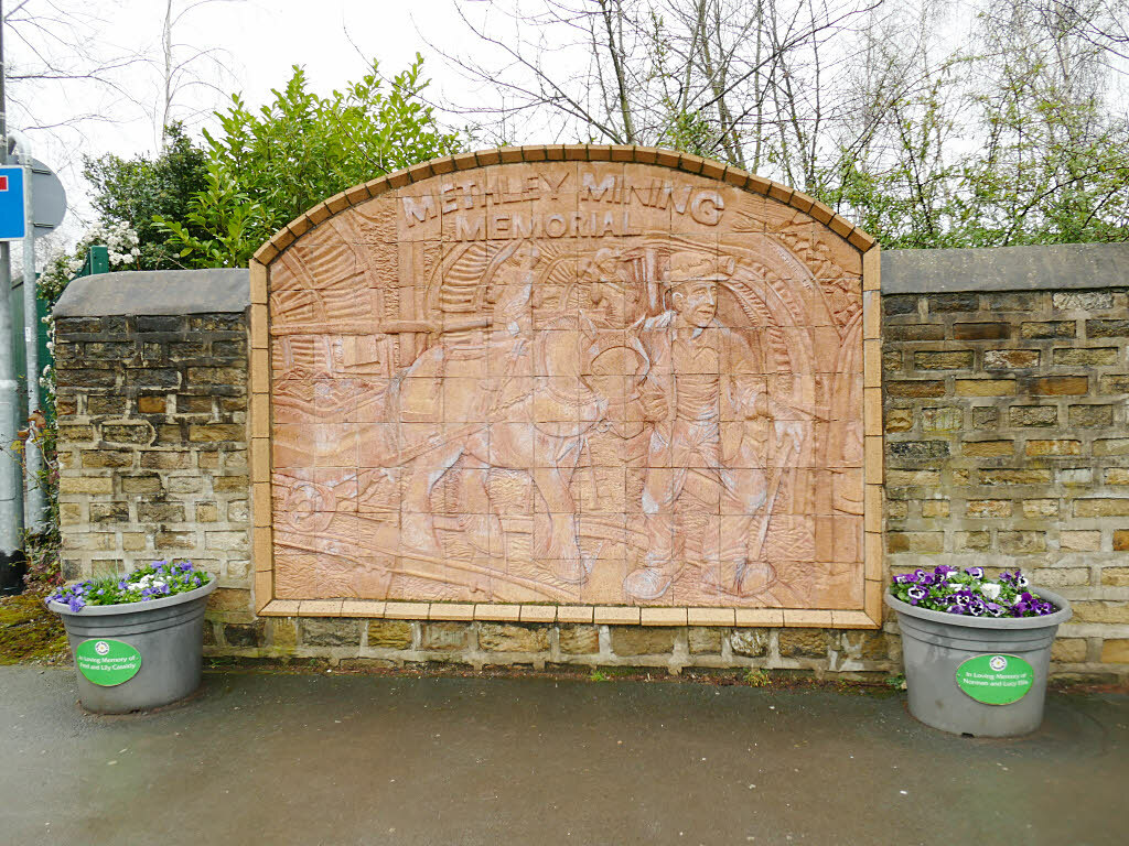
A terracotta relief, the Methley Mining Memorial, is set in the wall that bounded the colliery.
Redevelopment
Housing on part of the site.
Related mines
- Methley Junction Colliery — Both Briggs pits; after flooding Methley Junction's shafts ventilated the Savile mine.
- Whitwood Colliery — Savile's shafts were linked to Whitwood under the same owners, Henry Briggs, Son and Company, and from 1909 Savile's upcast shaft ventilated Whitwood's Silkstone and Beeston workings.
Nearby mines
- Methley Junction Colliery — 1.2 miles (1.9 km) SE
- Water Haigh Colliery — 1.3 miles (2.1 km) NW
- Allerton Bywater Colliery — 1.8 miles (2.8 km) NE
- Altofts Colliery — 1.9 miles (3.0 km) S
- Whitwood Colliery — 1.9 miles (3.0 km) SE
Straight-line distance, within 9 miles (15 km). Show on the map.
Culture
- Methley Mining Memorial (Art)
A memorial to Methley's coal mining set on the wall of the former Savile Colliery site, dedicated before its former manager and union men.
Further reading
Local archive photographs and notes on the pit from 1874 to its modernisation after 1947.
View sourceThe shafts, the 1909 deepening for Whitwood, the 1956-58 reconstruction and the families behind the pit's weighbridge and headgear.
View sourceSources
- (secondary) The Savile Pit - mppt040 - Methley Archive — Methley Archive
- (secondary) Savile Pit Demolition mppt043 - Methley Archive — Methley Archive
- (secondary) List of collieries in Yorkshire (1984–2015) — Wikipedia
- (secondary) Savile Colliery - Methley Village — Methley Village
- (observational) New houses on Station Road, Mickletown (Geograph 6081380) — Geograph
- (observational) Methley mining memorial (Geograph 6081455) — Geograph
- (secondary) Methley — Wikipedia
- (primary) BGS / Mining Remediation Authority abandonment plans: SAVILE (spoil tip No 6) — British Geological Survey
Record created: 21 September 2026 · Last researched: 1 October 2026