 MineArchive
Punchard Gill Mine
| Location | Arkengarthdale, North Yorkshire — 54.4278, -1.9903 (approximate) |
|---|---|
| Commodities | Lead, Coal |
| Type | Metal |
| Worked | By 1521–1927 |
| Maximum depth | Unknown. |
Overview
A lead mine in Arkengarthdale recorded as early as 1521, worked alongside the neighbouring Moulds and Faggergill setts, which later saw a separate small coal working survive into the 1920s -- one of the last four coal pits still operating in the dale after 1900.
History
Lead mining was already extensive in Arkengarthdale by 1521, recorded at Moulds, Punchard Gill and Faggergill alike; early working used simple bell pits through the 17th and 18th centuries, with ore sold on to lead merchants based in York. In 1820, miners working Little Punchard Gill built a canal level specifically so that ore and spoil could be floated out of the workings by water rather than hauled. Separately from the lead workings, a small coal mine developed at Punchard Gill to serve local demand; it was one of only four coal pits in Arkengarthdale still working after 1900, the others having already closed, and struggled throughout its later years to compete against better-quality coal shipped in from County Durham. The Punchard Gill coal mine finally closed in 1927.
Geology
Lead, with coal worked alongside it, in upper Arkengarthdale; the early working was by simple bell pits.
Workings
Lead was worked through simple bell pits in the 17th and 18th centuries; a canal level built in 1820 floated ore and spoil out of the Little Punchard Gill workings by water. The separate, later coal working is not described in detail.
Closure
The coal working closed in 1927, unable to compete with higher-quality coal imported from County Durham; the lead workings had gone out of use long before.
What remains
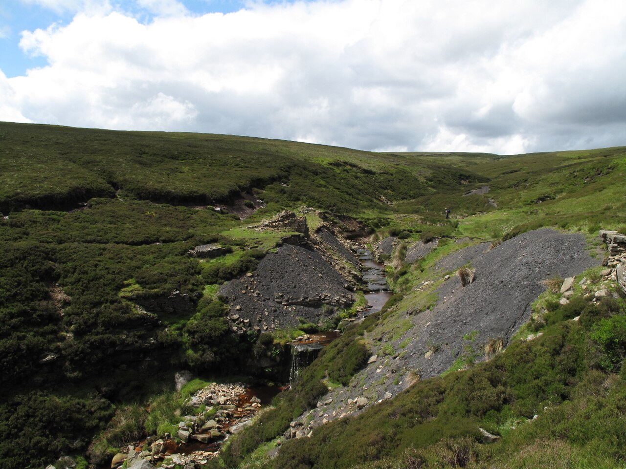
A gradually eroding spoil heap with a ruined building on top marks the site of the former coal level; the mine portal itself is no longer visible.
An eroding spoil heap and a ruined building at the site of the former Punchard Coal Level.
Nearby mines
- Arkendale Mine — 0.6 miles (1.0 km) S
- CB Mine — 0.7 miles (1.1 km) S
- Cragg End Flag Stone Mine — 0.7 miles (1.1 km) SW
- Shaw Beck Gill Mine — 0.9 miles (1.5 km) N
- Slei Gill Mine — 1.0 miles (1.6 km) S
Straight-line distance, within 9 miles (15 km). Show on the map.
Recorded claims
Individual factual claims, each attached to the source(s) that support it below. Where sources disagree, both are kept.
- Lead mining was already extensive in Arkengarthdale by 1521, recorded at Moulds, Punchard Gill and Faggergill; ore was sold on to lead merchants based in York. 1
- In 1820, miners working Little Punchard Gill built a canal level to float ore and spoil out of the workings by water. 1
- A separate coal mine at Punchard Gill was one of only four still working in Arkengarthdale after 1900, and closed in 1927 after struggling to compete against higher-quality coal imported from County Durham. 2
Photographs & further reading
A detailed account of lead mining across Swaledale and Arkengarthdale, including Punchard Gill.
View sourceSources
- (secondary) Lead Mines and Works — SWAAG — Swaledale and Arkengarthdale Archaeology Group
- (secondary) Coal Mines — SWAAG — Swaledale and Arkengarthdale Archaeology Group
- (observational) Great Punchard Gill, Site of Punchard Coal Level — Geograph Britain and Ireland (Trevor Littlewood)
Record created: 30 August 2026 · Last researched: 30 August 2026