 MineArchive
Slei Gill Mine
| Location | Booze Moor, Arkengarthdale, North Yorkshire — 54.4131, -1.9878 (approximate) |
|---|---|
| Commodity | Lead |
| Type | Metal |
| Worked | Before 1066–Late 19th century |
| Maximum depth | Unknown. |
Overview
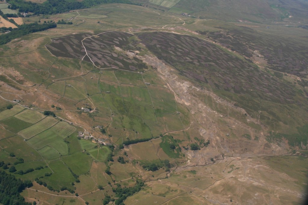
A lead-mining area in the gill overlooked by the hamlets of Langthwaite and Booze in Arkengarthdale, worked across several named veins and levels, whose remains have twice been exposed and reburied by flash flooding in recent years.
History
Lead mining in Arkengarthdale is recorded from before the Norman Conquest, and Slei Gill -- overlooked by Langthwaite and, on its steep hillside, the hamlet of Booze, where many of the gill's miners lived -- was one of the dale's principal working areas. Several distinct veins were worked here, including Fell End, Wellington, Blucher and Scatter Scar alongside Tanner's Rake, worked through a mixture of bell pits, hushing and driven levels with names including Scotts Level, Doctor, Procter, Sun Gutter and Tanner Rake, alongside the separate Booze Wood workings. The mine, though not itself a scheduled site, is considered archaeologically important within the wider Arkengarthdale lead field. Lead working declined along with the rest of the Yorkshire field at the end of the 19th century. In 2019 the gill was struck by flash flooding twice in the same year: the first flood tore away ground cover and exposed old mine workings that had never been formally recorded, but a second flood later that same year buried the newly-exposed areas again before archaeologists could complete a full survey.
Geology
Several lead veins in Slei Gill, Arkengarthdale — Fell End, Wellington, Blucher and Scatter Scar alongside Tanner's Rake.
Workings
Worked through bell pits, hushing and driven levels across several named veins (Fell End, Wellington, Blucher, Scatter Scar, Tanner's Rake), with named level entrances including Scotts Level, Doctor, Procter, Sun Gutter and Tanner Rake.
Closure
Lead working declined here with the rest of the Yorkshire field at the end of the nineteenth century.
What remains
Twice disturbed by flash flooding in 2019, which first exposed and then reburied previously-unrecorded sections of the workings.
Bell pits, hush gullies and level entrances scattered along the gill.
Nearby mines
- Whaw Mine — 0.4 miles (0.6 km) W
- CB Mine — 0.4 miles (0.7 km) NW
- Arkendale Mine — 0.5 miles (0.8 km) NW
- Booze Mine — 0.5 miles (0.8 km) SE
- Wetshaw Mine — 0.9 miles (1.4 km) E
Straight-line distance, within 9 miles (15 km). Show on the map.
Recorded claims
Individual factual claims, each attached to the source(s) that support it below. Where sources disagree, both are kept.
- Slei Gill's lead veins included Fell End, Wellington, Blucher, Scatter Scar and Tanner's Rake, worked through bell pits, hushing and driven levels including Scotts Level, Doctor, Procter, Sun Gutter and Tanner Rake. 1
- Flash flooding struck Slei Gill twice in 2019: the first flood exposed previously-unrecorded mine workings, and a second flood later the same year buried the newly-exposed areas again before a full archaeological survey could be completed. 2
- Two hand levels face each other across Slei Gill at NZ 02019 03068, about 320 metres up, each roughly a metre high and 0.7 wide and, from their matching profiles, driven by the same team to try a vein where it crossed the gill; the level on the west bank, at the foot of a small hush, has a bouse team below it and spoil running down to the beck, and the east-bank level is run in just inside its mouth. 3
- Tim Laurie's record places the Tanner Rake, Scatter Scar and North Rake hushes at NZ 020 024, 400 metres up in the Main Limestone: opencast hushes and levels on the Great Blackside Vein, whose history is in Len Tyson's 'The Arkengarthdale Mines' (British Mining 53, 1995). 3
Photographs & further reading
An overview of lead mining across Arkengarthdale, including Slei Gill.
View sourceSources
- (secondary) Lead mining in Arkengarthdale — Yorkshire Dales National Park
- (secondary) Slei Gill and the Floods — Upper Wharfedale Field Society
- (secondary) SWAAG database: mining-related records (Mining 1) — Swaledale and Arkengarthdale Archaeology Group (SWAAG)
- (observational) Slei Gill, Arkengarthdale — Geograph Britain and Ireland (Katy Walters)

Record created: 30 August 2026 · Last researched: 24 September 2026