 MineArchive
Booze Mine
| Also known as | Booze Wood Level, Booze Wood Mine |
|---|---|
| Location | Booze, Arkengarthdale, North Yorkshire — 54.4069, -1.9814 (approximate) |
| Commodities | Lead, Slate |
| Type | Metal |
| Worked | 1872–late 19th century (lead) |
| Maximum depth | About 70 m at the airshaft, inferred from surface levels rather than measured. |
| Operators | Jaques and Company (1863–1870), Arkengarthdale Lead Mining Company (1870–?) |
Overview
A lead mine above the tiny Arkengarthdale hamlet of Booze, overlooking Slei Gill, whose Booze Vein was formally cut in 1872 but which carries an older, unverified legend of a catastrophic underground flood.
History
Booze Wood mine worked lead in Slei Gill, the tributary valley overlooked by the hamlet of Booze itself. The Booze Vein was cut in March 1872 and ore production began that September; dressing floors were built at Booze Wood in 1873, with second-hand mine plant brought over from the Bolton Park lead mine in Wensleydale and erected at a cost of £276 2s 2d. Like the rest of the Yorkshire lead field, the mine declined with the industry's wider collapse at the end of the 19th century, but the Booze Wood Level found a second life as a slate mine, continuing to be worked for slate until the start of the First World War. Local legend holds that, at some point in the 18th century, miners working the vein broke into an underground lake near Boldershaw and unleashed a flood that killed twenty-four miners and two pit ponies -- eighteen of the dead said to have come from Booze itself -- giving the flooded working the name Water Blast Vein. Researchers have been unable to find any record of this event in the parish registers, though it has been suggested that a genuine, much smaller accident, in which three miners died, may be the true origin of the story.
The Swaledale and Arkengarthdale Archaeology Group's survey record fills in the years before that. Jaques and Company began work on the level soon after 1863, driving it almost due north to try the Booze, or Fell End, vein in the Fourth or Five Yard Limestone. Progress was slow: by 1869 it had been driven only about 320 metres. The Arkengarthdale Lead Mining Company was formed in 1870 and carried the work on, cutting the vein in 1872. The mine was never as productive as had been hoped — the limited figures available show an annual average of only 67 tons of ore across a twelve-year period in the 1870s and 1880s, against 145 tons a year from Danby Level and 966 from Faggergill. The air in the level was poor then and remains so; at an unrecorded date an airshaft was sunk to it from the hamlet of Booze, whose surface position some 70 metres above the level suggests its depth.
The same record describes the level's second life as an underground quarry for building stone, mainly flagstone, and says the houses on Bridge Terrace in Reeth were roofed with flag from this source. That sits alongside rather than against the account of it being reworked for slate: in these dales the same sandstone was called flag, slate or sandstone as the trade's language shifted, exactly as the statutory returns for Burtersett show.
Geology
Lead on the Booze Vein above Slei Gill in Arkengarthdale, cut in March 1872; the Booze Wood Level later found a second life as a slate mine.
Workings
Lead extraction through the Booze Vein and associated levels in Slei Gill, with dressing floors built at Booze Wood in 1873; later, separately, the Booze Wood Level was reworked for slate.
Closure
Lead working ended with the wider collapse of Yorkshire lead mining at the close of the 19th century; the Booze Wood Level continued as a slate mine until 1914.
What remains
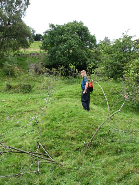
Surviving remains at Booze Wood include the dressing floor, mine tunnels and bouse teams (ore storage bins).
The dressing floor, tunnel entrances and bouse teams (ore storage bins) at Booze Wood mine. Of the airshaft sunk from the hamlet, all that survives on the surface is a large depression about 4 m across, some 40 m before the entrance to Town Farm, Booze.
Related mines
- Faggergill Mine — Both Arkengarthdale lead mines, and directly compared in the surviving output figures: Booze Wood Level averaged about 67 tons of ore a year across the 1870s and 1880s against 966 tons a year from Faggergill, which is the measure of how far it fell short of expectations.
Nearby mines
- Slei Gill Mine — 0.5 miles (0.8 km) NW
- Sir Francis Level (Lownathwaite Mine) — 0.6 miles (1.0 km) SW
- Wetshaw Mine — 0.6 miles (1.0 km) E
- Whaw Mine — 0.7 miles (1.1 km) NW
- CB Mine — 0.9 miles (1.5 km) NW
Straight-line distance, within 9 miles (15 km). Show on the map.
What's uncertain
Points where sources disagree or the record could not be settled; both accounts are kept. All open questions in the archive.
- A local legend describes a flood that killed 24 miners and 2 pit ponies after miners broke into an underground lake near Boldershaw, but researchers have found no record of this in parish registers; a smaller, unconfirmed accident killing three miners has been suggested as the story's possible real origin. (disputed) 2
Recorded claims
Individual factual claims, each attached to the source(s) that support it below. Where sources disagree, both are kept.
- The Booze Vein was cut in March 1872 and ore production began that September; dressing floors were built at Booze Wood in 1873 using second-hand plant brought from Bolton Park lead mine in Wensleydale, erected at a cost of £276 2s 2d. 1
- The Booze Wood Level continued to be worked as a slate mine after the collapse of lead mining, until the beginning of the First World War. 2
- A local legend describes a flood that killed 24 miners and 2 pit ponies after miners broke into an underground lake near Boldershaw, but researchers have found no record of this in parish registers; a smaller, unconfirmed accident killing three miners has been suggested as the story's possible real origin. (disputed) 2
- Jaques and Company started work on Booze Wood Level soon after 1863, driving it almost due north to try the Booze (Fell End) vein in the Fourth (Five Yard) Limestone; progress was slow, and by 1869 the level had been driven only about 320 m. 3
- The Arkengarthdale Lead Mining Company was formed in 1870 and continued work on the level. 3
- The limited data available shows an annual average of only 67 tons of ore over a 12-year period in the 1870s and 1880s, compared with 145 tons a year from Danby Level and 966 tons a year from Faggergill. 3
- The air in Booze Wood Level was, and still is, poor; an airshaft was sunk from the hamlet of Booze at an unknown date, its surface position some 70 m above the level suggesting that depth, and all that remains of it is a depression about 4 m across near Town Farm. 3
- Booze Wood Level, a 19th-century lead mine, was later used as an underground quarry for building stone, mainly flagstone; the houses on Bridge Terrace, Reeth are said to have been roofed with flag from this source. 3
Photographs & further reading
A local-history account of the hamlet and its mining connections.
View sourceThe archaeology group's survey record of the level, with the pre-1872 driving history, comparative ore output against Danby and Faggergill, and the airshaft sunk from the hamlet — none of it in the general histories of Booze.
View sourceSources
- (secondary) Booze, Arkengarthdale: the history behind the Yorkshire Dales hamlet — Yorkshire Post
- (secondary) Booze, North Yorkshire — Wikipedia
- (secondary) SWAAG database: mining-related records (Mining 1) — Swaledale and Arkengarthdale Archaeology Group (SWAAG)
- (observational) Remains at Booze Wood mine — Geograph Britain and Ireland (Gordon Hatton)

Record created: 30 August 2026 · Last researched: 5 September 2026