 MineArchive
Penmaenmawr Granite Quarry
| Also known as | Penmaenmawr Quarries, Graiglwyd Quarry |
|---|---|
| Location | Penmaenmawr headland, north Conwy coast, Conwy — 53.2630, -3.9500 (approximate) |
| Commodity | Granite |
| Type | Quarry |
| Worked | From 1830s–Still active |
| Maximum depth | Open quarrying in benches down the headland; no shaft depth applies. |
| Operators | Penmaenmawr & Welsh Granite Co. (1830–1969), The Darbishire Company (1879–1911), Hanson (1989–2023), Heidelberg Materials UK (2023–?) |
Overview
A granite quarry on the headland between Conwy and Llanfairfechan, worked for roadstone and setts and still working today. The rock was valued long before that: the same outcrop carried one of the most important Neolithic stone axe factories in Britain, and the hilltop bore the Iron Age hillfort of Braich y Ddinas. Nineteenth and twentieth-century quarrying removed much of the mountain, the axe-factory ground and the hillfort along with it.
History
Penmaenmawr takes its name from the headland, and the headland has been quarried away. The stone here — a hard igneous rock the trade calls granite — was worked in the Neolithic for axes, at what is recognised as one of the major axe-production sites in Britain, its products traded across the country. On the summit stood Braich y Ddinas, an Iron Age hillfort. Industrial quarrying from the nineteenth century took both. The quarries supplied setts for paving the streets of the industrial towns and, later, roadstone in bulk, shipped out by sea and by the coastal railway. The town below grew as a quarrying and seaside settlement together, and quarrying continues today.
There were two quarries. Penmaen quarry began commercially in 1830 and Graiglwyd on the mountain in 1834; the Darbishire Company ran Graiglwyd from 1879, and in 1911 the two joined in one company. Railway ballast was cut from 1881, and the quarries kept nearly a thousand men employed until the 1950s, when machinery took over; the internal railway gave way to trucks in the 1960s. The site passed to Amalgamated Roadstone in 1985, Hanson in 1989 and HeidelbergCement in 2007, and about twenty people work it now. The stone the trade calls granite is diorite.
Geology
An intrusion of hard igneous rock forming the headland on the north Welsh coast — sold as granite, and hard enough that it was worth carrying a Neolithic axe made from it the length of Britain. The same properties that made it a good axe made it a good sett and a good roadstone: it is tough, it takes a sharp edge, and it wears slowly.
Workings
Open quarrying in benches worked back into the headland, with processing sheds on site and output taken away by sea from the shore below and by the coastal railway. The scale is measured in landscape rather than tonnage: the profile of the mountain has been changed and the archaeology on top of it destroyed.
Closure
Still working. What has ended is the sett trade, which the quarry was built on: hand-dressed granite setts gave way to tarmacadam, and the business turned to crushed roadstone and aggregate.
What remains
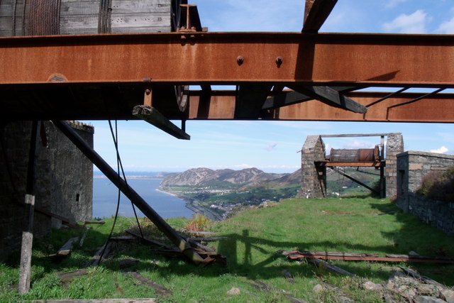
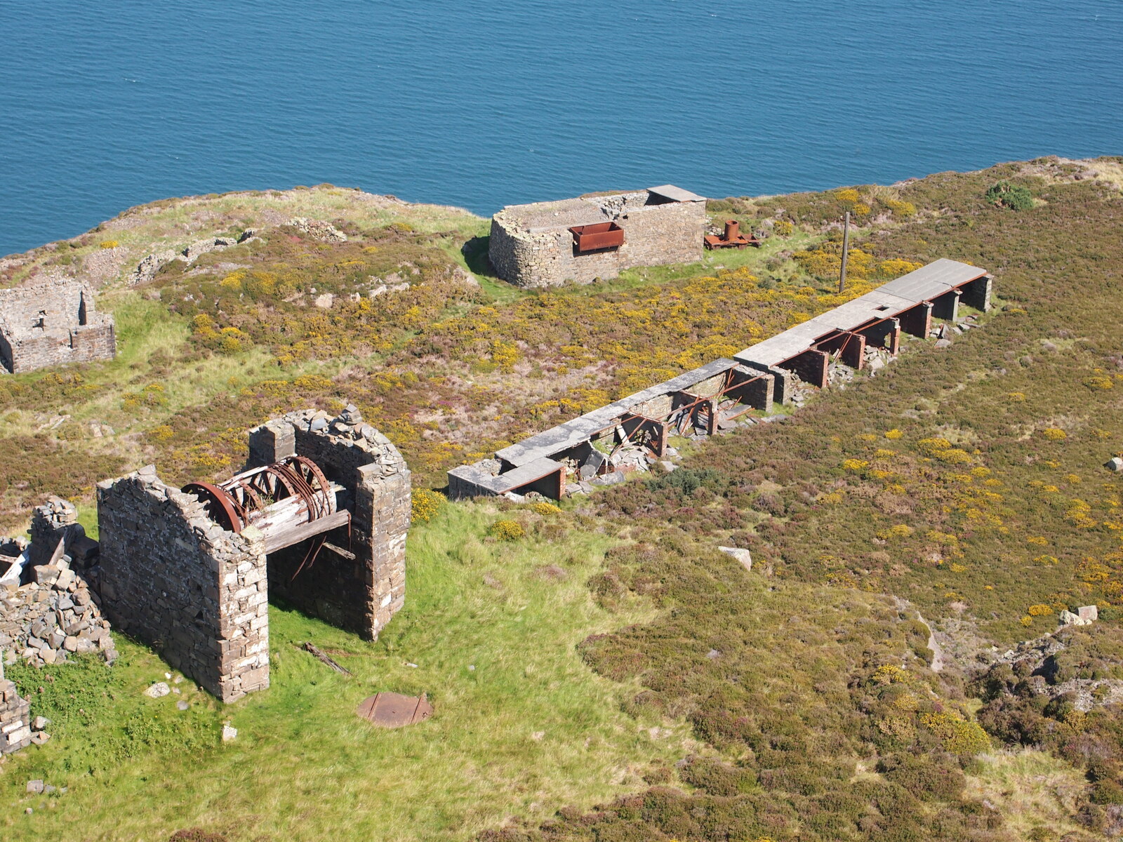
A working quarry, with processing sheds and benched faces above the town. The Neolithic axe factory ground and the hillfort of Braich y Ddinas have largely been quarried away.
The benched faces and processing plant of the working quarry. Of what preceded it, very little: the axe factory and the hillfort were removed by quarrying.
Related mines
- Trefor Granite Quarry — Amalgamated in 1911, when the Penmaenmawr and Llanfairfechan quarries were joined with the Yr Eifl workings to form the Penmaenmawr and Welsh Granite Co. Ltd under the Darbishire family, who owned both.
Nearby mines
- Penmon Quarry — 5.1 miles (8.2 km) NW, Anglesey
- Bryn Hafod-y-Wern Quarry — 5.9 miles (9.5 km) SW, Gwynedd
- Great Orme Copper Mines — 6.3 miles (10.2 km) NE
- Moel Faban Quarry — 6.7 miles (10.8 km) SW, Gwynedd
- Pantdreiniog Quarry — 7.2 miles (11.5 km) SW, Gwynedd
Straight-line distance, within 9 miles (15 km). Show on the map.
Recorded claims
Individual factual claims, each attached to the source(s) that support it below. Where sources disagree, both are kept.
- Penmaenmawr grew as a quarrying settlement on the north Conwy coast, its granite worked for setts and roadstone, and quarrying continues there today. 1
- The rock of the headland was worked in the Neolithic period at one of the major stone axe production sites in Britain, its axes traded widely; much of that ground has since been quarried away. 1
- The Iron Age hillfort of Braich y Ddinas stood on the summit of the headland and was destroyed by quarrying. 1
- In the 1830s commercial granite quarries were opened on Penmaenmawr to meet the growing demand for granite setts. The Penmaenmawr & Welsh Granite Co. operated from the 1830s to the 1960s. 2
- The granite was lowered from the quarry by self-acting inclines to a 3 ft narrow gauge tramway which ran to jetties, from where the setts were loaded into ships. The standard gauge Chester to Holyhead railway reached Penmaenmawr in 1848, after which the majority of the quarry output was sent by rail. 2
- Granite axe-heads and other implements from the Neolithic quarries at Penmaenmawr have been found throughout Britain. 2
- The quarry and its internal narrow gauge railway thrived through the nineteenth century; the railway was replaced by trucks in the 1960s and production at the quarry was continuing in 2006. 2
- Heidelberg Materials, the operator since Hanson's 2023 rebranding, dates commercial quarrying from 1830, railway ballast from 1881, the internal railway's replacement by trucks to the 1960s, and the site's passage to Amalgamated Roadstone in 1985, Hanson in 1989 and HeidelbergCement in 2007; about 20 people now work there across aggregates, asphalt and concrete. 3
- Graiglwyd Quarry, begun in 1834, joined its neighbour Penmaen Quarry in 1911 in a company the Hwb history calls the Penmaenmawr and North Wales Granite Company; documents of 1879 to 1911 from the Darbishire Company's years, found in the Bell Yard office cellar in 2005, show the sett trade giving way to macadam, and the quarries kept nearly a thousand men employed until the 1950s; the rock is diorite rather than granite. 4
Photographs & further reading
The town and its quarries: the Neolithic axe factory on the same rock, the hillfort lost to quarrying, and the growth of the settlement around the granite trade.
View sourceThe catalogue of the quarry company's records; the page refuses automated retrieval.
View sourceSources
- (secondary) Penmaenmawr — Wikipedia
- (secondary) Penmaenmawr & Welsh Granite Co. — Wikipedia
- (primary) Penmaenmawr quarry community page (Heidelberg Materials UK) — Heidelberg Materials UK
- (secondary) Stori Chwarel Graiglwyd 1834-1911 / The Story of Graiglwyd Quarry 1834-1911 (Hwb, Welsh Government) — Hwb (Welsh Government)
Record created: 8 September 2026 · Last researched: 24 September 2026