 MineArchive
Norwood Colliery, Killamarsh
| Also known as | Holbrook No. 2 (Norwood) |
|---|---|
| Location | Killamarsh, near Eckington, Derbyshire — 53.3316, -1.3019 (approximate) |
| Commodity | Coal |
| Type | Coal |
| Worked | 1865–1867–1914 |
| Maximum depth | 352 yards (Deep Soft, after deepening in 1916) |
| Operators | Sheepbridge Coal and Iron Company (1865–1914), J. and G. Wells Ltd (1916–1944) |
Overview
One of the Sheepbridge Coal and Iron Company's first four collieries, sunk at Killamarsh in 1865-67 to the Top Hard. It closed in 1914, then was deepened and reopened by J. and G. Wells as Holbrook No. 2 until 1944.
History
Norwood Colliery was one of the first four collieries sunk by the Sheepbridge company, in 1865-67, to develop the lucrative Top Hard seam at 161 yards. At one time 56 horses worked there. By 1869 it raised 400 tons a day, and soon after twice that. In 1872 a gas works was built at the colliery to burn slack for power and lighting. In 1896 it employed 407 men underground and 64 at the surface under J. W. Tankard, and in 1908 419 under W. L. Halpin.
Sheepbridge closed Norwood in 1914 and redeployed its 390 men and boys. The shafts were deepened in 1916 to the Deep Soft at 352 yards, and the colliery was reopened by J. and G. Wells of Eckington. It was worked as Holbrook No. 2 (Norwood), with 706 people employed in 1938. Holbrook Nos. 2 and 3 and Norwood finished in February 1944, joined to Westthorpe, and the chimney and winding house were demolished.
Geology
Derbyshire Coal Measures: the Top Hard at 161 yards (4 feet 9 inches) and the Deep Soft at 352 yards (5 feet 2 inches), with thinner seams between.
Workings
Shafts first sunk to the Top Hard and deepened in 1916 to the Deep Soft; a separate Comberwood shaft; coke ovens and a wooden cooling tower for steam winding at one period; a loading quay on the Chesterfield Canal.
Closure
Closed by Sheepbridge in 1914; reopened by J. and G. Wells and finished, as part of Holbrook, in February 1944 when the workings were joined to Westthorpe.
What remains
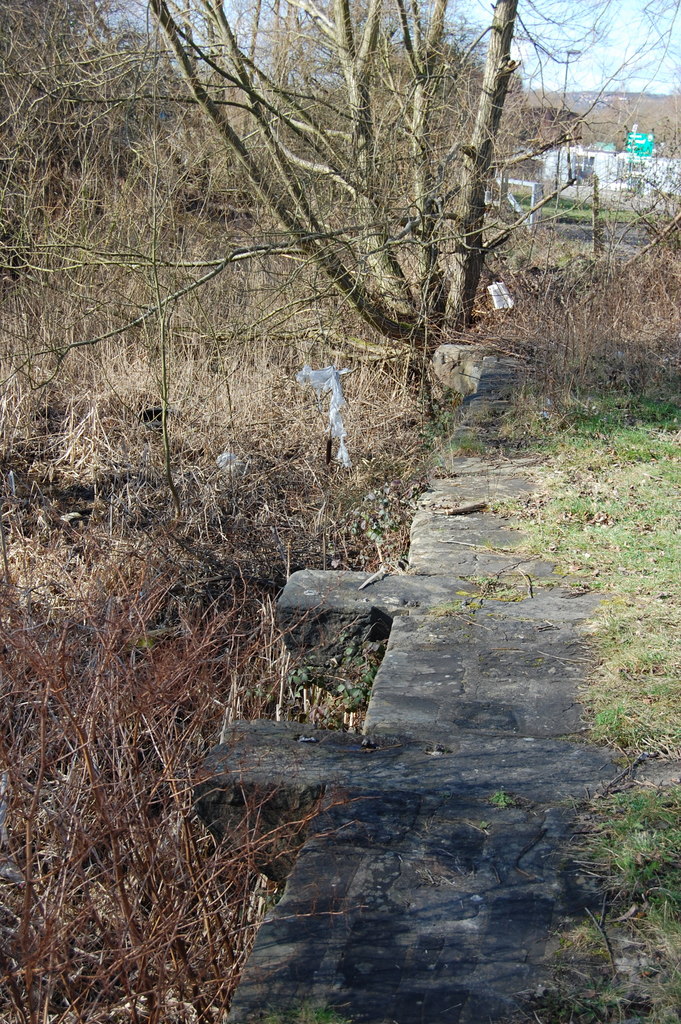
The colliery's loading quay on the Chesterfield Canal survives.
The canal loading quay; the chimney and winding house were demolished after 1944.
Redevelopment
Unknown.
Related mines
- Holbrook Colliery — Reopened in 1916 by J. and G. Wells as Holbrook No. 2.
- Westthorpe Colliery — Its workings were joined to Westthorpe in 1944.
Nearby mines
- Holbrook Colliery — 1.4 miles (2.3 km) W
- Westthorpe Colliery — 1.5 miles (2.5 km) SW
- Brookhouse Colliery — 1.7 miles (2.7 km) NW, South Yorkshire
- Kiveton Park Colliery — 1.7 miles (2.7 km) E, South Yorkshire
- North Staveley Colliery — 1.8 miles (2.9 km) N, South Yorkshire
Straight-line distance, within 9 miles (15 km). Show on the map.
Recorded claims
Individual factual claims, each attached to the source(s) that support it below. Where sources disagree, both are kept.
- Sunk in 1865-67 by the Sheepbridge company to work the Top Hard seam. 1
- Closed by Sheepbridge in 1914 with 390 men and boys redeployed. 1
- The shafts were deepened in 1916 from the Top Hard at 161 yards to the Deep Soft at 352 yards. 1
- Holbrook Nos. 2 and 3 and Norwood finished in February 1944, joined to Westthorpe. 2
- The colliery's loading quay survives on the Chesterfield Canal. 3
Photographs & further reading
Sinking, owners, managers, seam depths and workforce, 1865-1945.
View sourceSources
- (secondary) Norwood Colliery — oldminer.co.uk
- (secondary) Bob Bradley: 1944, page C (collieries closed in 1944) — Healey Hero
- (observational) Norwood Colliery loading quay (photograph) — Geograph
Record created: 2 October 2026 · Last researched: 2 October 2026