 MineArchive
Mitchell Main Colliery
| Also known as | Mitchell's Main Colliery |
|---|---|
| Location | Wombwell, near Aldham Junction, South Yorkshire — 53.5325, -1.4078 (approximate) |
| Commodity | Coal |
| Type | Coal |
| Worked | By 1883–1956 |
| Maximum depth | No reliable depth figure has yet been located. |
| Operators | Mitchell Main Colliery Company (?–1947), National Coal Board (1947–1956) |
Overview
A Wombwell colliery, often written Mitchell's Main, worked by the Mitchell Main Colliery Company alongside its Darfield Main pit. In April 1933 the company dismissed its 1,500 men and moved its whole quota to Darfield, a closure raised in the Commons; the pit was later working again, and the National Coal Board closed it for good in 1956, moving its men to Darfield.
History
Mitchell Main worked the Barnsley seam and, by 1905, a separate Parkgate pit working the Fenton and Parkgate seams; the Durham Mining Museum lists it under the Mitchell Main Coal Co. and then the Mitchell Main Colliery Co., Ltd., which in 1894 ran it with Darfield Main and Grimethorpe. Discover Dearne dates the colliery to 1883, after Wombwell Main of 1855. Employment rose from 753 in 1894 to 1,710 in 1915, when the Parkgate pit alone employed 1,508. In April 1933 the company gave notice to 1,500 miners: an independent arbitrator had declined to raise the standard tonnage for its two pits, and it proposed to produce its whole permitted output from Darfield Main as the more economic unit. In the Commons the Secretary for Mines, Ernest Brown, answered that the undertaking had even sold nearly 20,000 tons of quota since 1931; members pointed out that Wombwell Urban District Council relied on the colliery for its gas and that a local glass works would have to shut. The pit was working again by 1940, when it employed 1,230, and passed to the National Coal Board in 1947 with 860 men and an output of 290,000 tons. The NCB decided in 1952 to close it by 1956 and invest in Darfield instead; it closed in 1956 and its workforce transferred to Darfield Main.
Geology
Seams of the concealed Yorkshire coalfield: the Barnsley, and from the Parkgate pit the Fenton and Parkgate; by 1954 the Fenton, Haigh Moor and Meltonfield.
Geological setting: Sedimentary Beds and Seams (well documented example)
Workings
Two pits recorded separately from 1905, the Barnsley pit and the Parkgate pit, the latter the larger by 1910. A by-product plant supplied gas to Wombwell. No further detail of the shafts has been read.
Closure
Closed by its owners in April 1933, when 1,500 men were given notice after the arbitrator refused a larger quota and the company chose to concentrate output at Darfield Main; working again by 1940, it was closed by the National Coal Board in 1956 and its men moved to Darfield.
What remains
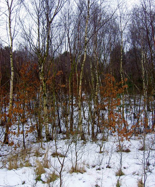
The pithead has gone; the spoil heap has been planted and carries permissive paths.
The wooded former spoil heap ('muck stack') and the course of the former railway past the colliery site.
Redevelopment
The line of the Mexborough and Barnsley railway past the site is now a cycle route.
Related mines
- Darfield Main Colliery — Both owned by the Mitchell Main Colliery Company; Mitchell Main's quota went to Darfield in 1933 and its men followed when it closed in 1956.
Nearby mines
- Darfield Main Colliery — 0.9 km E
- Wombwell Main Colliery — 1.5 km SW
- Lundhill Colliery — 2.3 km S
- Grimethorpe Colliery — 2.6 km N
- Hemingfield Colliery — 3.2 km S
Straight-line distance, within 15 km. Show on the map.
What's uncertain
Points where sources disagree or the record could not be settled; both accounts are kept. All open questions in the archive.
- Mitchell's Main Colliery followed Wombwell Main in 1883. (uncertain) 3
Recorded claims
Individual factual claims, each attached to the source(s) that support it below. Where sources disagree, both are kept.
- Owners: Mitchell Main Coal Co.; Mitchell Main Colliery Co., Ltd.; from 1947 the National Coal Board. 1,2
- Mitchell's Main Colliery followed Wombwell Main in 1883. (uncertain) 3
- Employment: 753 (1894); Barnsley pit 202 and Parkgate pit 1,508 (1915); 1,051 (1933); 1,230 (1940); 860 (1947, output 290,000 tons); 779 (1954). 1
- In April 1933 1,500 miners at Mitchell Main were dismissed; the company proposed to produce its whole permitted output from Darfield Main after an arbitrator declined to increase its standard tonnage on 22 March 1933. 4
- Since 1 January 1931 the undertaking had sold, on balance, nearly 20,000 tons of quota. 4
- The NCB decided in 1952 to close Mitchell Main by 1956; it closed in 1956 and the workforce transferred to Darfield Main. 5
- The BGS / Mining Remediation Authority mine-plans catalogue holds plans filed under 'MITCHELL MAIN'. 6
Sources
- (secondary) Durham Mining Museum - Mitchell's Main Colliery — Durham Mining Museum
- (secondary) Durham Mining Museum - Mitchell Main Colliery Co., Ltd. — Durham Mining Museum
- (secondary) Wombwell - Discover Dearne — Dearne Valley Landscape Partnership
- (primary) Mitchell Main Colliery, Wombwell (HC Deb 11 April 1933 vol 276 cc2348-50) — Hansard
- (secondary) The History of Darfield Main Colliery 1856 to 1989: Time Line — Darfield Main Colliery history site
- (primary) BGS / Mining Remediation Authority mine plans: MITCHELL MAIN — British Geological Survey
Record created: 21 September 2026 · Last researched: 21 September 2026