 MineArchive
Marehay Colliery
| Location | Marehay, south of Ripley, Derbyshire — 53.0489, -1.4239 (exact) |
|---|---|
| Commodities | Coal, Ironstone |
| Type | Coal |
| Worked | By 1837–After 1923 |
| Maximum depth | Unknown. |
| Operators | Coursham and Co., Marehay (Ford's) Colliery Co., Ford's, Ltd. |
Overview
Coal and ironstone pits at Marehay, south of Ripley, worked from at least the 1830s; in the 1890s to 1920s Nos 2 and 3 pits, owned latterly by Ford's, worked the Tupton, Kilburn and Silkstone seams with up to about 400 men.
History
Marehay, on the south side of Ripley, was worked for coal and ironstone long before the colliery's best-recorded years. Abandonment plans survive for the Marehay and Marehay New workings in the Ell coal and ironstone (1837), for the Deep Hard (1850), for the Marehay, Cally and Brickyard pits in the Deep Soft (1858), and for workings beside the Marehay and Whiteley railway (1872). The first edition 25-inch Ordnance Survey map of about 1880 names 'Marehay Colliery (Coal & Ironstone)' with an engine house, several old shafts and an old tramway. A tramway from the Marehay pits led down to Morley Park Ironworks.
The colliery was owned in turn by Coursham and Company, the Marehay (Ford's) Colliery Company and Ford's Limited. In 1894 No. 2 Pit worked the Tupton seam with 124 men and No. 3 the Kilburn with 101; by 1900 the two employed 170 and 233. No. 2's Tupton workings were abandoned in 1905 and it moved to the Silkstone seam, and in 1923 No. 2 Pit employed 256. Men were killed here from at least 1852, when a man fell down the shaft after the rope-roll was wilfully thrown out of gear. The historic environment record says the site had expanded by the early twentieth century, when it was known as Upper Hartshay Colliery; the Durham Mining Museum lists Upper Hartshay separately, under the Butterley Company, at almost the same grid reference.
Geology
Coal Measures of the Derbyshire coalfield: the Ell coal and ironstone, Deep Hard, Deep Soft, Tupton, Kilburn and Silkstone seams.
Workings
Several shafts with an engine house, including Nos 2 and 3 pits in the 1890s-1920s; a tramway to Morley Park Ironworks.
Closure
No. 2 Pit's Tupton seam was abandoned in 1905; No. 2 still employed 256 men in 1923, and the date of final closure is Unknown.
What remains
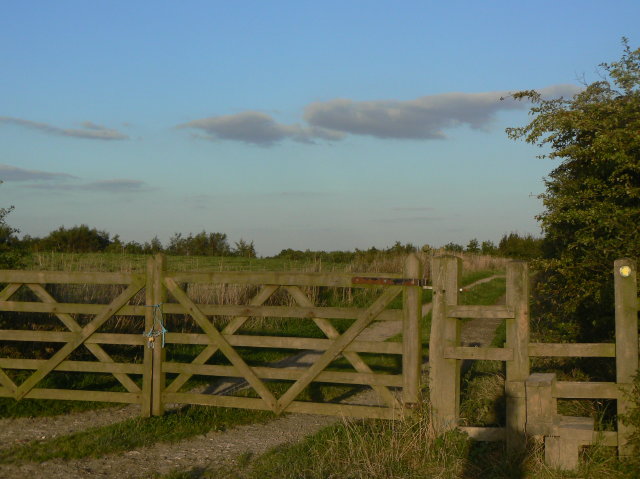
The site west of Brook Lane is scrub and disturbed ground, with a footpath along the line of the former tramway.
The line of the tramway, followed by a footpath; disturbed ground on the colliery site.
Redevelopment
Unknown.
Nearby mines
- Pentrich Colliery — 1.0 miles (1.6 km) NE
- Ripley Colliery — 1.2 miles (1.9 km) E
- Britain Colliery — 1.6 miles (2.6 km) NE
- Denby Hall Colliery — 2.2 miles (3.5 km) SE
- Loscoe Colliery — 2.9 miles (4.6 km) SE
Straight-line distance, within 9 miles (15 km). Show on the map.
What's uncertain
Points where sources disagree or the record could not be settled; both accounts are kept. All open questions in the archive.
- By the early twentieth century the expanded site was known as Upper Hartshay Colliery. (disputed) 3
- Upper Hartshay Colliery was a separate Butterley Company colliery at almost the same grid reference, listed alongside Marehay in 1910 and 1915. (disputed) 4,7
Recorded claims
Individual factual claims, each attached to the source(s) that support it below. Where sources disagree, both are kept.
- Abandonment plans survive for the Marehay and Marehay New Ell coal and ironstone workings (1837) and for the Marehay, Cally and Brickyard Deep Soft workings (1858). 1,2
- Marehay Colliery (Coal & Ironstone) is named on the 25-inch OS map of about 1880, with an engine house, several old shafts and an old tramway. 3
- Owned by Coursham and Company, the Marehay (Ford's) Colliery Company and Ford's Limited. 4
- Nos 2 and 3 pits worked the Tupton and Kilburn seams in 1894 with 124 and 101 men; No. 2 employed 256 in 1923. 4
- A tramway from the colliery led down to Morley Park Ironworks; a footpath now follows it. 5,6
- By the early twentieth century the expanded site was known as Upper Hartshay Colliery. (disputed) 3
- Upper Hartshay Colliery was a separate Butterley Company colliery at almost the same grid reference, listed alongside Marehay in 1910 and 1915. (disputed) 4,7
Sources
- (primary) BGS mine plan: Marehay, Marehay New, Ell coal and ironstone (abandoned 1837) — British Geological Survey / Mining Remediation Authority
- (primary) BGS mine plan: Marehay, Cally, Brickyard, Deep Soft (abandoned 1858) — British Geological Survey / Mining Remediation Authority
- (secondary) MDR11312 - Marehay Colliery (site of), Ripley — Derbyshire Historic Environment Record
- (primary) Marehay Colliery — Durham Mining Museum
- (secondary) MDR14356 - Former Marehay Colliery and Tramway (site of), Ripley — Derbyshire Historic Environment Record
- (observational) Gate and stile (Geograph 1485191) — Geograph
- (primary) Upper Hartshay Colliery — Durham Mining Museum
Record created: 17 October 2026 · Last researched: 17 October 2026