 MineArchive
Harehope Gill Mine
| Location | near Frosterley, County Durham — 54.7280, -1.9640 (approximate) |
|---|---|
| Commodities | Lead, Fluorspar |
| Type | Metal |
| Worked | 1796–1890 |
| Maximum depth | Engine Shaft reached approximately 60 metres, to the Great Limestone and Four Fathom Limestone. |
| Operators | London Lead Company (1796–1830), W. B. Lead Company (1835–?) |
Overview
A Weardale lead mine near Frosterley, leased by the London Lead Company in 1796 and later worked by the Beaumont Company, whose Engine Shaft reached some 60 metres down to the Great and Four Fathom Limestones.
History
Harehope Gill Mine lies in the Weardale valley near Frosterley, County Durham. The London Lead Company took a lease on the mine in 1796, and probably drove its main level; around the mid-1830s the Beaumont Company took over the working. The mine's Engine Shaft reached some 60 metres deep, giving access to the Great Limestone and the Four Fathom Limestone, two of the key host beds for lead mineralisation in the North Pennine orefield.
The earliest workings were two shafts and a short level driven from the side of the burn near Harehope Farm, reaching the Little Limestone and the Coal Sills on the Broadwood Cross and Slitt veins; the Day Shaft also fed water to an underground waterwheel that pumped the Engine Shaft, and the Borehole Shaft gave access to workings below the horse level. The Beaumont Company stopped in the middle of the century for want of ore, and small companies then worked the mine on and off until the last lead operation ended in 1890. In the late 1910s the dumps were reworked for fluorspar.
Geology
Lead in the Great Limestone and the Four Fathom Limestone, two of the key host beds of the Weardale orefield, reached by a main level and an engine shaft about 60 metres deep.
Workings
Worked via a main level (probably driven by the London Lead Company from 1796) and an Engine Shaft around 60 metres deep, reaching the Great Limestone and Four Fathom Limestone.
Closure
The Beaumont Company withdrew in the middle of the nineteenth century because of the low output of ore; small companies then worked the mine intermittently until the last lead operation ended in 1890. The dumps were reworked for fluorspar in the late 1910s.
What remains
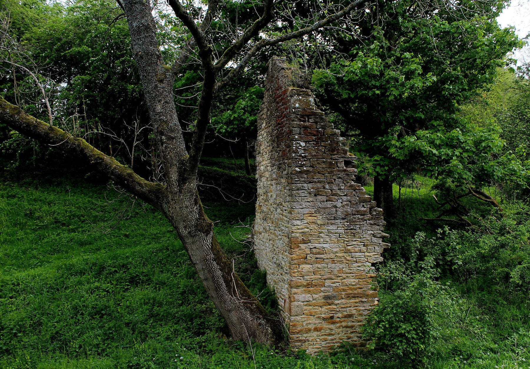
Only the gable end of one wall and the wall of a water-wheel housing survive above ground.
The gable end of one wall and a water-wheel housing wall.
Nearby mines
- Frosterley Marble Quarries — 0.2 miles (0.3 km) E
- Rogerley Mine — 0.6 miles (0.9 km) NW
- Cornish Hush Mine — 2.4 miles (3.8 km) SW
- Diana Maria Mine — 3.3 miles (5.2 km) W
- Stanhopeburn Mine — 3.6 miles (5.7 km) NW
Straight-line distance, within 9 miles (15 km). Show on the map.
Recorded claims
Individual factual claims, each attached to the source(s) that support it below. Where sources disagree, both are kept.
- The London Lead Company leased Harehope Gill Mine in 1796 and probably drove its main level; the Beaumont Company took over the working around the mid-1830s. 1
- The mine's Engine Shaft was around 60 metres deep, reaching the Great Limestone and the Four Fathom Limestone. 2
- After the Beaumont Company gave up the mine in the middle of the nineteenth century for want of ore, small companies worked it on and off until the last lead operation ended in 1890; in the late 1910s the dumps were reworked for fluorspar. 1
- The earliest workings were two shafts and a short level driven from the side of the burn near Harehope Farm, on the Broadwood Cross and Slitt veins; the Day Shaft also supplied water to an underground waterwheel that pumped the Engine Shaft, and the Borehole Shaft reached workings below the horse level. 1
- The Mining Remediation Authority holds abandonment plan OM2631 for Harehope Gill, catalogued for lead and ganister and drawn at twenty yards to the inch. 3
Photographs & further reading
Further detail on the mine's workings and surviving remains.
View sourceSources
- (secondary) Harehope Gill Mine — Mine Explorer Society
- (secondary) Fluorite Specimen Mining, Frosterley, Weardale, England — UK Mining Ventures
- (primary) Harehope Gill abandonment plan OM2631 (BGS mine plans catalogue) — British Geological Survey / Mining Remediation Authority
Record created: 1 September 2026 · Last researched: 24 September 2026