 MineArchive
Green Hurth Mine
| Also known as | Greenhurth Mine |
|---|---|
| Location | Herdship Fell, Harwood, Upper Teesdale, County Durham — 54.6891, -2.3416 (approximate) |
| Commodities | Lead, Zinc |
| Type | Metal |
| Worked | Leased 1799; at work by 1828–1902 |
| Maximum depth | No depth figure has yet been located. |
| Operators | John Surtees and Company (1799–?), Sherlock and Company (1845–1852), Green Hurth Lead Mining Company (1864–1902) |
Overview
A lead mine on the western slope of Herdship Fell in upper Teesdale, worked seriously only from the late 1860s but then profitably: its ore carried about twice the usual silver, and it raised over 18,000 tons of lead before water beat it in 1902. A waterwheel in the gill drove flat rods more than five hundred metres uphill to the drawing shaft.
History
The first known reference to Green Hurth is a 21-year lease granted to John Surtees and Company in 1799, which had to be surrendered early because the company never started work within the time allowed; nothing more is recorded until 1828. Between 1845 and 1852 the ground was worked as one of a group of small mines by Sherlock and Company, producing only about 500 tons a year. The mine proper dates from 1864, when the Green Hurth Lead Mining Company was formed and raised over £5,000 in working capital to develop it; most of what can be seen on the ground was built after about 1868, when mining is thought to have begun in earnest. It proved a good mine: the silver content of the ore rose with depth to 12 ounces to the ton of lead, double what was commonly expected, and the workings produced more than 18,000 tons of lead in all. Zinc ore was raised as well. Flooding forced abandonment in 1902. A local tradition, recorded in the mine databases, holds that in the deepest workings the vein stood three and a half feet wide and full of solid ore, and that the water came in so fast at the end that the tools were left where they lay.
Geology
The mine worked the Greenhurth vein and a set of cross veins — No. 1 Cross, No. 2 Cross, Annie's and Emmerson's — in the Carboniferous limestones of the Alston block. The richest oreshoots lay in the Tynebottom, Jew, Lower Little and Smiddy limestones, reached from the Middle Level below the Tynebottom Limestone, with further stoping in the underlying Whin Sill. The ground lies in the intermediate zone between the baryte and fluorite zones of the Northern Pennine Orefield.
Workings
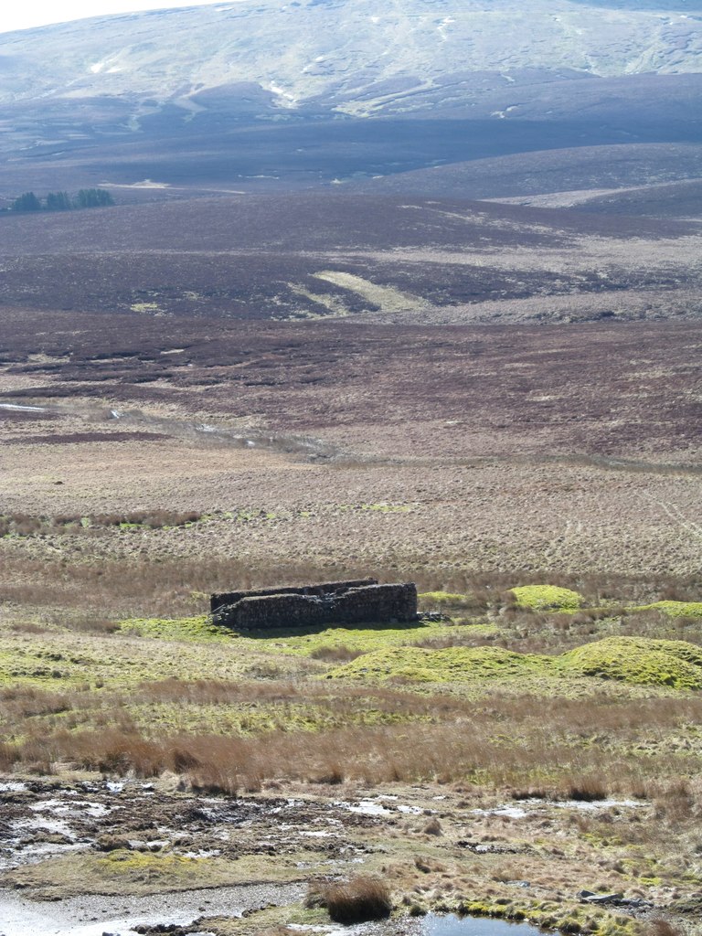
A group of levels and shafts on the fell, with Swan's Shaft — named after the company's managing director and sunk in the 1870s — as the main drawing shaft. Power came from a waterwheel in a stone and concrete wheelpit about 12 m by 4 m, which a 19th-century photograph shows as a large pitch-back wheel; flat rods ran 530 m uphill from it to the shaft, their balance-bob mountings still in place at either end of the pit, with a second set of rods taken off part way along to drive the ore works. A single-track tramway incline ran about 400 m downhill from the shaft to the dressing floors, where timber launders and a trunk buddle survive among the waste heaps.
Closure
Water ended the mine: flooding forced abandonment in 1902 after more than 18,000 tons of lead had been raised.
What remains
The ore works and the water-power system are a scheduled monument and are unusually well preserved, keeping timber launders, a trunk buddle and discrete deposits of processing waste; the wheelpit and its flat-rod line are described as nationally rare survivals. Swan's Shaft has collapsed and is now a pond ringed by a drystone wall, with machinery settings and holding-down bolts beside it; a small building on the shaft wall is used as a sheepfold. The more dispersed levels and shafts are not scheduled.
The wheelpit with its balance-bob mountings, the traceable line of the flat rods, Swan's Shaft and its machinery settings, the tramway embankment, a dam, a level, and the ore works with its buddle, launders and spoil heaps.
Redevelopment
None. The site lies on open fell.
Nearby mines
- Crook Burn Mine — 2.2 km N, Cumbria
- Lady's Rake Mine — 2.9 km NE
- Cow Green Mine — 4.2 km SE
- Tynehead Mine — 7.0 km N, Cumbria
- Cash Well Mine — 7.6 km NW, Cumbria
Straight-line distance, within 15 km. Show on the map.
Recorded claims
Individual factual claims, each attached to the source(s) that support it below. Where sources disagree, both are kept.
- A 21-year lease was granted to John Surtees and Company in 1799 but had to be surrendered early because no work was begun; there is no record of working at Green Hurth until 1828. 1
- Between 1845 and 1852 the ground was worked by Sherlock and Company as part of a group of small mines, producing only about 500 tons a year. 1
- The silver content of the ore increased with depth to 12 ounces per ton of lead, double what was commonly expected, and the mine produced over 18,000 tons of lead. 1
- A waterwheel in a 12 m by 4 m pit drove flat rods 530 m uphill to Swan's Shaft, with a second set taken off the rodway to power the ore works. 1
- Flooding forced the abandonment of the mine in 1902. 1,2
Photographs & further reading
A database record for the mine giving its veins, levels and working dates, with a bibliography of the Teesdale mining literature.
View sourceSources
- (primary) Green Hurth lead mine and ore works, Forest and Frith (List entry 1015836) — Historic England
- (secondary) Greenhurth Mine — Buddlepit Mine Database
- (primary) Abandoned mine plan catalogue entry: GREENHURTH MINE — British Geological Survey
Record created: 22 September 2026 · Last researched: 22 September 2026