 MineArchive
Foredale Quarry
| Location | Helwith Bridge, Ribblesdale, North Yorkshire — 54.1352, -2.2905 (approximate) |
|---|---|
| Commodity | Limestone |
| Type | Quarry |
| Worked | from 1878 |
| Maximum depth | Unknown. |
| Operators | Ribblesdale Lime and Flag Quarry Co Ltd (1882–?) |
Overview
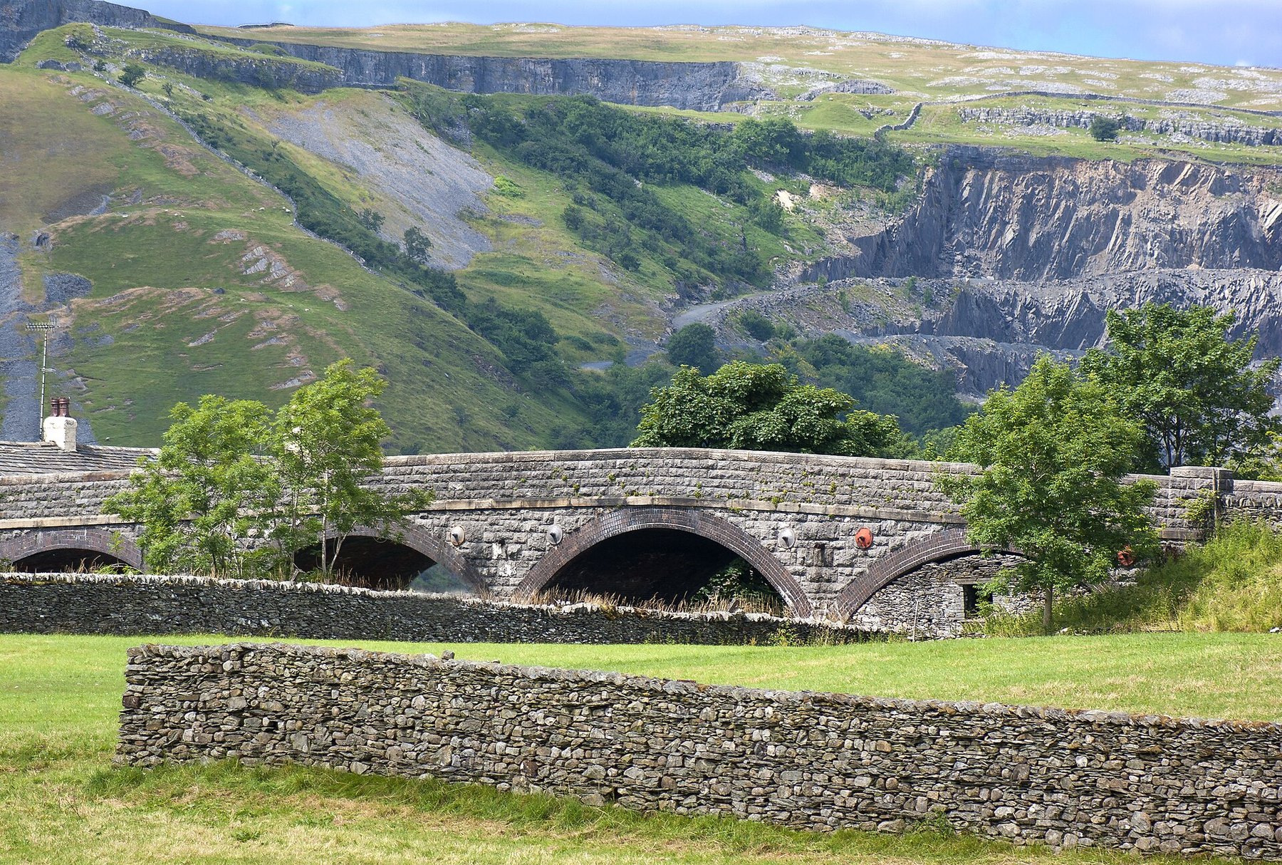
A limestone quarry high on the hillside above Helwith Bridge in Ribblesdale, opened in 1878 and sold in 1882 to the Ribblesdale Lime and Flag Quarry Company. It worked the Great Scar Limestone above the unconformity, at the top of the valley side, and sent its stone down to the processing plant and lime kilns by a rope-hauled inclined plane. Barely noticeable from the valley floor today, it covers an enormous area of ground.
History
The quarry was opened in 1878 and sold four years later to a newly formed company, the Ribblesdale Lime and Flag Quarry Co Ltd. It sits high above the dale, working the Carboniferous Great Scar Limestone that lies above the unconformity and forms the top of the valley side — a different rock from the gritstone worked at Arcow and Dry Rigg on the valley floor below.
Foredale Cottages were built high on the hillside for the quarry workers in the 1890s. They do not appear on earlier maps but are on the Ordnance Survey sheet of 1909, and they remain in use as private houses. The quarry was connected to the Settle and Carlisle railway through the Ribblesdale Lime Works sidings, reached from the main line by a triangular junction controlled from Helwith Bridge signal box, which closed on 7 September 1969.
Geology
Carboniferous Great Scar Limestone, lying above the unconformity and forming the top of the valley side at Helwith Bridge. That places Foredale in a different rock from its neighbours on the dale floor: Arcow and Dry Rigg work the older Silurian gritstone below the unconformity, and the two quarrying industries at Helwith Bridge sat one above the other in the same short stretch of valley.
Geological setting: Sedimentary Beds and Seams (well documented example)
Workings
An open quarry covering an enormous area high on the hillside, with an extensive narrow-gauge tramway system laid along the quarry floor. A rope-hauled inclined plane linked the quarry to the stone processing plant and lime kilns below, and from there the Ribblesdale Lime Works sidings connected to the Settle and Carlisle line by a triangular junction.
Closure
The closure date is not known. The Helwith Bridge signal box that controlled the junction serving the works closed on 7 September 1969.
What remains
The quarry is hardly noticeable from the valley floor today despite its size. Foredale Cottages, built for the quarrymen in the 1890s, are still occupied as private houses, and the quarry face is used by climbers.
The quarry face, used by climbers, and Foredale Cottages of the 1890s, still occupied.
Related mines
- Arcow Quarry — The two are Helwith Bridge neighbours working different rocks one above the other: Arcow the Silurian gritstone on the valley floor, Foredale the Carboniferous limestone at the top of the valley side. Foredale is named on the Arcow record.
- Dry Rigg Quarry — Both are Helwith Bridge quarries served off the same stretch of the Settle and Carlisle line, Dry Rigg working gritstone below the unconformity and Foredale limestone above it.
Nearby mines
- Arcow Quarry — 0.6 miles (1.0 km) SW
- Dry Rigg Quarry — 1.2 miles (1.9 km) SW
- Fountains Fell Colliery — 3.5 miles (5.6 km) E
- Ribblehead Quarry — 5.4 miles (8.7 km) NW
- Pikedaw Calamine Mines — 6.0 miles (9.7 km) SE
Straight-line distance, within 9 miles (15 km). Show on the map.
Recorded claims
Individual factual claims, each attached to the source(s) that support it below. Where sources disagree, both are kept.
- The quarry was opened in 1878 and sold in 1882 to a newly formed company, the Ribblesdale Lime and Flag Quarry Co Ltd. 1
- Foredale worked the Carboniferous Great Scar Limestone lying above the unconformity and forming the top of the valley side, a different rock from the gritstone quarried on the dale floor below. 1
- An extensive narrow-gauge tramway ran along the quarry floor and a rope-hauled inclined plane linked the quarry to the stone processing plant and lime kilns; the Ribblesdale Lime Works sidings reached the Settle and Carlisle line by a triangular junction controlled from Helwith Bridge signal box, closed on 7 September 1969. 1
- Foredale Cottages were built high on the hillside for quarry workers in the 1890s, appearing on the 1909 Ordnance Survey map but not on earlier ones, and remain in use as private residences. 1
Photographs & further reading
An account of all the Helwith Bridge workings and the railway infrastructure that served them, including Foredale's incline and the lime works sidings.
View sourceSources
- (secondary) SCRCA Knowledge Base: Helwith Bridge Quarries — Settle-Carlisle Railway Conservation Area project, Friends of the Settle-Carlisle Line
- (observational) Helwith Bridge with Foredale quarry beyond — Geograph Britain and Ireland
Record created: 9 September 2026 · Last researched: 9 September 2026