 MineArchive
Faskine Colliery
| Also known as | Faskine No. 7 Pit |
|---|---|
| Location | Faskine, near Calderbank, Airdrie, North Lanarkshire — 55.8473, -3.9778 (exact) |
| Commodities | Coal, Ironstone |
| Type | Coal |
| Worked | By 1835–After 1933 |
| Maximum depth | 120 fathoms (219 m), No. 8 Pit |
| Operators | William Dixon (1819–?), McLay and Love (1870–1870), William Baird & Company, Castlecary Fireclay Co. Ltd, Faskine and Palacecraig Brick and Coal Ltd |
Overview
Coal and blackband ironstone pits on the Faskine estate by the Monkland Canal near Calderbank, Airdrie, worked from an early date, bought by William Dixon in 1819, later Baird property, and still raising household coal from the Ell, Humph and Main seams in the 1920s.
History
Faskine is an estate and village in Old Monkland parish, on the right bank of the North Calder Water west of Calderbank. Groome's Ordnance Gazetteer of the 1880s says its coal and ironstone mines had been worked from an earlier period than any others in the great Clydesdale mineral field. William Dixon, owner of the Govan collieries, bought the estate in 1819 for its coal and minerals, and a plan of the Faskine ironstone workings was surveyed in 1835.
In the mid nineteenth century numbered pits worked blackband ironstone and coal here. No. 6 Pit's ironstone workings were connected underground to Peep O'Day No. 2 Pit, with survey dates of 1862 to 1864; No. 7 Pit worked two ironstone seams, at 12 and 40 fathoms, in 1861; and from No. 8 Pit the drawing roads ran south beneath the Monkland Canal to workings across the Calder, surveyed in 1861 and 1862. Five men are recorded killed at Faskine between 1861 and 1873, by a fall from a mid-working, a boiler bursting, a slipping pinch at an ironstone face, a roof fall and an overwind. In April 1870 No. 6 Pit, the property of Bairds of Gartsherrie and worked under contract by McLay and Love, lost two boys when a stone fell from the shaft side through the cage roof.
The No. 7 Pit site was later worked as Faskine Colliery. Its owners are recorded as William Baird and Company, the Castlecary Fireclay Company and Faskine and Palacecraig Brick and Coal Ltd. It raised household and manufacturing coal from the Ell seam in 1910 with 69 men, and from the Ell, Humph and Main seams in 1920; the Pyotshaw seam had been abandoned by 1915. Sixteen men worked there in 1933.
Geology
Scottish Coal Measures with blackband ironstone: the Airdrie Blackband and Kennelburn ironstones, the Kiltongue and Drumgray coals, and later the Ell, Humph, Main and Pyotshaw seams.
Workings
Numbered shafts, among them Nos 6, 7, 8 and 10, with level drawing roads; No. 7 reached the Drumgray coal at 100 fathoms (183 m) and No. 8 the Kiltongue coal at 120 fathoms (219 m), its workings running south under the Monkland Canal.
Closure
Employment fell from 69 in 1910 to 16 in 1933; the date of closure is Unknown.
What remains
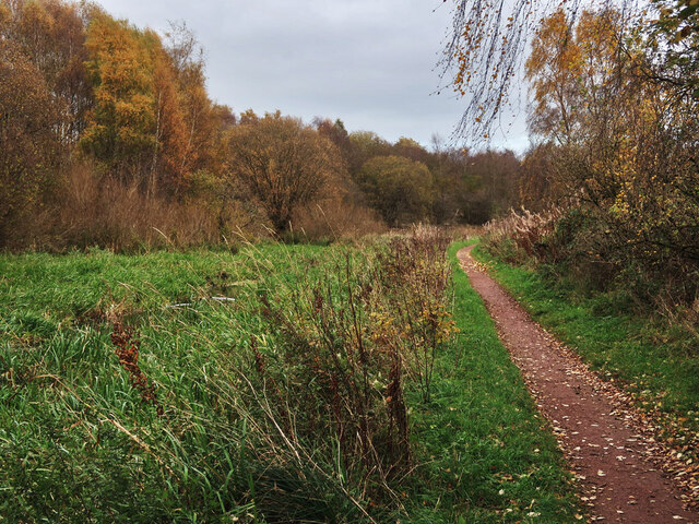
The pit sites are lost; the No. 8 shaft site lies in woodland north of the Monkland Canal.
No visible remains; the shaft sites are under woodland.
Redevelopment
Woodland beside the Monkland Canal.
Related mines
- Palacecraig Colliery — Neighbouring Baird coal and blackband ironstone pits; the Faskine estate lies directly west of Palacecraig.
Nearby mines
- Palacecraig Colliery — 0.5 miles (0.8 km) W
- Thankerton Colliery — 1.6 miles (2.5 km) SW
- Milnwood Colliery — 2.2 miles (3.5 km) S
- Hattonrigg Colliery — 2.4 miles (3.8 km) SW
- Rosehall Colliery — 2.5 miles (4.0 km) SW
Straight-line distance, within 9 miles (15 km). Show on the map.
Recorded claims
Individual factual claims, each attached to the source(s) that support it below. Where sources disagree, both are kept.
- The Faskine estate's coal and ironstone mines were worked from an earlier period than any others in the Clydesdale mineral field. 1
- William Dixon bought the Faskine estate in 1819 for coal and mineral extraction. 2
- A plan of the Faskine ironstone workings was surveyed in 1835. 3
- No. 7 Pit worked two ironstone seams, at 12 and 40 fathoms, in 1861, and the site later became Faskine Colliery, producing coal about 1910. 4
- No. 8 Pit reached the Kiltongue coal at 120 fathoms, its workings extending beneath the Monkland Canal. 5
- No. 6 Pit's ironstone workings were connected to Peep O'Day No. 2 Pit, with survey dates of 1862 to 1864. 6,7
- In April 1870 two boys were killed at No. 6 Pit, the property of Bairds of Gartsherrie, when a stone fell from the shaft side through the cage roof. 8
- Employed 69 men in 1910, 57 in 1920 and 1923, and 16 in 1933, working the Ell, Humph and Main seams. 9
- Faskine Colliery stood beside the Monkland Canal near Calderbank. 10
Sources
- (secondary) Faskine, Lanarkshire (Groome's Ordnance Gazetteer of Scotland, 1882-4) — A Vision of Britain through Time
- (secondary) William Dixon (industrialist, born 1753) — Wikipedia
- (primary) BGS mine plan: Plan of Faskine ironstone workings, surveyed 1835 — British Geological Survey / Mining Remediation Authority
- (secondary) Faskine No.7 Pit — Scottish Cave and Mine Database (Grampian Speleological Group)
- (secondary) Faskine No.8 Pit — Scottish Cave and Mine Database (Grampian Speleological Group)
- (secondary) Faskine No.6 Pit — Scottish Cave and Mine Database (Grampian Speleological Group)
- (secondary) Peep O'Day No.2 Pit — Scottish Cave and Mine Database (Grampian Speleological Group)
- (secondary) Coal Accident (Glasgow Herald, 14 April 1870, transcribed) — slavens.net
- (primary) Faskine Colliery — Durham Mining Museum
- (observational) Monkland Canal near Calderbank (Geograph 7912746) — Geograph
Record created: 17 October 2026 · Last researched: 17 October 2026