 MineArchive
Dulcote Quarry
| Location | Dulcote, near Wells, Somerset — 51.1981, -2.6239 (exact) |
|---|---|
| Commodity | Limestone |
| Type | Quarry |
| Worked | Mid-19th century–From 2016 |
| Maximum depth | Unknown. |
| Operators | Foster Yeoman Ltd. (1923–?) |
Overview
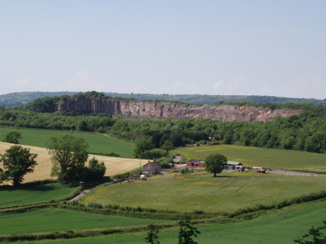
A worked-out limestone quarry at Dulcote below the Mendip Hills, a mile east of Wells, and the place the Foster Yeoman company was founded in 1923. It took Carboniferous Limestone for construction aggregate at about a quarter of a million tonnes a year and sent most of it away by rail on the Cheddar Valley line. Quarrying has stopped; the hole it left, eighteen acres inside eighty acres of woodland, was bought in 2016 and turned into a food factory, which opened the following year.
History
The site has been quarried since the middle of the nineteenth century, with serious working from about 1890. By the turn of the century Dulcote Hill carried two separate quarries, Dulcote Hill to the west and the Great Western Railway's Dulcote Quarry to the east. In 1923 Foster Yeoman signed a lease from Charles Clement Tudway for the ground just west of the railway company's quarry, and the following year came to an agreement with the railway for a new siding. The Foster Yeoman company, later part of Aggregate Industries, was founded here.
Output ran at roughly 0.25 million tonnes a year of Carboniferous Limestone for general construction aggregate. Most of it left on the Cheddar Valley line, a Great Western branch, worked latterly by the independent operator that became Mendip Rail. A geodiversity audit of the site in 2004 recorded the limestone strata and the fossils in them.
The quarry was bought in 2007 by the Kilbride group, a subsidiary of Kilmartin Holdings which itself became part of Hansteen Holdings. When the parent went into receivership the company holding Dulcote survived, and put the worked-out site up for commercial redevelopment with outline planning permission at £1.5 million. It was bought in 2016 as a food production site for Charlie Bigham's, which opened there in 2017.
Geology
Carboniferous Limestone, overlain here by Triassic Mercia Mudstones and sandstones. The sandstones carry geodes formed by siliceous mineral replacement, and the fossils in the limestone were catalogued in a geodiversity audit of the site in 2004. The quarry sits on the southern edge of the Mendip limestone, the same resource that made the hills a national aggregate source.
Geological setting: Sedimentary Beds and Seams (well documented example)
Workings
An open quarry roughly 600 m east to west and 350 m north to south, eighteen acres of working face and floor set inside about eighty acres of woodland. Transport decided its shape as much as the geology did: the Great Western branch ran below the hill, the railway company worked its own quarry on the eastern side, and Foster Yeoman's 1924 agreement for a siding is what let the western workings grow.
Closure
Quarrying ended with the stone worked out rather than by any single closure decision. The site then passed through property ownership rather than quarrying ownership, and was marketed for redevelopment with outline planning permission before being sold in 2016.
What remains
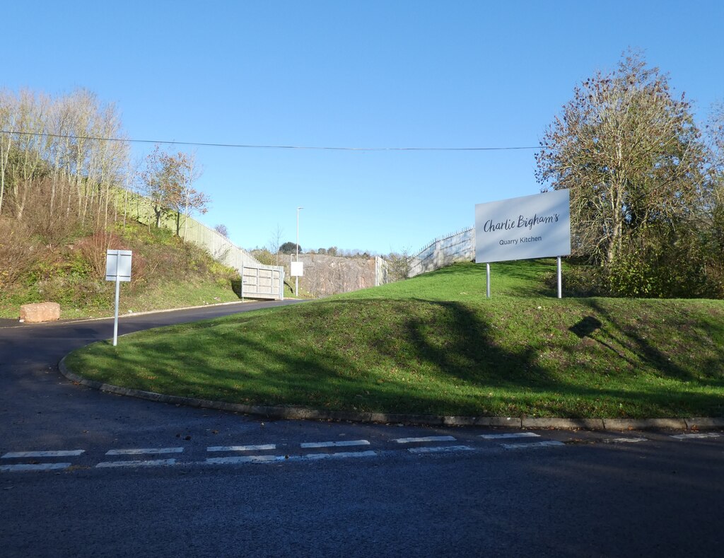
No longer a quarry. The floor of the hole is occupied by a food production plant built for Charlie Bigham's and opened in 2017, with the quarry faces standing round it and the woodland beyond. In March 2022 a shared-use path forming part of the Strawberry Line was opened, linking the end of the Wells to Dulcote railway path at the Dulcote underpass to the quarry entrance.
The quarry faces stand around the food production plant that now occupies the floor.
Redevelopment
Bought in 2016 and developed as a food production site for Charlie Bigham's, which opened in 2017 — the working face and floor of a Mendip aggregate quarry given over to manufacturing rather than restored to landscape.
Related mines
- Torr Works — Both are Mendip limestone quarries built around rail-borne aggregate traffic, and both passed into the Foster Yeoman business that began at Dulcote in 1923.
Nearby mines
- Higher Pitts Mine — 3.4 miles (5.4 km) NW
- Priddy (St Cuthbert's) Lead Works — 4.2 miles (6.7 km) N
- Chewton Mineries — 4.6 miles (7.4 km) N
- Gurney Slade Quarry — 5.0 miles (8.0 km) NE
- Doulting Quarry — 5.3 miles (8.6 km) E
Straight-line distance, within 9 miles (15 km). Show on the map.
Recorded claims
Individual factual claims, each attached to the source(s) that support it below. Where sources disagree, both are kept.
- The Foster Yeoman company was founded at Dulcote in 1923, when it leased ground west of the Great Western Railway's own quarry from Charles Clement Tudway and, the next year, agreed a new siding with the railway. 1,2
- The quarry produced about 0.25 million tonnes a year of Carboniferous Limestone for general construction aggregate, most of it moved on the Cheddar Valley line. 1
- Carboniferous Limestone overlain by Triassic Mercia Mudstones and sandstones containing geodes formed by siliceous mineral replacement, recorded in a 2004 geodiversity audit. 1
- The worked-out site was marketed with outline planning permission at £1.5 million, bought in 2016 as a food production site for Charlie Bigham's, and opened in 2017. 1
- Located at about 51.198 N, 2.624 W. 1
Photographs & further reading
The survey's account of how quarrying developed across the western Mendips, which puts Dulcote in the context of the wider aggregate industry there.
View sourceSources
- (secondary) Dulcote Quarry — Wikipedia
- (primary) History of the West Mendip quarries — Foundations of the Mendips — British Geological Survey
- (observational) Dulcote Quarry — Geograph Britain and Ireland
Record created: 9 September 2026 · Last researched: 9 September 2026