 MineArchive
Dean Lane Colliery
| Location | Dean Lane, Bedminster, Bristol — 51.4422, -2.5986 (approximate) |
|---|---|
| Commodity | Coal |
| Type | Coal |
| Worked | to 1906 |
| Maximum depth | Over 1,000 feet (main shaft) |
| Operators | Bedminster Coal Company (?–1906), The Smyth family of Ashton Court (?–1906) |
Overview
The Bedminster Coal Company's pit off Dean Lane, Bedminster, the largest of Bristol's Bedminster mines, working the Great Vein from a shaft over 1,000 feet deep. An explosion killed ten in 1886; it closed in 1906 with the loss of over 400 jobs, and its site is now Dame Emily Park.
History
Deep coal mining in Bedminster began on the Smyth family's Ashton Court estate in the 1740s, and by 1800 there were eighteen collieries between Ashton Vale and Bedminster. Dean Lane was the largest, with a main shaft of over 1,000 feet and some 400 men. Worked by the Bedminster Coal Company, it raised gas, household and steam coal from the Bedminster Great Vein, employing 235 in 1894 and 327 in 1900. The Gas Coal seam, two feet eight inches thick, was reached by a 50-yard staple known as the tip and a 300-yard incline.
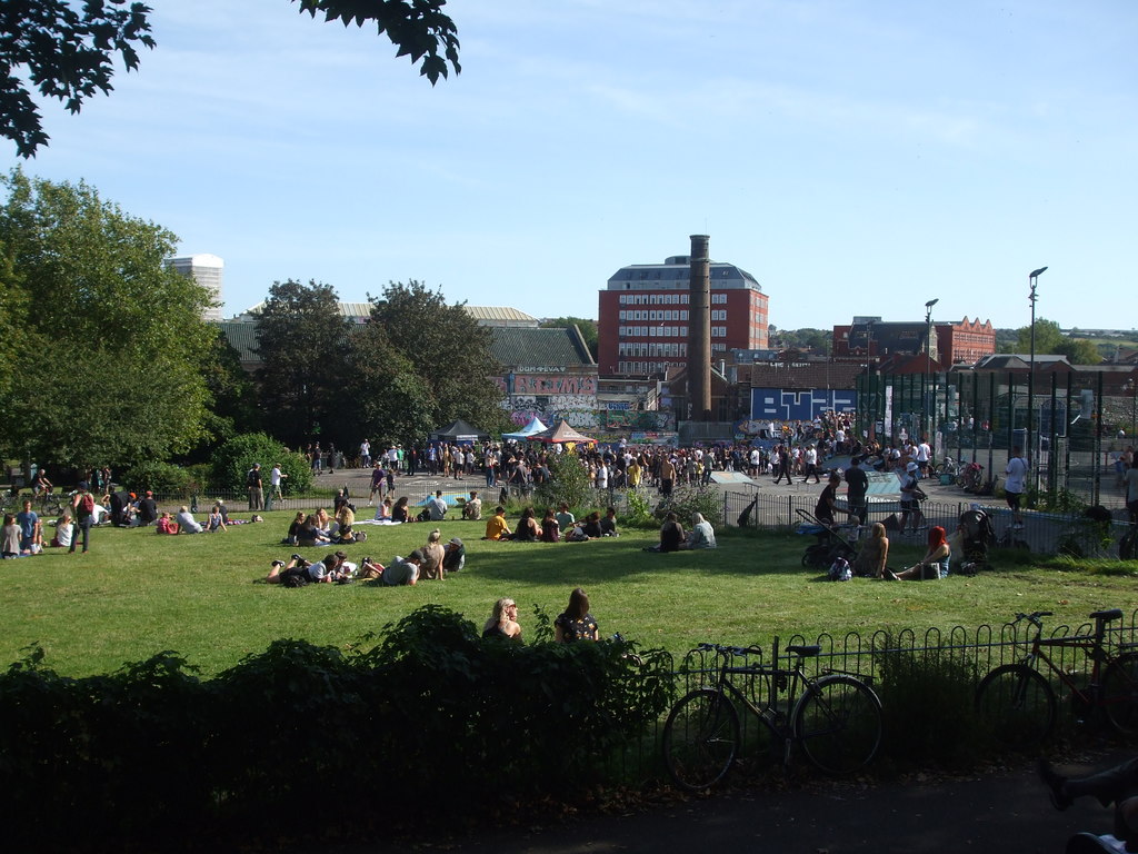
On 10 September 1886 firedamp exploded in the Gas Coal seam and killed ten of the twenty men working there; afterwards new ventilation roads were driven and locked lamps adopted. Employment had fallen to 144 by 1905, and the colliery closed in 1906 with the loss of over 400 jobs. The Smyth family gave the ground to the city as an open space, now Dame Emily Park, where a memorial bandstand once stood over the old shaft.
Geology
Bristol Coal Measures: the Bedminster Great Vein, and the Gas Coal seam, two feet eight inches thick and pitching south at about fifteen inches to the yard.
Workings
A main shaft over 1,000 feet deep; the Gas Coal reached by a 50-yard staple and a 300-yard engine-hauled incline.
Closure
Closed in 1906, with the loss of over 400 jobs.
What remains
The site is Dame Emily Park, a public park with a community garden, playground and skateboard area.
Redevelopment
Given by the Smyth family to the city as an open space, now Dame Emily Park; a memorial bandstand once stood over the pit shaft, later replaced by a skateboard area and playground.
Related mines
- Hanham Colliery — Both worked by the Bedminster Coal Company.
Nearby mines
- South Liberty Colliery — 0.9 miles (1.5 km) SW
- Easton Colliery — 2.0 miles (3.2 km) NE
- Hanham Colliery — 3.2 miles (5.2 km) E
- Speedwell Colliery — 3.4 miles (5.5 km) NE
- Pensford Colliery — 5.3 miles (8.5 km) S, Somerset
Straight-line distance, within 9 miles (15 km). Show on the map.
Disasters & major incidents
-
Dean Lane Colliery explosion, 1886
10 September 1886 · Explosion · 10 fatalities
On 10 September 1886 firedamp exploded in the Gas Coal seam at the Bedminster Coal Company's Dean Lane Colliery in Bristol, killing ten of the twenty men working there. The inspector found that gas from the coal had seeped through cracks in an arch and fired at a boy's naked light.
Recorded claims
Individual factual claims, each attached to the source(s) that support it below. Where sources disagree, both are kept.
- Dean Lane was the largest of the Bedminster pits, employing about 400 men, with a main shaft of over 1,000 feet. 1,2
- It worked the Bedminster Great Vein for gas, household and steam coal. 3,4
- An explosion on 10 September 1886 killed ten. 5,3
- The colliery closed in 1906 with the loss of over 400 jobs. 1
- The pit site is now Dame Emily Park, where a memorial bandstand stood over the shaft. 6,2
Photographs & further reading
Owners, seams, employment 1894-1905 and those killed.
View sourceLocal memories of the Bedminster pits, including Dean Lane.
View sourceBedminster's history, with its coal pits and the Smyth family.
View sourceSources
- (secondary) West Street and coal mining in Bedminster — Map your Bristol
- (secondary) Bristol - Bedminster — brisray.com
- (primary) Dean Lane Colliery — Durham Mining Museum
- (primary) Mine plan: Malago Vale and Dean Lane, Great Vein — British Geological Survey
- (secondary) Dean Lane Colliery Explosion - Bristol - 1886 — Northern Mine Research Society
- (secondary) Mining in Bedminster — Bristol Stories
Record created: 3 October 2026 · Last researched: 3 October 2026