 MineArchive
Cwm Dwyfor Mine
| Also known as | Cwm Dwyfor Copper Mine, Cwmdwyfor Mine |
|---|---|
| Location | Cwm Dwyfor, head of Cwm Pennant, below Mynydd Tal-y-Mignedd, Gwynedd — 53.0325, -4.1768 (exact) |
| Commodities | Copper, Lead |
| Type | Metal |
| Worked | By 1873–1878 |
| Maximum depth | Unknown. |
| Operators | Cwmdwyfor Mine Company Ltd (1873–1879) |
Overview
A small copper and lead mine high in Cwm Dwyfor at the head of Cwm Pennant, linked by an incline to a branch of the Gorseddau Junction and Portmadoc Railway, worked in the 1870s and abandoned in 1878.
History
Cwm Dwyfor mine lies in the hollow below Mynydd Tal-y-Mignedd at the head of Cwm Pennant, in the hills between Dolbenmaen and the Nantlle ridge. In December 1873 the New Prince of Wales Slate Company, owner of the land, was telling investors that the Cwm Dwyfor company paid it a royalty of one-fifteenth on the ore, that the mines were being vigorously worked and that a large quantity had been raised. The Huddart family of Brynkir are said to have been behind the venture. Though recorded as a copper mine, it is said to have produced more lead than copper.
The mine was reached by a branch of the Gorseddau Junction and Portmadoc Railway, which ran from near the Prince of Wales quarry mill at Cwm Trwsgl round the head of Cwm Pennant to the foot of an incline below the mine; a prospectus of 1874 described the incline as 255 yards long with two lines of rails. Most of the buildings at the top date from 1876: a massive wheelpit, a crusher house, a barracks and a powder magazine. Crosscuts driven from the shaft found little ore, and a correspondent to the Mining World wrote that the company had been in financial agony from its birth. The mine was abandoned in 1878, and on 18 November 1879 the plant of the Cwmdwyfor Mine Company Ltd was auctioned at the mine, including a 35-foot water wheel, a crusher, winding drums, wire ropes, pumps, rails and incline rollers.
Geology
Unknown.
Workings
A shaft with crosscuts, an adit and trials towards the head of the cwm, with a crusher driven by a large water wheel.
Closure
Abandoned in 1878 after the crosscuts found little ore; the company's plant was auctioned in November 1879.
What remains
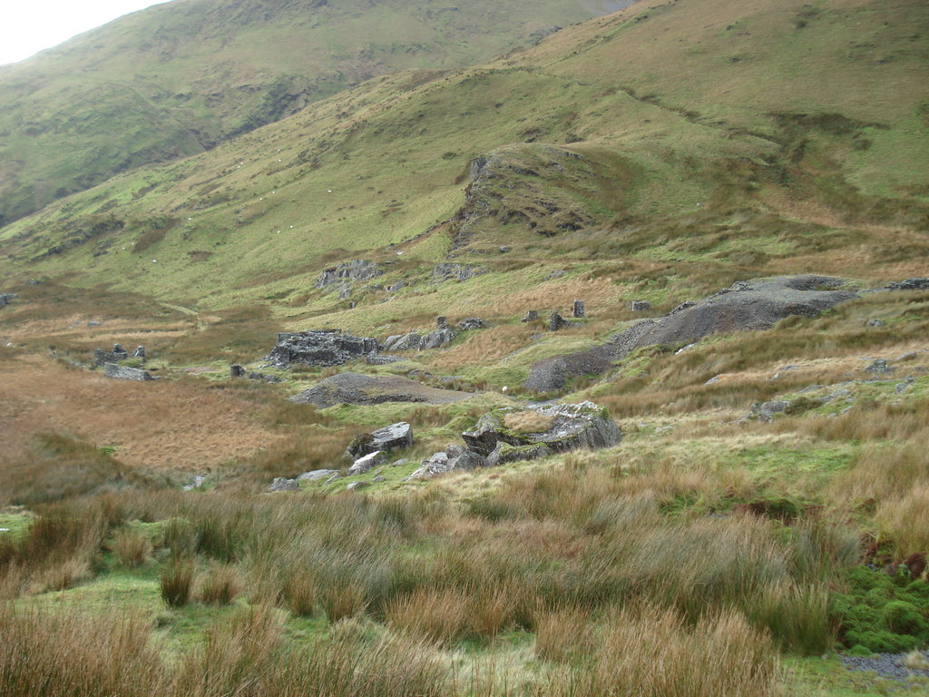
The ruined incline housing, wheelpit, crusher house and barracks stand on boggy ground, the barracks the best preserved; the shafts are open and overgrown.
The incline with its winding-house walls about 5 m high and eight tapering pillars, a slate-slab bridge on the tramway, the wheelpit and crusher house, the barracks and a powder magazine.
Redevelopment
None; open hill grazing.
Related mines
- Prince of Wales Quarry — The mine worked the Prince of Wales quarry company's land under royalty and was reached by a branch of the same railway from the quarry mill.
Nearby mines
- Gadair Wyllt Slate Quarry — 1.6 miles (2.6 km) NE
- Drws-y-Coed Copper Mine — 1.8 miles (2.9 km) N
- Cwm Ciprwth Mine — 2.0 miles (3.2 km) SW
- Moel Hebog Mine — 2.3 miles (3.7 km) SE
- Prince of Wales Quarry — 2.4 miles (3.8 km) S
Straight-line distance, within 9 miles (15 km). Show on the map.
What's uncertain
Points where sources disagree or the record could not be settled; both accounts are kept. All open questions in the archive.
- The Huddart family of Brynkir were involved in the Cwm Dwyfor venture, which produced more lead than copper. (uncertain) 5
Recorded claims
Individual factual claims, each attached to the source(s) that support it below. Where sources disagree, both are kept.
- In 1873 the Cwm Dwyfor mine company paid a royalty of one-fifteenth to the New Prince of Wales Slate Company, whose land it worked. 1
- A branch of the Gorseddau Junction and Portmadoc Railway led from near the Prince of Wales mill at Cwm Trwsgl to the Cwm Dwyfor metal mine. 2,3
- The mine's incline had a winding housing about 20 m square with walls up to about 5 m high and eight tapering pillars. 4
- The Huddart family of Brynkir were involved in the Cwm Dwyfor venture, which produced more lead than copper. (uncertain) 5
- The Cwm Dwyfor mine was abandoned in 1878. 5
- On 18 November 1879 the mining plant of the Cwmdwyfor Mine Company Ltd, including a 35-foot water wheel and a crusher, was auctioned at the mine. 6
Sources
- (primary) The North Wales Chronicle, 27 December 1873: The slate veins of Cwm Trwsgl and Blaen-y-Pennant — The North Wales Chronicle (Welsh Newspapers Online, National Library of Wales)
- (secondary) Gorseddau Junction and Portmadoc Railway — Wikipedia
- (secondary) Gorseddau Junction And Portmadoc Railway — Festipedia (FR Heritage Group)
- (secondary) Cwm Dwyfor Copper Mine (NPRN 287709) — Coflein (RCAHMW)
- (observational) Cwm Dwyfor Mine — Treasure Maps (Iain Robinson)
- (primary) The Cambrian News and Merionethshire Standard, 31 October 1879: Re Cwmdwyfor Mine Company, Limited (sale advertisement) — The Cambrian News and Merionethshire Standard (Welsh Newspapers Online, National Library of Wales)
Record created: 20 October 2026 · Last researched: 20 October 2026