 MineArchive
Moel Hebog Mine
| Also known as | Moel Hebog Copper Mine |
|---|---|
| Location | Western slopes of Moel Hebog, above Cwm Llefrith and Cwm Pennant, Gwynedd — 53.0031, -4.1505 (exact) |
| Commodity | Copper |
| Type | Metal |
| Worked | 1837–1889 |
| Maximum depth | Unknown. |
Overview
A remote copper mine high on the western slopes of Moel Hebog above Cwm Pennant, opened in 1837 and abandoned in 1889, whose promoters sold it as a mountain of copper.
History
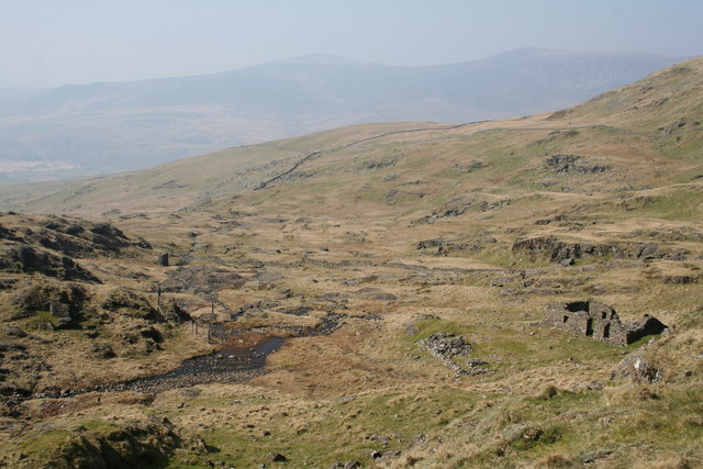
Moel Hebog mine lies high on the western slopes of Moel Hebog, above Cwm Llefrith and Cwm Pennant, on ground of brecciated volcanic tuff. It was opened in 1837 and changed hands several times. Copper was found in some quantity, but carrying it out across the neighbouring land made the mine hard to work, and its promoters' claims, of a 'mountain made of copper' and of gold still to be found, ran well ahead of the ore. The site was so exposed that work went on only about eight months a year; the mine captain, Henry Marshall, wrote that no work could be done in the winter months. It was abandoned in 1889.
The workings are scattered across the sett: open cuts, adits and trials, with a main level whose stopes still hold the timber stemples the miners stood on to work the vein overhead. Below them stand a smithy of granite and dolerite blocks, a dressing shed beside the middle adit, a single-roomed building with the remains of a cast-iron range, thought to be the miners' house shown on the original plans, and a large spoil tip below a shaft.
Geology
Copper ore in brecciated volcanic tuff on Moel Hebog.
Workings
Numerous openworks, adits and trials across the sett; a main level with stoped ground timbered with stemples, a shaft with a barrow-way to its tip, and an upper and lower series of adits, most of them short or flooded.
Closure
Abandoned in 1889 after several changes of ownership.
What remains
The buildings are roofless ruins; the main adit is open to a fork, with one branch blind and the other blocked by a fall beyond which the level is flooded.
A smithy, a dressing shed, a single-celled building with a fireplace and the remains of a cast-iron range, a spoil tip about 20 m by 15 m below a shaft, and a barrow-way.
Redevelopment
Open mountain land within Eryri National Park.
Nearby mines
- Prince of Wales Quarry — 0.6 miles (1.0 km) SW
- Gorseddau Quarry — 1.5 miles (2.5 km) SE
- Bryn y Felin Copper Mine — 1.9 miles (3.1 km) E
- Cwm Ciprwth Mine — 2.0 miles (3.3 km) W
- Aberglaslyn Copper Mine — 2.3 miles (3.7 km) E
Straight-line distance, within 9 miles (15 km). Show on the map.
Recorded claims
Individual factual claims, each attached to the source(s) that support it below. Where sources disagree, both are kept.
- Moel Hebog mine was opened in 1837, changed hands several times, and was abandoned in 1889. 1
- The site was so exposed that work went on only about eight months of the year; the captain, Henry Marshall, wrote that no work could be done in winter. 1
- Part of the main copper mining complex is a shaft with a spoil tip about 20 m by 15 m below it, linked to an adit by a barrow-way. 2
- A single-celled building of the main copper complex keeps its chimney, fireplace and pieces of a cast-iron range. 3,1
- A stope on the main level keeps the timber stemples put in as working platforms for the miners. 4
- Numerous openworks, adits and trials are scattered across the whole area of the sett. 1,5
Sources
- (observational) Mining for mysteries on Moel Hebog — Treasure Maps (Iain Robinson)
- (secondary) Moel Hebog Mine (NPRN 287876) — Coflein (RCAHMW)
- (secondary) Mine Building, Moel Hebog (NPRN 287875) — Coflein (RCAHMW)
- (observational) Moel Hebog mine - underground workings (photograph and caption, John Gibson) — Geograph
- (observational) Moel Hebog copper mine (photograph and caption, John Gibson) — Geograph
Record created: 19 October 2026 · Last researched: 19 October 2026