 MineArchive
Carnelloe Consols
| Also known as | Zennor Consols, Carnellow Consols, Carnelloe Tin Mine |
|---|---|
| Location | Carnelloe Cliff, above Porthglaze Cove, Zennor, Cornwall — 50.1930, -5.5848 (approximate) |
| Commodities | Tin, Copper |
| Type | Metal |
| Worked | 1853–1874 |
| Maximum depth | Unknown. |
| Operators | John Hawkin (1871–?) |
Overview
A small cliff mine on Carnelloe Cliff above Porthglaze Cove, a mile from Zennor churchtown, which raised copper in the 1850s and 1860s and tin from 1871 to 1874 under a lease from John Hawkin, with five lodes in forty fathoms, water power alone and about fifteen hands; its wheelpit and a shaft still stand above the cove.
History
Carnelloe Consols lay on the cliff a mile from Zennor churchtown, immediately above Porthglaze Cove and near Gurnard's Head, five miles from St Ives, its nearest shipping place, and seven from Penzance, the nearest railway station. It was worked for copper from 1853 to 1856 and again from 1862 to 1866, and then for tin from 1871 to 1874, under the names Carnelloe Consols, Carnellow Consols and Zennor Consols.
Kelly's directory of 1873 describes the tin mine: held under a lease of 21 years from 1871 granted by John Hawkin, paying dues of one eighteenth, with five lodes within a distance of about forty fathoms. Water power alone was used for drawing and the other processes, and about fifteen hands were employed. The company was on the cost-book system, with George Nettle as purser, William Rich as manager and William Ennor as chief agent. The tin working ended in 1874, and the abandonment plan of Carnelloe Consols, at twelve yards to the inch, records tin and copper ores.
Geology
Five tin and copper lodes within about forty fathoms of one another in the granite of the Zennor cliffs between Zennor Head and Gurnard's Head.
Geological setting: Veins and Lodes (historical documentary reference)
Workings
Five lodes worked within forty fathoms from the cliff above Porthglaze Cove, drawn and dressed by water power alone; a shaft and a wheelpit survive together above the cove.
Closure
The copper working stopped in 1866 and the tin working under the 1871 lease in 1874; no reason is recorded.
What remains
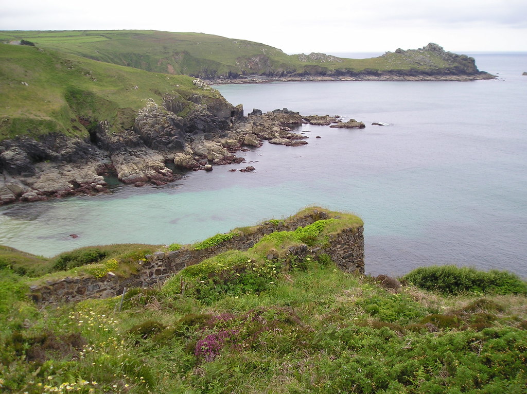
A stone wheelpit with a shaft beside it stands on the cliff above Porthglaze Cove, photographed in 2013.
The wheelpit and shaft above Porthglaze Cove; a plaque on the coast path describes the mining here.
Redevelopment
None.
Nearby mines
- Gurnard's Head Mine — 0.5 miles (0.8 km) SW
- Rosevale Mine — 1.8 miles (2.9 km) E
- Carn Galver Mine — 2.0 miles (3.2 km) SW
- Ding Dong Mine — 2.8 miles (4.5 km) S
- Rosewall Hill Mine — 3.4 miles (5.4 km) E
Straight-line distance, within 9 miles (15 km). Show on the map.
Recorded claims
Individual factual claims, each attached to the source(s) that support it below. Where sources disagree, both are kept.
- Carnelloe Consols mined copper from 1853 to 1856 and from 1862 to 1866, and tin from 1871 to 1874. 1
- The mine lies a mile from Zennor churchtown, immediately over Porthglaze Cove and near Gurnard's Head, five miles from St Ives and seven from Penzance. 1
- It was held under a 21-year lease from 1871 granted by John Hawkin, at dues of one eighteenth. 1
- There are five lodes within a distance of about forty fathoms. 1
- Water power only was used for drawing and the other processes, and about fifteen hands were employed. 1
- In 1873 the purser was George Nettle, the manager William Rich and the chief agent William Ennor, on the cost-book system. 1
- The abandonment plan of Carnelloe Consols, at twelve yards to the inch, records tin and copper ores. 2
- A wheelpit with a shaft alongside it stands above Porthglaze Cove, photographed in 2013. 3
Photographs & further reading
The mine's dates and Kelly's 1873 directory entry.
View sourceA 2013 photograph of the wheelpit and shaft on the cliff.
View sourceSources
- (secondary) Carnelloe Tin Mine, Zennor — Cornwall Calling
- (primary) BGS mine plan: Carnelloe Consols, tin and copper ores — British Geological Survey
- (observational) Wheelpit above Porthglaze Cove (photograph, 2013) — Geograph
Record created: 18 October 2026 · Last researched: 21 October 2026