 MineArchive
Calcutts Colliery
| Also known as | Calcuts Colliery, The Calcutts |
|---|---|
| Location | The Calcutts, Jackfield, Broseley, Shropshire — 52.6248, -2.4653 (approximate) |
| Commodities | Coal, Brick Clay |
| Type | Coal |
| Worked | c. 1588–c. 1900 |
| Maximum depth | Two shafts of 6 ft diameter and 60 ft depth as returned in 1891 |
| Operators | James Clifford (1588–1620), W. O. Foster (1869–1890) |
Overview
The Calcutts, on the north-facing slope above the Severn between Jackfield and Ironbridge, were the principal mines of Broseley parish by the early seventeenth century and were still being returned as a working colliery in 1880 under W. O. Foster. James Clifford, lord of the manor, opened them from about 1588 on land leased to Richard Wilcox, and by 1605 the coal was leaving by a wooden railway down to the river — the second railway anywhere in England for which evidence survives. John Weld reckoned in 1622 that £1,000 had been spent on them for a clear annual profit of £100 and sometimes less, and thought them adequate security against the encumbrances on the land he had bought. The site later carried the Calcutts Ironworks, which cast cannon for the Napoleonic wars, and by 1891 the Calcutts pit was working red clay from two sixty-foot shafts.
History
Coal was being got in Broseley by the early fifteenth century, but large-scale working dates from the 1570s, when James Clifford, lord of the manor, encouraged immigrant miners to settle on the waste and set about exploiting coal under land he did not own as well as land he did. From about 1588 there were mines at Calcutts on land leased to Richard Wilcox, which Wilcox allowed Clifford to open and work; by 1605, when railways began to be laid, the agreement had broken down and there were violent disputes involving Wilcox’s undertenant William Wells. A document of that year refers to a line from Birch Leasows in Broseley to the Calcutts — the second railway anywhere in England for which evidence survives.
Richard Wilcox eventually released the Calcutts to Clifford for the mining of stone coal or sea coal, and the mines there — "the great pasture ground where the coalmines are" — became the most valuable in the parish. John Weld alleged in 1622 that £1,000 had been spent on them and that their clear annual profit was £100 and sometimes less, but he considered them adequate to indemnify him against the encumbrances on the lands he had bought from William Porter, which makes them probably the principal mines in Broseley. They were managed in Clifford’s and Porter’s time by John Huxley, and the Huxleys went on managing them for the leaseholders after 1620, acquired the leasehold themselves in 1659 and were still working the mines in 1685. In 1681–2 an average of 116 tons of coal a month was raised from Calcutts and Peartree croft together.
The ground above the mines became an industrial site in its own right. By 1730 single houses and rows stood among pottery kilns, pits and railway lines at Calcutts; in 1767 George Matthews leased the site from Sir Onesiphorus Paul and built two blast furnaces, and brick making probably began soon after. Alexander Brodie bought the lease in 1786 and made the works nationally known for cannon — 32-pounders by 1796, bored eleven at a time on one of only three steam-powered boring mills in the country, and shipped to Bristol for the navy. William Hazledine took the works over about 1817 and the last furnace closed in 1828.
The colliery outlasted the furnaces. The minerals of the Broseley estate were under lease to the Foster family until 1843, their mines mainly on the Forester and Calcutts ground, and W. O. Foster is returned as the owner of Calcutts in the collieries at work in both 1869 and 1880. By 1891, when the mines still working in the area were listed, Calcutts was down to two shafts of six feet diameter and sixty feet depth, working red clay and naturally ventilated.
Geology
The Lower Coal Measures outcrop extensively in the western part of Broseley parish and along the slopes down to the Severn, with coal, ironstone and clay lying close enough together to be got from the same shallow workings; to the east the workable seams are overlain by the Carboniferous sandstones, marls and mudstones of the Hadley and Coalport formations. The seams here are few, thin and shallow, and the slopes down to the river are unstable, having produced notable landslips in 1881 and 1952 — which is part of why the Calcutts workings were sixty feet deep rather than six hundred.
Geological setting: Sedimentary Beds and Seams (well documented example)
Workings
Shallow shafts and insetts — the local word for an adit driven straight into the hillside from the riverside — worked along the outcrops. The Calcutts mines were unusual not for their depth but for how the coal got away: the wooden railway of 1605 from Birch Leasows down to the Calcutts is the second in England for which any evidence survives, and by 1730 railway lines ran among the houses, pottery kilns and pits on the site. The last recorded state of the colliery, in the 1891 return of mines at work in the Broseley area, was two shafts each six feet in diameter and sixty feet deep, working red clay, and — like all but three of the seventeen mines then at work in the parish — ventilated naturally.
Closure
Broseley coal had all but given out by the middle of the nineteenth century and what continued here was clay, with a little coal alongside. The 1891 return still lists Calcutts as a working red clay pit of two sixty-foot shafts, but it does not appear in the 1908 list of mines in the Broseley area, by which time the whole parish employed only eighty-two men underground. Clay mining in Broseley ended about 1950 and all mining by 1960.
What remains
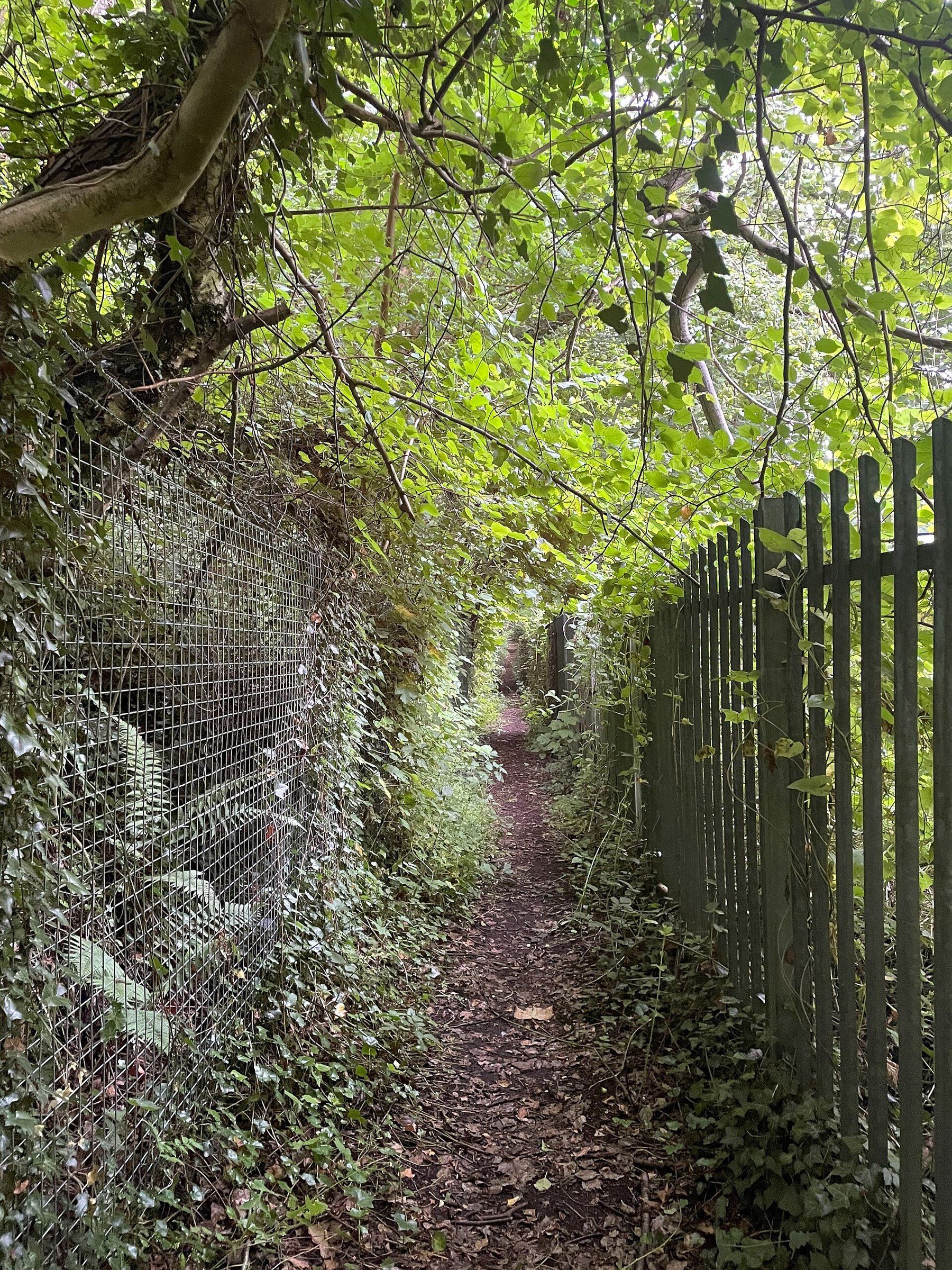
The ground is residential and wooded. The Calcutts, Calcutts Road and Dark Lane at Jackfield carry the name; a footpath between Dark Lane and Calcutts Road was photographed in August 2024 running through what is now ordinary woodland. Nothing of the colliery is known to survive on the ground. The ironworks that stood above it is represented by a model in the Ironbridge Gorge diorama at the Museum of the Gorge.
Nothing identifiable as the colliery. The road names at Jackfield — The Calcutts, Calcutts Road — and the site of the ironworks, whose foundry was demolished in 1836, are what is left of the name on the ground.
Related mines
- Jackfield Colliery — Both are small workings in the same Jackfield ground of Broseley parish, returned together in the collieries at work in 1869, 1880 and 1908, and both ended as clay pits serving the Severn Gorge tile industry rather than as coal mines.
Nearby mines
- Jackfield Colliery — 0.3 miles (0.4 km) SE
- Lloyds Mines Ironbridge — 0.4 miles (0.7 km) W
- Coalbrookdale Colliery — 1.2 miles (1.9 km) NW
- Halesfield Pit — 1.2 miles (1.9 km) E
- Blists Hill Colliery — 1.3 miles (2.0 km) N
Straight-line distance, within 9 miles (15 km). Show on the map.
Recorded claims
Individual factual claims, each attached to the source(s) that support it below. Where sources disagree, both are kept.
- The official list of collieries at work in 1880 returns the pit in the Shropshire section as "Calcuts, Wellington, W. O. Foster"; the Broseley Local History Society’s transcription of the 1869 list gives "Calcutts, Ironbridge, W. O. Foster". 1,2
- From about 1588 there were mines at Calcutts on land leased to Richard Wilcox, which Wilcox allowed his landlord James Clifford to open up and work; by 1605, when railways began to be laid, the agreement had broken down and there were violent disputes involving Wilcox’s undertenant William Wells. 3
- A document of 1605 refers to a line from Birch Leasows, Broseley, to the Calcutts — the second railway anywhere in England for which evidence survives. 3
- John Weld alleged in 1622 that £1,000 had been spent on the Calcutts mines and that their clear annual profit was £100 and sometimes less, but considered them adequate to indemnify him against the encumbrances on the lands he had bought from William Porter — which makes them probably the principal mines in the parish. 3
- The Calcutts mines were managed in Clifford’s and Porter’s time by John Huxley; the Huxleys continued to manage them for the leaseholders after 1620, acquired the leasehold themselves in 1659 and were still working the mines in 1685. In 1681–2 an average of 116 tons of coal a month was raised from Calcutts and Peartree croft. 3
- The 1891 return of mines at work in the Broseley area records Calcutts as two shafts, each 6 ft in diameter and 60 ft deep, working red clay and naturally ventilated. 4
- Calcutts Ironworks was established on the site in 1767 when George Matthews leased it from Sir Onesiphorus Paul and built two furnaces; Alexander Brodie bought the lease in 1786 and made 32-pounder cannon there by 1796, bored eleven at a time on one of only three steam-powered boring mills in the country. William Hazledine leased the works about 1817 and the last furnace closed in 1828. 5
Photographs & further reading
The authoritative account of Broseley’s coal and ironstone, which is where the Calcutts mines’ seventeenth-century history is set out: Clifford’s dealings with Wilcox, the 1605 railway, Weld’s 1622 valuation, and the Huxleys’ long management.
View sourceThe local history society’s transcription of the official colliery returns for Broseley in 1869, 1880 and 1908, which places Calcutts under W. O. Foster in the first two and shows it gone from the third.
View sourceSources
- (secondary) List of coal mines UK 1880 — Coalmining History Resource Centre
- (primary) List of mines in Broseley — Broseley Local History Society
- (primary) Broseley — A History of the County of Shropshire, Volume 10 — Victoria County History, via British History Online
- (secondary) Some Mining Incidents in the Broseley Field (Wilkinson Journal No. 8, 1980) — Ivor Brown, Broseley Local History Society
- (secondary) Calcutts Ironworks — Wikipedia
- (observational) Footpath between Dark Lane and Calcutts Road, Jackfield (photographed 19 August 2024) — Eirian Evans, Geograph Britain and Ireland
Record created: 6 September 2026 · Last researched: 6 September 2026