 MineArchive
Bolton Parks Lead Mine
| Also known as | Bolton Park Mine |
|---|---|
| Location | Castle Bolton, Wensleydale, North Yorkshire — 54.3328, -1.9561 (approximate) |
| Commodity | Lead |
| Type | Metal |
| Worked | From January 1849–1871 |
| Maximum depth | Unknown. Worked by levels driven into the hillside. |
Overview
A small Wensleydale lead mine in the old deer park of Bolton Castle, worked from the late 1840s to 1871 on the Cobscar vein. Around 1,400 tons of lead came out of it, and it left an unusually complete set of ore works down the hillside — bouse teams, two dressing floors, a water-powered crushing mill and settling tanks — with the first dressing floor, against all normal practice, above the crusher instead of below it.
History
Little is known of the mine's beginnings. It was one of many small lead mines developed in mid-19th-century Wensleydale, sited on part of the deer park that surrounded Bolton Castle, and it is known to have been in use from January 1849, when six named individuals were identified as shareholders. Levels were driven into the hillside to reach the Cobscar vein, and around 1,400 tons of lead were produced between 1856 and 1872; most of the structures on the ground date from that period. The mine closed in 1871 and much of its machinery was taken away to be used in Arkengarthdale. The lead concentrate it dressed went to be smelted at mills nearby — the smeltmill on Cobscar Rake, above Redmire, had been refurbished in 1848 by William Orde-Powlett, 2nd Baron Bolton, the year before the mine's first recorded shareholders.
Geology
The mine worked the Cobscar vein in the Carboniferous rocks of the south-facing flank of Wensleydale, the same vein that was smelted at Cobscar Rake above Redmire to the east.
Workings
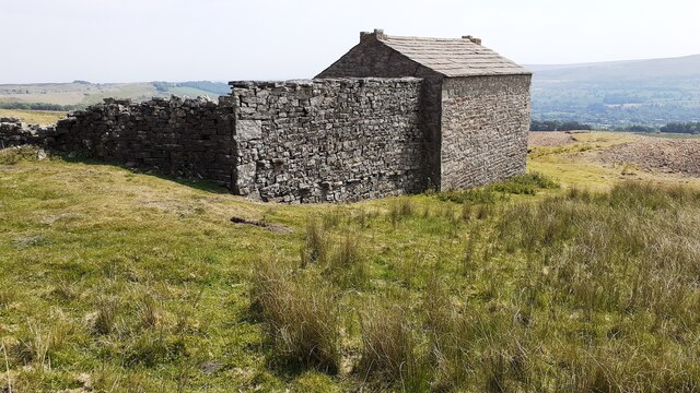
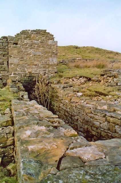
The mine itself is an adit driven into the hillside at the top of the site, with the ore works laid out on a series of terraces stepping down the slope. South-west of the mine, spoil was used to build a dam 2 m high and 5 m wide at the base, revetted with stone on its outer face, holding a reservoir; a long curving bank about 100 m long east of it appears to be an unfinished second dam, and never held much water. At the west end of the dam's outer face stand six roofless stone chambers — bouse teams — in which the ore was stored before crushing, and at their foot is the first of two dressing floors. Unusually this one lies above the crushing mill, 50 m to the south-east, rather than below it: normally the ore was crushed first and then moved downhill to the floors with the help of gravity. The second floor lies below the first and just under the level of the mill, with a large tip of fine spoil and dressing waste beside it showing where the fine dressing was done. The crushing mill took water from the reservoir above and was driven by a waterwheel whose wheel pit survives; the ore was crushed between water-powered rollers. Further down the slope are at least two large settling tanks, and leats and channels run through the whole site carrying water to the various processes. West of the bouse teams stands a two-storey rectangular building used as an office, a shelter for the men and a store.
Closure
The mine closed in 1871 and much of the machinery went to Arkengarthdale. Historic England's scheduling gives the closure as 1871, and the Yorkshire Dales record puts the production to 1872, a year later.
What remains
The mine and its ore works are a scheduled monument and unusually complete, described as having wonderfully well-preserved remains, with interpretation boards on the site. Among the features noted as rare are the use of spoil to build a dam, the flushing of material stored in the bouse teams with water, and the odd position of the dressing floor relative to the crushing plant. The two-storey office building still stands and the wheel pit by the dressing floor is one of the more easily recognised remains.
The adit, six bouse teams, two dressing floors, the crushing mill with its wheel pit, two settling tanks, the reservoir dam and the unfinished dam, leats and sluices, spoil heaps and the two-storey office and store.
Redevelopment
None. The site is moorland above Castle Bolton.
Related mines
- Cobscar Mill — Bolton Parks worked the Cobscar vein, the same vein on whose rake above Redmire the Cobscar smeltmill stood; the mill was refurbished for Lord Bolton in 1848, the year before the mine's first recorded shareholders.
Nearby mines
- Cobscar Mill — 2.3 km SE
- Whiteside Mine — 3.5 km NE
- Grinton Smelt Mill — 3.9 km NE
- Surrender Mine — 5.0 km N
- Keld Heads Mine — 5.2 km E
Straight-line distance, within 15 km. Show on the map.
Recorded claims
Individual factual claims, each attached to the source(s) that support it below. Where sources disagree, both are kept.
- The mine is known to have been in use from January 1849, when six named individuals were identified as shareholders. 1
- Around 1,400 tons of lead were produced between 1856 and 1872. 2
- The mine closed in 1871 and much of its machinery was taken to be used in Arkengarthdale. 2
- The first dressing floor lies above the crushing mill rather than below it, reversing the normal arrangement in which crushed ore moved downhill to the floors by gravity. 1
- Ore from the Cobscar vein was carried out of Level No. 3 on a tramway to the bouse teams, washed and sorted by hand, then crushed between water-powered rollers. 2
Photographs & further reading
The national park authority's gazetteer entry for the mine, with its production figures, the Cobscar vein, the sequence of dressing processes and a reconstruction drawing of the site at work.
View sourceSources
- (primary) Bolton Parks Lead Mine and ore works, Castle Bolton with East and West Bolton (List entry 1018712) — Historic England
- (primary) Bolton Park Mine (Yorkshire Dales Historic Environment Record MYD17407) — Yorkshire Dales National Park Authority
Record created: 22 September 2026 · Last researched: 22 September 2026