 MineArchive
Wensley Quarry
| Location | Preston-under-Scar, Wensleydale, North Yorkshire — 54.3230, -1.9000 (approximate) |
|---|---|
| Commodity | Limestone |
| Type | Quarry |
| Worked | 1947–Still active |
| Maximum depth | Unknown. |
| Operators | Tarmac |
Overview
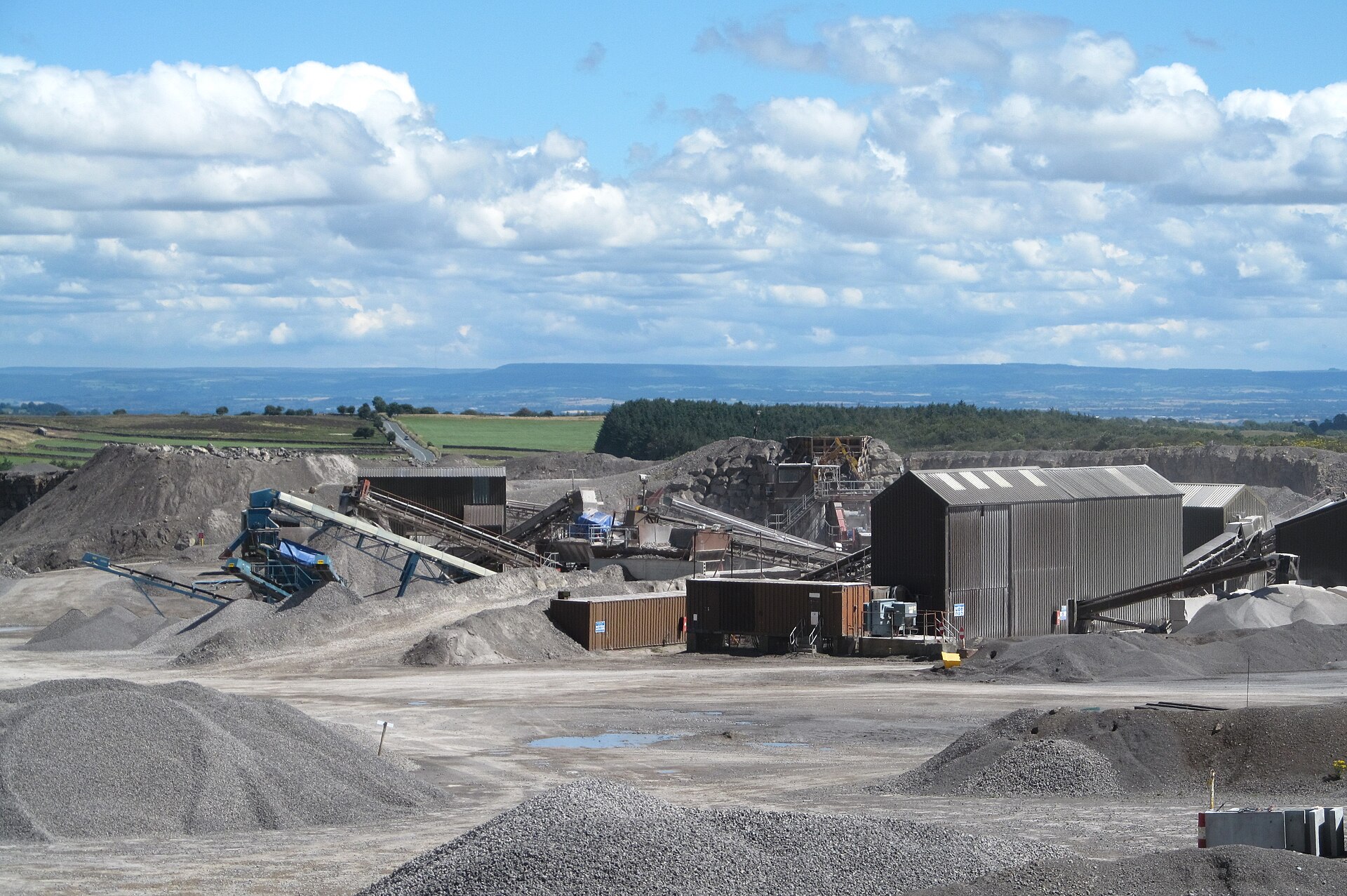
A Tarmac limestone quarry near Preston-under-Scar in Wensleydale, worked since planning permission was granted in 1947. It produces industrial carbonate, aggregate and agricultural lime, about 450,000 tonnes a year, and once sent trainloads of sinter dust to Teesside.
History
Many limestone workings have been active around Wensleydale, but Wensley Quarry was developed only after planning permission was granted in 1947, covering 322 hectares with no time limit. The neighbouring Redmire Quarry had been sending lime as sinter dust to the Teesside ironworks since 1912, by aerial ropeway to Redmire station and then by the Wensleydale railway, and Wensley also sent trainloads of sinter dust to Teesside until the loading point closed in 1992. Wensley supplied industrial carbonate to British Steel in the 1970s and 1980s, and when Redmire closed in 1992 it took up more of that trade.
The quarry covers 124 hectares about a kilometre north of Preston-under-Scar, at 300 metres above sea level, just outside the Yorkshire Dales National Park, and works limestone of the Alston Formation. Its whole output, about 450,000 tonnes a year and by Tarmac's account 20 to 30 per cent of the county's limestone, goes by lorry along the 'Tank Road' used by the army from Catterick. Residents' appeals over the open-ended permission ended in a House of Lords decision that keeps part of the site from being worked. Tarmac has consent to 2042; an application to extend working to 2053 was withdrawn in 2025 to be resubmitted, amid concern for the Lovely Seat SSSI to the north.
Geology
Carboniferous limestone of the Alston Formation.
Workings
Open quarry of about 124 hectares within a 322-hectare permission, producing crushed aggregate, industrial carbonate and agricultural lime; rail loading of sinter dust until 1992; road haulage since.
Closure
Working; consent to 2042, with an extension to 2053 being sought.
What remains
Working quarry (Tarmac).
Redevelopment
Unknown.
Nearby mines
- Cobscar Mill — 0.8 miles (1.3 km) NW
- Keld Heads Mine — 0.9 miles (1.4 km) SE
- Bolton Parks Lead Mine — 2.4 miles (3.8 km) W
- Whiteside Mine — 2.8 miles (4.6 km) NW
- Grinton Smelt Mill — 3.0 miles (4.8 km) N
Straight-line distance, within 9 miles (15 km). Show on the map.
Recorded claims
Individual factual claims, each attached to the source(s) that support it below. Where sources disagree, both are kept.
- Wensley Quarry did not produce limestone until 1947, when planning permission was granted. 1
- The quarry sent trainloads of sinter dust to Teesside until the rail loading point closed in 1992. 1
- The quarry produces about 450,000 tonnes of limestone a year. 1
- Wensley Quarry supplies 20 to 30 per cent of the county's limestone. 2
- An application to extend working to 2053 was withdrawn in 2025 for resubmission. 1,2
Photographs & further reading
The operator's 2025 note on its planning application.
View sourceSources
- (secondary) Wensley Quarry — Wikipedia
- (primary) Wensley Quarry: Tarmac community briefing note, October 2025 — Tarmac, via Preston-under-Scar Parish Council
Record created: 4 October 2026 · Last researched: 4 October 2026