 MineArchive
Alderley Edge Mines
| Location | Alderley Edge, Cheshire East, Cheshire — 53.2960, -2.2120 (approximate) |
|---|---|
| Commodities | Copper, Cobalt, Lead |
| Type | Metal |
| Worked | Bronze Age–1926 |
| Maximum depth | 60–90ft (shafts) |
| Operators | Charles Roe (1758–1768), Tomlinson and Company (1808–1810), James Michell (1857–1877) |
Overview
The mines at Alderley Edge, on a Cheshire sandstone escarpment now owned largely by the National Trust, were worked on and off for around 4,000 years — from Bronze Age copper extraction through Roman-era working to a final industrial phase mining copper, lead and cobalt that ended in the 1920s.
History
Archaeological evidence — including a wooden shovel carbon-dated to around 1780 BC, rediscovered by the author Alan Garner — shows Bronze Age copper extraction at Engine Vein, alongside what are believed to be smelting hearths dating to around 2000 BC. Roman-era working is evidenced by a hoard of 4th-century AD coins, the ‘Pot Shaft Hoard’, found in an Engine Vein shaft in 1995, alongside carbon-dated timbers from the last century BC. After a long gap, mining resumed around 1693; Charles Roe of Macclesfield operated the mines from 1758 to 1768, combining the copper with zinc calamine to make brass. In the early 19th century a company that included Derbyshire miner James Ashton mined for lead from 1805, and cobalt demand created by the Napoleonic blockade briefly made the site valuable for a different reason: Sir John Stanley leased cobalt rights to a Yorkshire company in 1807, and Tomlinson and Company of the Ferrybridge Pottery took over in 1808, shipping ore to Ferrybridge to make cobalt glass and smalt, a blue pigment used in pottery and laundry whitening. That trade collapsed with cobalt prices at the end of 1810. The most intensive phase came under the Cornish miner James Michell, who began working West Mine in 1857; by the mines' 1877 closure — Michell himself died in a mining accident in 1862 — nearly 200,000 tons of ore had been raised for around 3,500 tons of copper metal, worked across West Mine, Wood Mine, Engine Vein, Brynlow and Doc Mine. An Abandonment Plan drawn up in 1878 documented the full extent of the workings. Unsuccessful attempts to reopen the mines followed in 1911 and 1914, and again after the First World War, before the equipment was finally sold off in 1926.
Geology
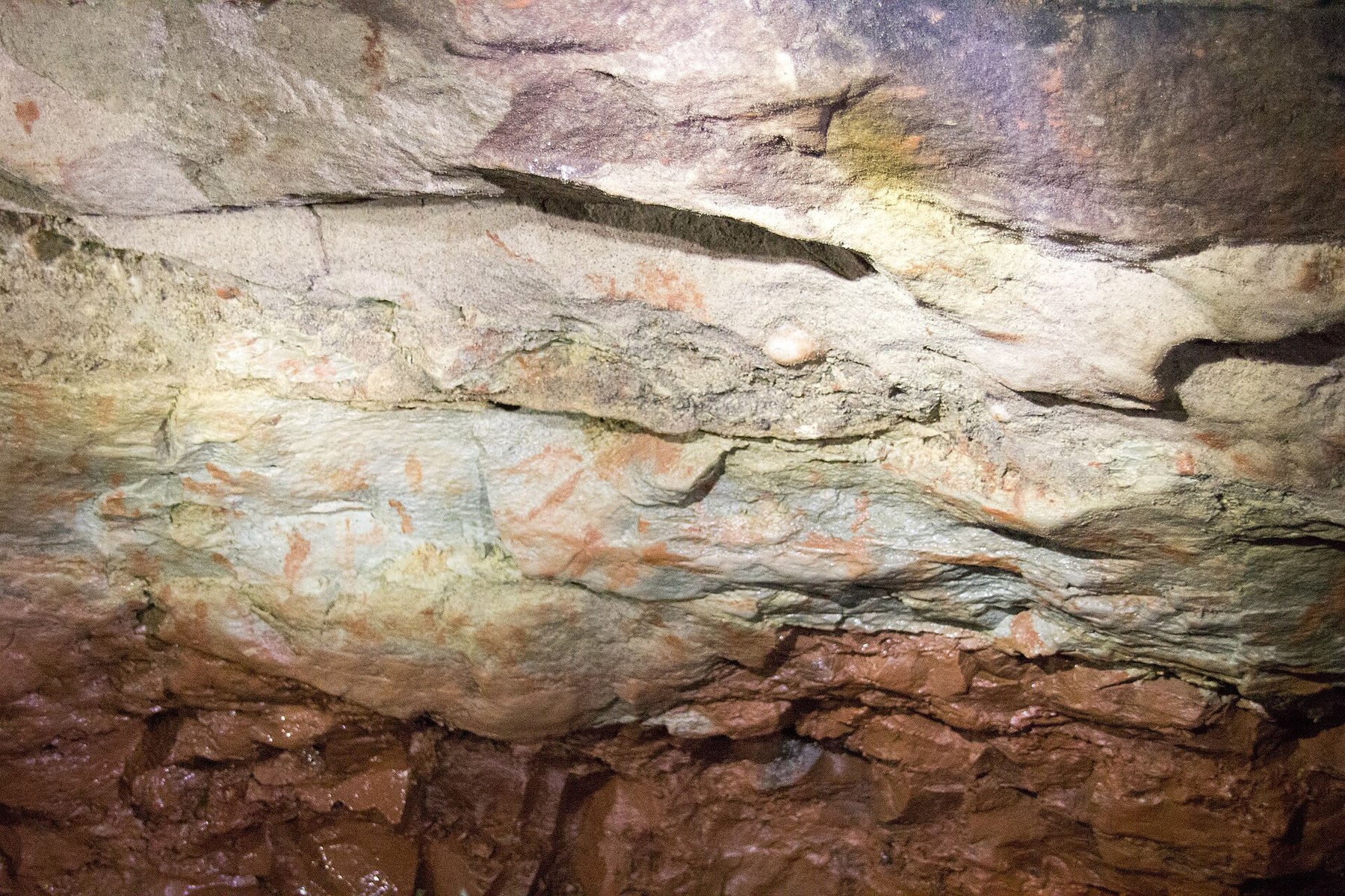
The mines follow the Engine Vein fault line through the Sherwood Sandstone of the Edge, the host rock at Engine Vein being known as the Engine Vein conglomerate. The vein carries copper and cobalt together with at least forty other minerals, an assemblage unusual enough to have earned the site designation as a geological Site of Special Scientific Interest alongside its archaeological scheduling. Lead was also worked, and it was the cobalt in the copper ores that the nineteenth-century works were rebuilt to extract.
Geological setting: Faults and Fractures (well documented example)
Workings
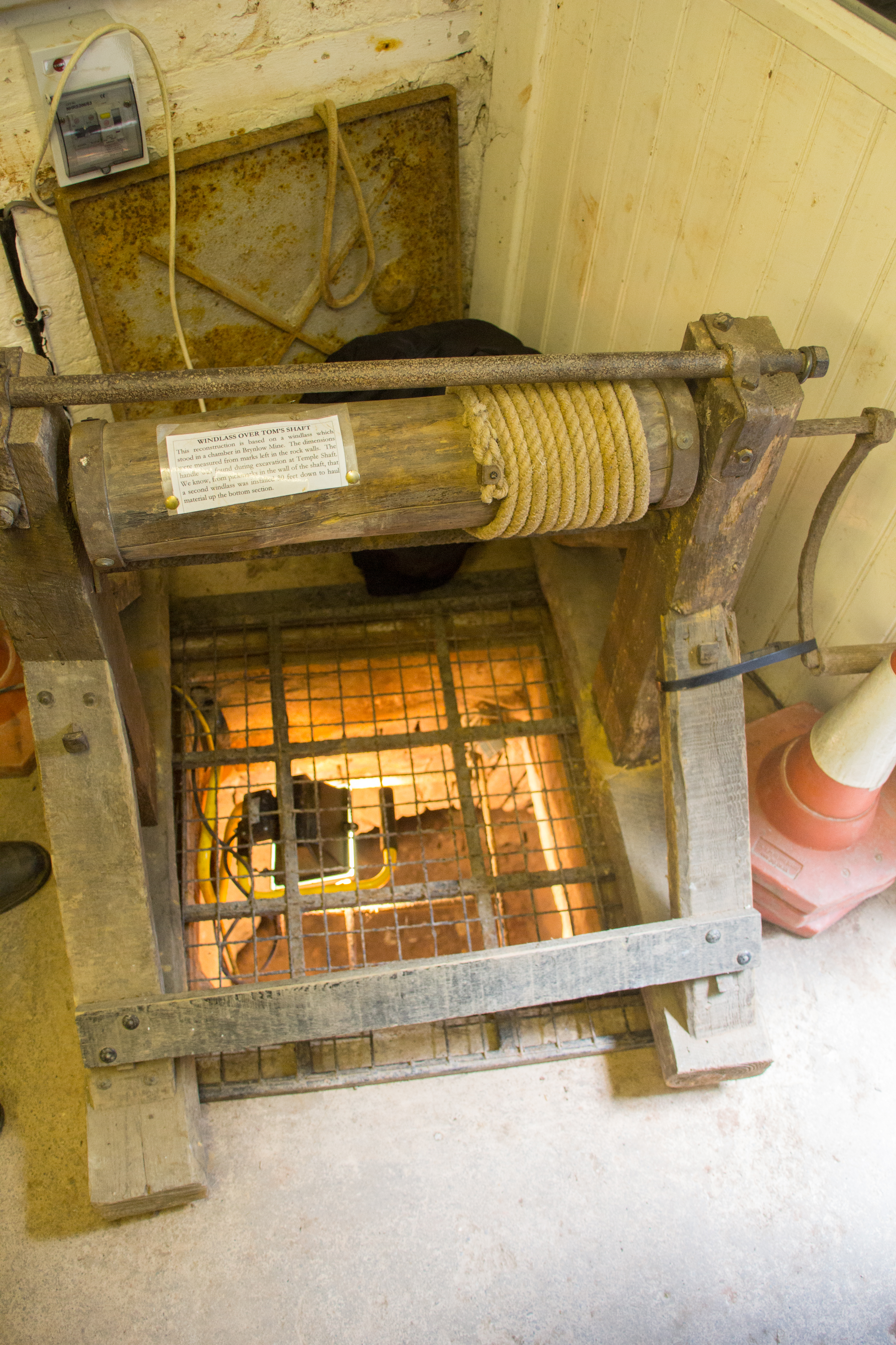
The mines are linked by the roughly 1,500m Hough Level, connecting West Mine, Wood Mine, Brynlow Mine and Engine Vein. Distinctive 18th-century ‘coffin levels’ — narrow tunnels with a coffin-shaped cross-section — survive alongside shafts 60–90ft deep, and West Mine includes exploratory levels driven to relocate mineralised ground after a major fault was struck around 1862.
Closure
Mining ended with the sale of equipment in 1926, following unsuccessful reopening attempts in 1911, 1914 and shortly after the First World War.
What remains
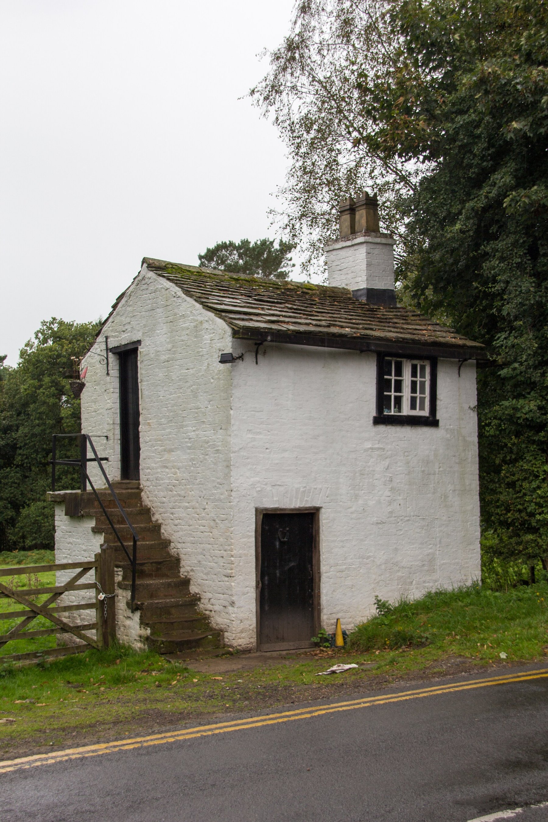
The National Trust owns much of the site and the Derbyshire Caving Club has leased access rights since 1969, exploring, mapping and excavating the workings and finding passages not previously recorded; the club reports that the run of accidents ended once it took the lease. West Mine and Wood Mine were blocked in the early 1960s after a series of accidents to visitors, some fatal, and were reopened by the club — Wood Mine in 1969 and West Mine in 1975. Guided visits now run about once a month with booking required. Between 1995 and 2005 a project team led by Manchester Museum and the National Trust made a comprehensive study of the mines, published by Manchester University Press.
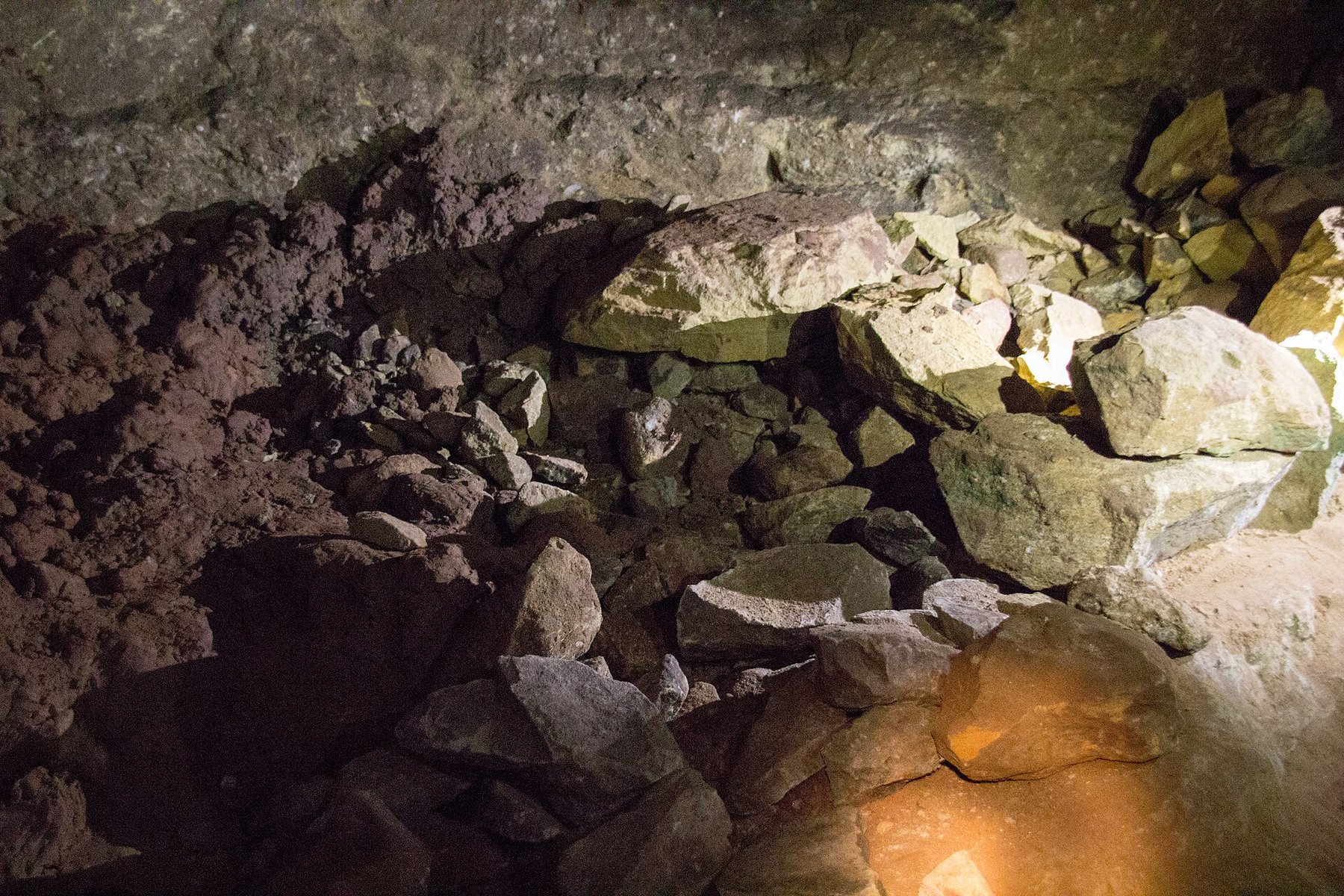
At Engine Vein the eastern half of the scheduled area is a steep-sided canyon cut down into the fault line by successive opencast working, about 15 m deep, its floor since capped with concrete for public safety so that the present surface sits about 8 m down. That cutting has bisected several shallow pits worked by Bronze Age miners with stone hammers, leaving characteristic peck marks in the rock face. Rock-cut workings, a mine entrance, spoil heaps and capped shafts survive along about 150 m of the vein. At Wood Mine and West Mine the earthworks and buried remains of the ore-processing works survive on the western side of Windmill Wood, with both the original and modern entrances included in the scheduled area. Many surface features elsewhere are now obscured by vegetation.
Related mines
- Brynlow Mine — One of the named workings within the wider Alderley Edge Mines complex, documented in detail on the Derbyshire Caving Club's dedicated Brynlow page.
- Cobalt Mine — One of the named workings within the wider Alderley Edge Mines complex, worked for cobalt during the early 19th-century Napoleonic-era boom.
- Doc Mine — One of the named workings within the wider Alderley Edge Mines complex, reworked under James Michell's 1857-1877 operation.
- Engine Vein — One of the named workings within the wider Alderley Edge Mines complex; its Bronze Age and Roman finds are the ones referenced in the district overview's own history text.
- Hough Level — The main drainage and ore-haulage tunnel connecting several named workings within the wider Alderley Edge Mines complex.
- Pillar Mine — One of the named workings within the wider Alderley Edge Mines complex, at Stormy Point.
- Saddlebole Mine — One of the named workings within the wider Alderley Edge Mines complex, at the southern end of the fault worked for cobalt in the early 19th century.
- Twin Shafts — One of the named workings within the wider Alderley Edge Mines complex, at Stormy Point.
- West Mine — The largest named working within the wider Alderley Edge Mines complex, worked 1857-1877 by the Alderley Edge Mining Company.
- Wood Mine — One of the named workings within the wider Alderley Edge Mines complex, worked 1857-1877 alongside West Mine by the same company.
Nearby mines
- Brynlow Mine — 0.1 miles (0.1 km) SW
- Hough Level — 0.1 miles (0.1 km) NE
- Pillar Mine — 0.1 miles (0.1 km) NW
- Doc Mine — 0.1 miles (0.2 km) NW
- Twin Shafts — 0.1 miles (0.2 km) NW
Straight-line distance, within 9 miles (15 km). Show on the map.
Disasters & major incidents
-
Alderley Edge West Mine deaths
May 1929 · Other · 2 fatalities
Two men, George Etchells and Alfred Hadfield, died after going into the disused West Mine and losing their way in its passages; their bodies were not found for three months.
What's uncertain
Points where sources disagree or the record could not be settled; both accounts are kept. All open questions in the archive.
- A May 2013 permission-visit report describes Wood Mine's original entrance being blasted shut in 1964 after accidents involving ill-equipped visitors, before the Derbyshire Caving Club reopened it in 1970 with National Trust permission; the passages retain green-coloured water features from copper mineralisation. (uncertain) 2
- The mines are recorded as having seen numerous accidents and six fatalities after they were closed, the entrances having been left unbarred. Accidents are reported to have stopped after the Derbyshire Caving Club took on the lease in 1969. (uncertain) 6
- The BGS mine-plans catalogue holds a Mining Remediation Authority abandonment plan titled 'Alderley Edge' (catalogue OM882, Copper Ore, undated in the catalogue); the catalogue gives no location and the plan's details do not clearly tie it to this working, so it may belong to another of the same name. (uncertain) 7
Recorded claims
Individual factual claims, each attached to the source(s) that support it below. Where sources disagree, both are kept.
- A wooden shovel recovered from the mines, rediscovered by the author Alan Garner, has been carbon-dated to around 1780 BC — among the evidence for Bronze Age copper extraction at Engine Vein. 1
- A hoard of 4th-century AD Roman coins, the ‘Pot Shaft Hoard’, was found in an Engine Vein mine shaft in 1995. 1
- Between 1857 and the mines' 1877 closure, James Michell's operation at West Mine raised close to 200,000 tons of ore, yielding around 3,500 tons of copper metal. 1
- At least six fatalities have been recorded at the mines since 1909, including three visitors who died in West Mine between 1946 and 1954, after which the workings were sealed for a period before the Derbyshire Caving Club reopened them. 1
- A May 2013 permission-visit report describes Wood Mine's original entrance being blasted shut in 1964 after accidents involving ill-equipped visitors, before the Derbyshire Caving Club reopened it in 1970 with National Trust permission; the passages retain green-coloured water features from copper mineralisation. (uncertain) 2
- Engine Vein is a scheduled monument (Historic England 1020191) covering rock-cut workings, mine entrance, spoil heaps and capped shafts along about 150 m of the Engine Vein fault. The vein carries copper, cobalt and at least 40 other minerals, a combination that also justified designation as a geological Site of Special Scientific Interest. 3
- Shallow open pit working at Engine Vein dates from the Bronze Age and has left characteristic peck marks in the rock face, comparable with examples from Europe and the Near East. Many broken stone axe-hammers, made from hard river pebbles grooved to take a handle, have been found at and near the site over the last hundred years. 3
- A primitive oak shovel recovered from the Brynlow pits and described by the Rev. Sainter in 1878, now in the collections of Manchester Museum, has been radiocarbon dated to about 1750 BC. William Boyd Dawkins had reported grooved hammer stones from the same workings in 1874. 4
- The Wood Mine and West Mine processing works, set up shortly before 1860 by the Alderley Edge Mining Company, handled 168,269 tons of copper ore and produced 3,200 tons of fine copper metal, together with almost 100 tons of lead and 11 tons of cobalt-nickel. The lead works closed in 1863, the cobalt plant ceased in 1864 and copper production was abandoned on the site in 1878. 5
- The production of cobalt at the Wood Mine site is regarded as of great interest in the history of mining and smelting in England, and the processing site is believed to be unique. 5
- The mines are recorded as having seen numerous accidents and six fatalities after they were closed, the entrances having been left unbarred. Accidents are reported to have stopped after the Derbyshire Caving Club took on the lease in 1969. (uncertain) 6
- The BGS mine-plans catalogue holds a Mining Remediation Authority abandonment plan titled 'Alderley Edge' (catalogue OM882, Copper Ore, undated in the catalogue); the catalogue gives no location and the plan's details do not clearly tie it to this working, so it may belong to another of the same name. (uncertain) 7
Photographs & further reading
A Derbyshire Caving Club permission visit through Wood Mine's 1.5 miles of mainly 19th-century tunnels, including copper-stained ‘green waterfalls’.
View sourceThe club that has held the lease from the National Trust since 1969 maintains the fullest public account of the individual mines, their history, geology and present state, along with details of the open days on which the workings can be visited.
View sourceSources
- (secondary) Alderley Edge Mines — Wikipedia
- (observational) Wood Mine - Alderley Edge, May 2013 — 28DaysLater
- (primary) Engine Vein opencast copper mine, Nether Alderley — scheduled monument 1020191 (Historic England scheduling text) — Historic England scheduling text, via ancientmonuments.uk
- (secondary) Alderley Edge Copper Mines — Early Mines Research Group
- (primary) Wood Mine cobalt works and associated mines, Nether Alderley — scheduled monument 1020181 (Historic England scheduling text) — Historic England scheduling text, via ancientmonuments.uk
- (observational) Alderley Edge Mines — Show Caves of Great Britain
- (primary) BGS / Mining Remediation Authority mine plans: ALDERLEY EDGE — British Geological Survey / Mining Remediation Authority
Record created: 19 August 2026 · Last researched: 4 September 2026