 MineArchive
Abbey Consols Mine
| Also known as | Florida Mine, Bronberllan Mine |
|---|---|
| Location | Pontrhydfendigaid, near Strata Florida Abbey, Ceredigion — 52.2788, -3.8446 (exact) |
| Commodities | Lead, Zinc, Silver |
| Type | Metal |
| Worked | Before 1845–1909 or 1913 |
| Maximum depth | 50 fathoms below the adit (about 91 m) |
Abbey Consols was a small lead and zinc mine on the north side of the Teifi valley, a kilometre east of Pontrhydfendigaid and within sight of the ruins of Strata Florida Abbey. Known first as Bronberllan and later as Florida, it was worked in short spells from the 1840s to the 1900s and sold more zinc blende than lead ore. Its tips are now the largest source of zinc in the River Teifi.
Location
Recorded location. The large pin is this mine; the small round markers are the nearest mines on record. Click one for its page. View on full map
History
The mine took its first name, Bronberllan, from the farm beside it, and it was at work under that name before 1845. Strata Florida Abbey, founded in 1164, stands across the river, and the Cistercians' interest in lead makes far older working here likely, although the written record begins in the 1840s. The mine reopened in 1848 and again in 1852, and from then on it was worked in bursts: 1856 to 1861, 1877 to 1882, 1886 to 1891, 1893 to 1898 and 1905 to 1909.
It was never large. Between 1848 and 1909 it returned 1,236 tons of lead ore and 1,765 tons of blende. The best year was 1872, when 287 tons of lead ore were sold; returns survive for 1871 to 1873, outside the spells of working otherwise recorded. The ore carried little silver: 1,555 ounces were returned over the life of the mine. Beside Frongoch and Cwmystwyth, a few miles to the north, these were modest figures.
An abandonment plan was deposited under the names Florida, Abbey Consols and Bronberllan on 8 July 1905. The mine was slow to take the hint: ore was returned in 1905, 1908 and 1909, and a last output is recorded for 1913.
Geology
The lode strikes east-north-east and dips south at 55 degrees. The ore lay irregularly along it in narrow shoots dipping westward, with the largest body near the surface, and much blende accompanied the galena. The rocks on either side belong to a high horizon in the Frongoch formation, much the same as at Esgair Mwyn.
Geological setting: Veins and Lodes (well documented example)
Workings
The mine was worked partly from a shaft sunk on the lode to 50 fathoms below the adit and partly from the adit itself, about 690 feet above sea level, which met the lode 23 fathoms east of the shaft and drained the workings to about 25 fathoms. None of it went far: the adit is about 70 fathoms long, and the longest level, the 40-fathom, was driven only 90 fathoms. At surface there were two shaft heads, a group of five level entrances, two wheelpits with a leat and a flat-rod run, and a tramway from the shafts to the dressing floors.
Closure
An abandonment plan is dated 8 July 1905. Lead ore was nevertheless returned in 1905, 1908 and 1909, and a last output is recorded for 1913.
What remains
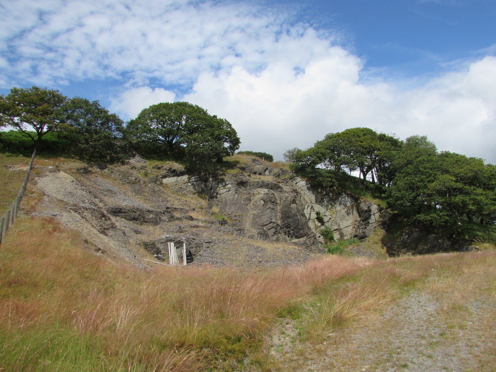
Earlier reclamation destroyed many of the mine's features. What is left is spoil, put at 32,000 tonnes, with several shafts and the remains of a wheelpit, dressing floors and filter beds. Contaminated water rises in the north-east corner of the site, thought to come from the collapsed mouth of the deep adit, and runs round the tips to the Teifi. Two nationally rare lichens grow on the spoil.
Scant remains of the dressing floors, a ruined house beside them, tips and settling pits, and the site of the deep adit entrance. To the north a rock-cut wheelpit has been partly destroyed by a quarry; traces of a tramway link it to two shaft heads. Between the shafts and a group of five level entrances lie the site of a second wheelpit and traces of a leat and a flat-rod run.
Redevelopment
Natural Resources Wales has studied the site since 2008 as the largest source of zinc in the River Teifi, which fails its zinc standard for almost 30 km downstream. Drainage channels were altered in March 2011 to measure the flow, the tips were surveyed in 2014, and options for capping or removing the fine tailings and diverting the adit water were assessed in 2015. An archaeological watching brief was carried out in 2019.
Nearby mines
- Cwm Mawr Mine — 0.8 miles (1.4 km) NW
- Bronmwyn Mine — 2.0 miles (3.3 km) SW
- Esgair Mwyn Mine — 2.1 miles (3.3 km) N
- Penlanfach Mine — 2.4 miles (3.9 km) N
- Glogfawr Mine — 2.7 miles (4.4 km) N
Straight-line distance, within 9 miles (15 km). Show on the map.
Further reading
The Royal Commission's site record, with the working periods, a description of the surface remains and aerial photographs.
View sourceThe regulator's page on the mine's effect on the River Teifi and the work planned to treat it.
View sourceSources
- (primary) Lead and Zinc: The Mining District of North Cardiganshire and West Montgomeryshire (Special Reports on the Mineral Resources of Great Britain, vol. XX), O. T. Jones, 1922 — Memoirs of the Geological Survey
- (primary) Florida Lead & Zinc Mine; Abbey Consols Mine, Nr. Strata Florida Abbey; Bronberllan (NPRN 33843) — Coflein, Royal Commission on the Ancient and Historical Monuments of Wales
- (secondary) Abbey Consols Lead & Zinc Mine — Natural Resources Wales
- (primary) Mine plan: Florida or Abbey Consols or Bromberllan (lead ore, abandoned 8 July 1905), OM5136 — British Geological Survey / Mining Remediation Authority
- (secondary) Abandoned Mine Case Study: Abbey Consols Lead & Zinc Mine (June 2016) — Natural Resources Wales
- (primary) Notes on a site visit to the abandoned Abbey Consols Mine, Mid-Wales (Open Report OR/12/047), B. Palumbo-Roe, V. J. Banks and T. C. Colman, 2012 — British Geological Survey
Record created: 18 November 2026 · Last researched: 18 November 2026