 MineArchive
Trowell Moor Colliery
| Location | Stanton Gate, near Trowell and Stapleford, Nottinghamshire — 52.9653, -1.2592 (exact) |
|---|---|
| Commodity | Coal |
| Type | Coal |
| Worked | by 1887 |
| Maximum depth | Unknown. |
| Operators | Dunn Brothers (?–1900), Cossall Colliery Company (1900–1947) |
Overview
A Kilburn-seam colliery at Stanton Gate on the Nottinghamshire side of the Erewash, worked by Dunn Brothers and then, from about 1900, by the Cossall Colliery Company, whose two pits were managed and memorialised together. Lord Middleton drew a half-yearly profit from it through the late nineteenth century. It employed about 600 men between the wars and its site at Stapleford is now open space on the Robin Hood Way.
History
Trowell parish had been dug for coal long before the deep colliery: the Historic Environment Record maps a spread of eighteen classic bell-pit mounds with their annuli and coal spoil in the parish, worked at some point between the sixteenth century and 1914, and thought possibly worthy of preservation. The colliery proper stood at Stanton Gate, five miles west of Nottingham on the county boundary, and worked the Kilburn seam, the same deep coal its neighbour Cossall took. Lord Middleton, the Willoughby family of Wollaton, held a royalty interest: the University of Nottingham holds an account of his profits out of Trowell Moor Colliery calculated half yearly from 1883 to 1902.
The Lists of Mines give the owners as Dunn Brothers and then the Cossall Colliery Co. Ltd, which held both pits by 1900 and was still returning them together in the 1930s; the University's papers relating to the Cossall Colliery Company run from 1866 to 1939. Employment moved between about 300 and 470 before the First World War, 408 in 1894 and 473 in 1910, and stood at 606 in 1923. All its coal was sold as household; the Furnace Coal was added to the Kilburn by 1910 and the Tupton by 1915. A new headgear was going up in 1925, photographed for the record as it was completed and again with the erectors, fitters and blacksmiths who built it. The pit's fatal accidents are the ordinary ones of a Nottinghamshire colliery: a dayman killed holing the coal face in the Kilburn in 1898, a stallman killed in 1924 by a fall that came away without warning while he was fetching a drink from his tea can in the gateroad, a seventeen-year-old screen boy crushed between buffers in the sidings at mealtime in 1891, and a trammer killed in 1889 when a self-acting incline chain broke and the tubs ran back.
Geology
The colliery worked the Kilburn seam, one of the deeper coals of the Nottinghamshire and Derbyshire field and the same seam its sister pit at Cossall took, adding the Furnace Coal by 1910 and the Tupton by 1915. Trowell parish also carries the shallow end of the same measures, where the bell pits recorded by the Historic Environment Record took coal from at or near the surface.
Geological setting: Sedimentary Beds and Seams (well documented example)
Workings
A shaft colliery with railway sidings at Stanton Gate, self-acting inclines underground and a new headgear erected in 1925. The National Coal Board's photographic collection preserves images of that headgear being completed and of the erectors, fitters and blacksmiths who put it up.
Closure
No source gives a closing date. The Lists of Mines return the same figure of 606 men for 1923, 1933, 1937 and 1940, which is the repeated-value artefact this source shows elsewhere rather than four separate counts, and the University of Nottingham's papers relating to the Cossall Colliery Company end in 1939. The colliery was certainly gone by the time the site became open space. A refresh should look at the Lists of Mines directly and at healeyhero's Trowell Moor pages, which could not be read on the day.
What remains
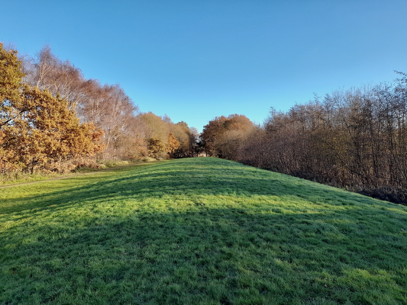
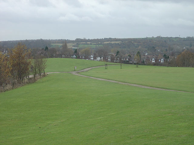
Cleared and green. The colliery ground near Stapleford is managed as open space and gives access to the Robin Hood Way; the line of the former sidings on the site could still be traced in a photograph of 2023. The memorial to John Whyte, colliery manager, put up in the churchyard by the directors and officials of the Cossall and Trowell Moor collieries, is the clearest surviving mark of the pit.
The line of the sidings, and the Whyte memorial in the churchyard.
Redevelopment
Public open space with access to the Robin Hood Way.
Related mines
- Cossall Colliery — Both worked by the Cossall Colliery Company, which held Trowell Moor from about 1900 and returned the two pits together; the memorial to the colliery manager John Whyte was raised by the directors and officials of the Cossall and Trowell Moor collieries jointly.
Nearby mines
- Strelley Colliery — 0.9 miles (1.5 km) E
- Cossall Colliery — 1.6 miles (2.6 km) NW
- Broxtowe Colliery — 1.9 miles (3.1 km) NE
- Oakwell Colliery — 2.2 miles (3.6 km) W, Derbyshire
- Speedwell Colliery, Giltbrook — 2.3 miles (3.7 km) N
Straight-line distance, within 9 miles (15 km). Show on the map.
Recorded claims
Individual factual claims, each attached to the source(s) that support it below. Where sources disagree, both are kept.
- The Lists of Mines give the owners of Trowell Moor Colliery as Dunn Brothers and then the Cossall Colliery Co. Ltd, which also held Cossall Colliery. 1
- The University of Nottingham holds an account of Lord Middleton's profits out of Trowell Moor Colliery, calculated half yearly, covering 1883 to 1902. 2
- The colliery worked the Kilburn seam throughout its returns, adding the Furnace Coal by 1910 and the Tupton by 1915, and sold all its coal as household. 1
- Employment was 408 in 1894, 292 in 1905, 473 in 1910 and 606 in 1923, the last figure being repeated unchanged in the returns for 1933, 1937 and 1940. 1
- A new headgear was erected at the colliery in 1925 and photographed for the record as it was completed, together with the erectors, fitters and blacksmiths who built it. 3
- Trowell parish carries eighteen classic bell-pit mounds with annuli and coal spoil, recorded from aerial photographs as pre-1914 workings and thought possibly worthy of preservation; these are an earlier and separate site from the deep colliery. 4
- The University of Nottingham's papers relating to the Cossall Colliery Company, which owned both Trowell Moor and Cossall, run from 1866 to 1939. 5
- The colliery site near Stapleford is now managed as open space and gives access to the Robin Hood Way, and the line of the former sidings could still be traced there in 2023. 6,7
Photographs & further reading
The Lists of Mines returns for the pit with owners, manpower and seams by year, and the inspectors' accounts of the accidents that killed men there.
View sourceSources
- (primary) Durham Mining Museum: Trowell Moor Colliery — Durham Mining Museum
- (primary) University of Nottingham Mi 4E 57: account of Lord Middleton's profits out of Trowell Moor Colliery calculated half yearly, 1883-1902 (National Archives Discovery) — University of Nottingham Manuscripts and Special Collections
- (primary) The National Archives COAL 80/980: Trowell Moor colliery, Nottinghamshire, photographs, 1925 (National Archives Discovery) — The National Archives
- (primary) Nottinghamshire HER monument M2352: coal mine in Trowell parish — Nottinghamshire Historic Environment Record
- (primary) University of Nottingham Mi 4E 55-107: papers relating to the Cossall Colliery Company, 1866-1939 (National Archives Discovery) — University of Nottingham Manuscripts and Special Collections
- (observational) Former sidings on the site of Trowell Moor Colliery (Geograph photograph, 28 November 2023) — Geograph / Ian Calderwood
- (observational) Open space near Stapleford, the site of the former Trowell Moor Colliery (Geograph photograph, 25 November 2007) — Geograph / Alan Murray-Rust
Record created: 9 September 2026 · Last researched: 9 September 2026