 MineArchive
Rimington Lead Mines
| Also known as | Skeleron Lead Mines, Skeleron Old Mines, Rimington Lead and Silver Mines |
|---|---|
| Location | Rimington, Ribble Valley, Lancashire — 53.9016, -2.2849 (approximate) |
| Commodities | Lead, Barite, Silver |
| Type | Metal |
| Worked | Later 16th century–1885 |
| Maximum depth | A shaft of 165 feet (about 50 m), sunk on vein A in 1876. |
| Operators | Tomkinson and Hayes (1822–1833), Baynes and Colville (1876–1880), York and Lancaster Mining Company (1880–1885) |
Overview
Lead, silver and barytes workings along Ings Beck on the old Lancashire–Yorkshire boundary, reputedly worked for silver by William Pudsay in the later 16th century and assayed in 1656 at 26 pounds of silver to the ton. Mining was spasmodic for three centuries; a cog and rung gin circle of the 17th or 18th century survives around the largest shaft.
History
The date mining began at Rimington is unknown. Documentary sources first mention it in the later 16th century, when William Pudsay of Bolton Hall is reputed to have obtained and perhaps coined silver from the mine; his grandson Ambrose seems to have run it briefly before 1660. In 1656 the ore was tested by an assayer and reported to hold 26 pounds of silver to the ton. Some mining may have gone on in the 1660s, but soon after the Pudsey family sold the mine to pay off debts, and nothing further is documented until leases were taken twice in the 18th century. In 1822 a twenty-year lease was agreed between the lessor George Lane-Fox and John Tomkinson and Henry Hayes, who mined intensively — producing calamine as well as lead — until the price of lead fell sharply in the 1830s and the venture failed. By the 1851 census only four miners were employed and barytes rather than lead was being got; an Ordnance Survey map of 1853 shows this early area, then called Skeleron Old Mines, out of use. Messrs Baynes and Colville took the mine about 1876, sank a shaft 165 feet deep on one vein and equipped it with steam winding and pumping gear, raising small amounts of lead, barytes, zinc and calamine and employing up to twenty-eight people. The York and Lancaster Mining Company took over in 1880 and barytes output rose sharply for five years — 1,340 tons in 1882, falling to 308 in 1885. Work resumed again in 1933, and in the early 1950s some barytes was produced, probably by reworking the old spoil tips rather than by new mining.
Geology
The mines lie along the east side of Ings Beck, which until 1974 marked the boundary between Lancashire and Yorkshire, and work two veins that enter the ground from the south-east and south-south-east and converge beneath the largest shaft. Lead, silver, barytes, zinc and calamine have all been got here at different times.
Workings
The northern part of the mines survives as earthworks on the crest of a ridge: shafts, spoil heaps, an ore-processing area, a possible buddle and a prospecting rake, of two periods, with the later and better preserved features overlying earlier and slighter ones, and the whole overlying part of a medieval open field system of ridge and furrow. The largest feature is a circular shaft 2 m across ringed by a flat circular area read as a cog and rung gin circle — a form that suggests the 17th or 18th century — with a carefully graded and revetted spoil tip around it and an entrance on the south-east; it appears on the 1853 Ordnance Survey map. Another shaft 2 m deep, with a sharp ring of spoil and an entrance on the west, overlies a slight platform and hummocks interpreted as a spalling floor where ore was broken. Three limestone clamp kilns stand in a small quarry at the south-west corner of the scheduled area.
Closure
The barytes boom of the early 1880s was the last real working; output fell from 1,340 tons in 1882 to 308 in 1885. Work resumed briefly in 1933, and the barytes produced in the early 1950s probably came from reworking the spoil rather than from new ground.
What remains
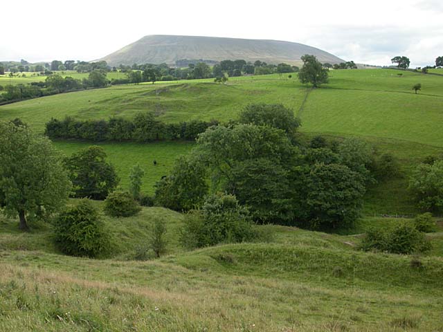
The northern part of the mines, with the medieval field system and the clamp kilns, is a scheduled monument. The earthworks survive on the ridge crest under pasture, the gin circle and its revetted spoil tip the most striking feature; spoil heaps extend along the beck towards Skeleron Wood.
Shafts with rings of spoil, the cog and rung gin circle and its revetted tip, an ore-processing or spalling floor, a possible buddle, a prospecting rake, ridge and furrow of the medieval field system, and three limestone clamp kilns.
Redevelopment
None. The ground is farmland on the ridge above Ings Beck.
Nearby mines
- Habergham Colliery — 11.6 km S
- Bank Hall Colliery — 12.0 km S
- Ashnott Lead Mine — 12.5 km W
- Gannow Colliery — 12.5 km S
- Towneley Colliery — 14.1 km S
Straight-line distance, within 15 km. Show on the map.
Recorded claims
Individual factual claims, each attached to the source(s) that support it below. Where sources disagree, both are kept.
- Documentary sources first mention mining at Rimington in the later 16th century, when William Pudsay is reputed to have obtained and perhaps coined silver from the mine. 1
- In 1656 the ore was tested by an assayer and reported to hold 26 pounds of silver to the ton. 1,2
- Barytes output rose to 1,340 tons in 1882 and fell to 308 tons in 1885, with up to twenty-eight people employed in this period. 3
- Baynes and Colville sank a shaft 165 feet deep onto vein A in 1876 and equipped it with steam winding and pumping gear. 3
- The largest feature is a circular shaft 2 m across ringed by a cog and rung gin circle, a form suggesting the 17th or 18th century, which appears on the 1853 Ordnance Survey map. 1
Photographs & further reading
The village history of the mines on Ings Beck, with the Pudsay silver tradition, the 19th-century leases and links to the society memoir and the 1998 survey report.
View sourceJ. M. Dickinson's account of the mines, with the shaft sunk in 1876, the barytes tonnages of the 1880s and the numbers employed.
View sourceSources
- (primary) Northern part of Rimington lead mines, part of a medieval open field system and three limestone clamp kilns 120m south east of Hollins, Rimington (List entry 1020975) — Historic England
- (secondary) Skeleron Lead and Silver Mines — Rimington Village
- (secondary) The Rimington Lead and Silver Mines (J. M. Dickinson, NCMRS Memoirs 1968) — Northern Cavern and Mine Research Society
Record created: 22 September 2026 · Last researched: 22 September 2026