 MineArchive
Plynlimmon Mine
| Also known as | Plynlimon Mine |
|---|---|
| Location | Afon Tarennig, Plynlimon, Ceredigion — 52.4620, -3.7292 (exact) |
| Commodity | Lead |
| Type | Metal |
| Worked | Worked from 1867–1897 |
| Maximum depth | Engine shaft 24 fathoms (about 44 m) below adit level |
| Operators | Royal Plynlimon Mining Company (1867–1870), Plynlimmon Mining Company Limited (1870–1897) |
Overview
A lead mine in remote upland at about 550 m on the flank of Plynlimon, probably the highest developed in mid-Wales. It yielded around 3,270 tons of lead concentrates between 1867 and 1897. The Royal Plynlimon Mining Company drove its adit 155 fathoms east along the lode, almost all of it in ore, put up a forty-foot water wheel and sank an engine shaft 24 fathoms below adit before selling the mine on in 1870. No plans survive and the workings are almost entirely flooded.
History
The mine lies in country high and empty enough that its own rainfall could not be turned into much power: at around 550 m above sea level, with about 250 mm of rain a year, the catchments feeding it were too small to drive machinery at the scale the ground deserved. It was nevertheless developed vigorously in the late 1860s by the Royal Plynlimon Mining Company under Captain James Richards of Devon Great Consols, who drove the adit level eastwards along the course of the lode for 155 fathoms — almost all of it in ore — erected a water wheel forty feet across, and sank an engine shaft 24 fathoms below the adit, though little was done at that depth.
In three years the company sold about 1,000 tons of galena for some £13,000, which may have shown a modest profit; no accounts were published in the Mining Journal. In April 1870 it sold the mine and plant to the newly formed Plynlimmon Mining Company (Limited) for about £19,000. Working continued to 1897, by which time about 3,270 tons of lead concentrates had been raised. The adjacent sett at East Plynlimon was tried and failed.
Because no plans survive and the workings are flooded, what is known about the shape of the mine underground has been reconstructed rather than surveyed. A 2010s study built geological sections in the plane of the Main Lode from reports published in the Mining Journal at the time, then tested them against new surface mapping; the two proved to reconcile fairly simply. Its authors argue that a check of the Mining Journal should be the first step in planning any new survey of an old mine.
Geology
The Central Wales orefield, lead in steeply dipping lodes cutting Lower Palaeozoic mudstones and grits. Two lodes are recorded: the Main Lode, still visible in the adit though no longer in the bed of the Afon Tarennig, and a North Lode found about fifty metres upstream of the dam and not now visible at outcrop. The dip of the lode is not well enough constrained for accurate plans of the deeper levels to be drawn.
Geological setting: Veins and Lodes (well documented example)
Workings
An adit driven 155 fathoms east along the lode, almost all of it in ore, with major crosscuts off it, and an engine shaft sunk 24 fathoms below adit level where little work was done. Power was the limiting factor: a forty-foot water wheel was put up, but the small catchments at this altitude severely restricted what water power could do. Almost the entire workings are now flooded and no modern survey has been applied to them.
Closure
Working ended in 1897 after thirty years and about 3,270 tons of concentrates. The neighbouring sett at East Plynlimon was an unsuccessful venture, and the data from it is correspondingly sparse.
What remains
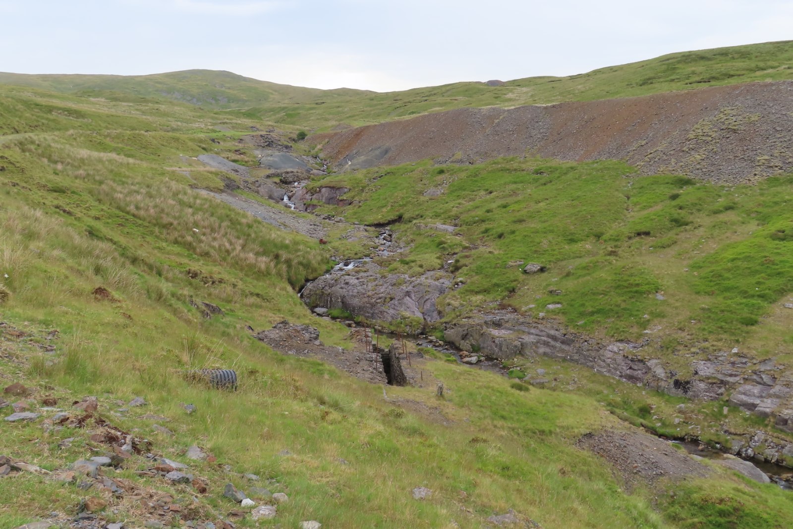
The workings are flooded and the site is open moorland on the flank of Plynlimon, the spoil and surface remains visible from the hill paths. The Main Lode can still be seen in the adit.
Spoil and surface remains on open moorland on the flank of Plynlimon, visible from the hill paths; the Main Lode can be seen in the adit.
Related mines
- Nantiago Mine — The two are neighbours in the same upland orefield and share a name problem: Nantiago's own older name was Plynlimmon, which is why this mine has to be distinguished as the one west of the mountain.
Nearby mines
- Nantiago Mine — 0.0 miles (0.0 km) E, Powys
- Bryntail Lead Mine — 5.4 miles (8.7 km) E, Powys
- Rhyd Fach Mine — 5.6 miles (9.0 km) W
- Eaglebrook Mine — 5.9 miles (9.5 km) W
- Dylife — 6.0 miles (9.6 km) N, Powys
Straight-line distance, within 9 miles (15 km). Show on the map.
Recorded claims
Individual factual claims, each attached to the source(s) that support it below. Where sources disagree, both are kept.
- The mine yielded about 3,270 tons of lead concentrates between 1867 and 1897. 1
- The Royal Plynlimon Mining Company, under Captain James Richards of Devon Great Consols, drove the adit level 155 fathoms east along the lode almost all in ore, put up a forty-foot water wheel and sank an engine shaft 24 fathoms below adit; it sold about 1,000 tons of galena for some £13,000 in three years and sold the mine on in April 1870 for about £19,000. 1
- The workings lie at about 550 m above sea level where, despite around 250 mm of rain a year, small catchment areas severely restricted the use of water power. 1
- No plans of the mine survive, almost the entire workings are flooded and no modern survey techniques appear to have been applied; what is known of the underground layout has been reconstructed from Mining Journal reports tested against new surface mapping. 1
Photographs & further reading
A study reconstructing the mine's underground geology from Mining Journal reports and new surface mapping, with the working history and the East Plynlimon venture.
View sourceSources
- (secondary) The Plynlimon Mines, Ceredigion: an integrated evaluation from new surface geological mapping and contemporary subsurface documentation (James and Hall) — D. M. D. James and G. W. Hall
- (observational) Mine workings on Plynlimon / Pumlumon Fawr — Geograph Britain and Ireland
Record created: 9 September 2026 · Last researched: 9 September 2026