 MineArchive
Penmachno Quarry
| Also known as | Cwm Machno Quarry, Rhiwfachno Quarry, Tan-y-Rhiw Quarry, Cwm Machno Slate Quarries |
|---|---|
| Location | Cwm Penmachno, Bro Machno, near Betws-y-coed, Conwy — 53.0048, -3.8625 (exact) |
| Commodity | Slate |
| Type | Slate |
| Worked | 1818–1962 |
| Maximum depth | Unknown. The quarry was worked as galleries and underground chambers on several levels. |
| Operators | Cwm Machno Slate Quarries Ltd (?–1962) |
Overview
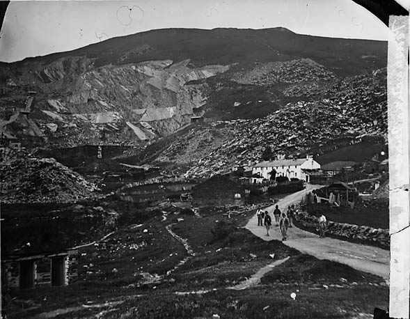
A slate quarry at the head of the Machno valley above Cwm Penmachno, south-west of Betws-y-coed, on the north-eastern edge of the Ffestiniog group and directly below Rhiwbach. Known also as Cwm Machno, Rhiwfachno or Tan-y-rhiw, it was recorded working in 1818, was developed in earnest from 1849, and grew to 178 men in 1898 and 8,000 tons of slate in its best year, working an open pit on several levels and underground beneath it. It was the largest slate quarry in Wales never to have a railway, carting its slate to Trefriw and later Betws-y-coed, and its water-wheel-powered incline, which lowered blocks to the mills and hauled rubble from the underground workings, is a scheduled monument. It closed in 1962.
History
Slate was taken from the hillside at Tan-y-rhiw by local men in an ad hoc way from at least 1818, and serious development began in 1849. The first mill, water-powered, was built in 1852, and the quarry used water power to the end. It grew into a substantial concern with two pits, the upper Rhiw Fachno and the lower main Cwm Machno, worked as galleries and, from adits driven off both, underground; balanced inclines linked the terraces and the mills at village level. Transport was its lifelong difficulty. Slate went at first by horse and cart to the wharf at Trefriw on the Conwy, from the late 1830s south over Cwm Teigl to Maentwrog for the Dwyryd boats to Porthmadog, and after the London and North Western Railway reached Betws-y-coed in 1868 eleven kilometres over mountain roads to the railhead there; the Rhiwbach tramway of 1863 let some slate go up to Rhiwbach and out to Blaenau Ffestiniog, and there were proposals, never carried out, for a tramway to Rhiwbach on the surface or through that quarry's drainage tunnel. Output peaked at 8,000 tons in 1869 and had fallen to 2,260 tons by 1890; the workforce was 70 in 1872 and 178 at its peak in 1898, with houses for married men and barracks for single ones, and drought stopped the water-powered quarry more than once, including in 1891. In the twentieth century it traded as Cwm Machno Slate Quarries Ltd, employed 108 in 1937-38, ran locomotives inside the quarry though never outside it, and worked on after the Second World War until its closure in 1962, the abandonment plan being dated 8 June that year. The lower quarry was landscaped in the 1980s, which removed the walled rubbish tramway and its arched entrance tunnel and the winding house of the main Trwnc incline.
Geology
The quarry worked the Ordovician slates of the Ffestiniog district's north-eastern margin, mudstones metamorphosed to slate and dipping into the mountain, so that the veins were followed from open galleries into underground chambers; the Mining Remediation Authority's catalogue holds a plan of Cwm Machno Slate Quarries Ltd's workings in the North Vein.
Geological setting: Slate and Regional Metamorphism (well documented example)
Workings
Two pits worked as terraced open galleries, with adits from each into underground chambers on several levels; balanced inclines connected the terraces to two water-powered mills at village level, the main Trwnc incline dropping three levels and later converted to a twin-track table type with a water counterbalance so that it could also haul waste up from the pit. A unique water-wheel-powered incline, now scheduled, both lowered blocks to the mills and drew blocks and rubble from the underground workings. A walled rubbish tramway crossed the site to tips on the east, through an arched tunnel that served as the quarry's entrance. Locomotives were used internally.
Closure
Closed in 1962, the abandonment plan dated 8 June 1962; transport costs, a shortage of tipping space and the general collapse of the Welsh slate trade are the difficulties the record describes, but nothing is recorded of the closure decision itself.
What remains
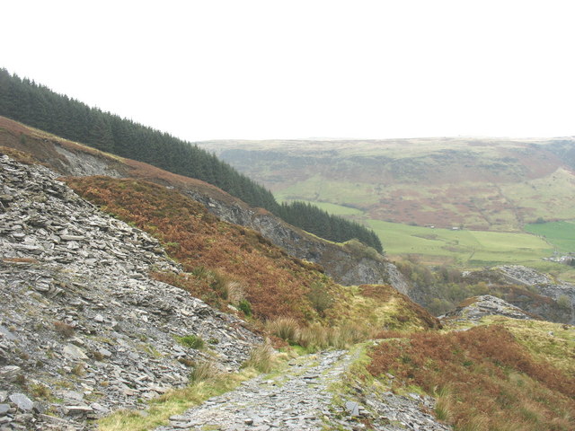
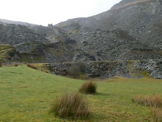
Visited in August 2021 and April 2022: the main incline, described as a sight to behold, survives with its rusting wire rope, the tower at its top standing like a Welsh slate castle, the remains of the water-wheel housing and piping beside it, several winding houses in varying condition, a retaining wall at the bottom of the quarry, and slate waste as far as the eye can see; a few buildings stand and a small rock-cut store survives. The lower part of the quarry was landscaped in the 1980s.
Inclines and drumhouses on several levels, the scheduled water-wheel incline, mill ruins, revetted tips and a rock-cut store; the entrance tunnel and Trwnc winding house were lost to 1980s landscaping.
Nearby mines
- Rhiwbach Quarry — 0.9 miles (1.4 km) SW, Gwynedd
- Blaen y Cwm Quarry — 1.1 miles (1.8 km) W, Gwynedd
- Manod Quarry — 1.5 miles (2.4 km) SW, Gwynedd
- Graig Ddu Quarry — 1.8 miles (2.9 km) SW, Gwynedd
- Cwt-y-Bugail Quarry — 1.9 miles (3.1 km) W, Gwynedd
Straight-line distance, within 9 miles (15 km). Show on the map.
Recorded claims
Individual factual claims, each attached to the source(s) that support it below. Where sources disagree, both are kept.
- The quarry was recorded working in 1818, developed in earnest from 1849, and closed in 1962. 1,2,3
- The Cadw scheduling text gives the quarry as worked from the 1820s until 1962. 4
- The quarry employed 70 men in 1872, 178 in 1898 and 108 in 1937-38. 1,2
- Output peaked at 8,000 tons in 1869 and had fallen to 2,260 tons by 1890. 3
- It was the largest slate quarry in Wales without rail access; slate was carted to Trefriw and, after 1868, to Betws-y-coed, and some went out via the Rhiwbach tramway from 1863. 2,4,3
- The scheduled monument comprises a unique surviving water-wheel-powered incline that both lowered blocks to the mills and drew blocks and rubble from the underground workings; water power was used from the first mill of 1852 to closure. 4
- There were two pits, the upper Rhiw Fachno and the lower main Cwm Machno, with adits from both into underground workings; it was unusual in working as both a gallery and an underground quarry. 4,3
- The quarry suffered from a lack of tipping space and a restricted water supply, stopping for drought in 1891. 2,3
- Tramway connections to Rhiwbach, on the surface or through its drainage tunnel, were proposed but never built. 2
- The Cwm Machno slate abandonment plan is dated 8 June 1962, and the catalogue holds a plan of Cwm Machno Slate Quarries Ltd's North Vein workings. 5
- In August 1982 the arched entrance tunnel carrying the rubbish tramway and the Trwnc incline winding house still stood; both were removed in the 1980s landscaping. 6
- Visits in 2021 and 2022 found the main incline, its water-wheel housing, several winding houses, a retaining wall, a rock-cut store and vast slate tips surviving. 3,7
Photographs & further reading
The Royal Commission's site record with the quarry's history, transport difficulties and the 1991 survey of surviving structures.
View sourceThe scheduling text for the water-wheel-powered incline, with the quarry's working dates and its lack of rail access.
View sourceA history and a photographed walk through the quarry's inclines, winding houses and tips.
View sourcePhotographs from 1982 of the entrance tunnel, main workings and Trwnc incline winding house, before landscaping removed them.
View sourceSources
- (secondary) Penmachno quarry — Wikipedia
- (primary) Cwm Machno Slate Quarry; Penmachno Slate Quarry (NPRN 40535) — Coflein, Royal Commission on the Ancient and Historical Monuments of Wales
- (observational) Penmachno quarry, near Betws-y-coed, North Wales, August 2021 (visit report) — 28DaysLater (HughieD)
- (primary) Cwm Penmachno Slate Quarry, scheduled monument CN333 (Cadw, scheduled 28 September 2001) — Cadw scheduling text, via ancientmonuments.uk
- (primary) Cwm Machno: slate abandonment plan, 8 June 1962 (mine plans catalogue) — British Geological Survey / Mining Remediation Authority
- (observational) Cwm Machno, page 1 (photographs of August 1982) — JGD, Remains of the Welsh Slate Industry
- (observational) Penmachno Quarry [revisit], North Wales, April 2022 (visit report) — 28DaysLater (HughieD)
Record created: 9 September 2026 · Last researched: 9 September 2026