 MineArchive
Pen-ffordd-goch Ironstone Scours
| Also known as | Cefn Garnyrerw Extractive Area, Pen-ffordd-goch Patches |
|---|---|
| Location | Pen-ffordd-goch and Cefn Garnyrerw, above Blaenavon, Blaenau Gwent — 51.8090, -3.1030 (approximate) |
| Commodities | Ironstone, Coal |
| Type | Ironstone |
| Worked | At least the 17th century–by 1817 (scouring) |
| Maximum depth | Surface extraction from outcrops, with adits driven before 1812; no depth applies. |
| Operators | Hanbury family of Pontypool (1600–1800) |
Overview
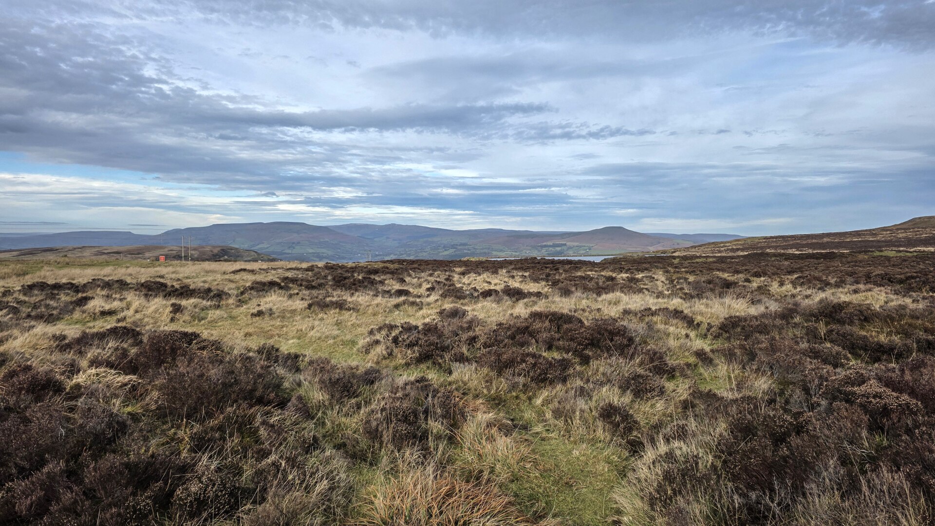
An exceptional survival of patching and scouring on the open common above Blaenavon, where iron ore was taken from outcrops on the hilltop by stripping the ground with water. The workings date back to at least the seventeenth century and grew after Blaenavon ironworks was established near the end of the eighteenth. Leats, hushing dams, scours, levels, shaft mounds, tracks and tramroad formations all survive, and the whole is scheduled. Scouring had ceased by 1817, when the water that fed it was taken for a reservoir to serve Garn Ddyrys ironworks.
History
Mineral extraction on this stretch of the north-eastern outcrop of the South Wales coalfield goes back to at least the seventeenth century. The Hanbury family of Pontypool are known to have worked part of the area during the seventeenth and eighteenth centuries, including the coal and iron ore workings west of the Abergavenny road, where many hand-dug features survive. Extraction grew sharply after Blaenavon ironworks was established near the end of the eighteenth century, and the approaches and tips of adit mines driven before 1812 can still be seen around Pen-ffordd-goch. The scouring itself can be dated closely, and that is unusual: it had ceased by 1817, when the reservoir was built to serve Garn Ddyrys ironworks — the water that had been used to strip the hillside was needed for the furnaces instead. Later working on the same ground shows the technology moving on: New Pit, Balance Pit and Hill’s Pits, the last sunk in 1839 for coal and ironstone and still retaining its stone chimney, listed Grade II. Through the nineteenth century numerous levels, quarries and pits were worked across the area, among them Peggi’s Level for clay and the ironstone level and quarry near Tir Abraham-Harry. The whole was served by a complex water-management system, supplying both the ironworks and the water-balance systems of the local pits, and by an extensive tramroad network; substantial remains of both survive.
Geology
The north-eastern outcrop of the South Wales coalfield, where coal, iron ore, fireclay and limestone all come to the surface within a short distance of each other on the open upland. That is the whole reason for Blaenavon: an ironworks needs ore, fuel and flux, and here they crop out together on the same hill. Because the ore was at outcrop it could be taken from the surface, which is what made scouring and patching possible before there was capital for deep mining.
Workings
Patching and scouring — surface extraction in which water is impounded behind a dam and then released down the hillside to strip the overburden and expose the ore, the ground then being worked over by hand. The surviving features are the whole apparatus of it: leats to bring the water, hushing dams to hold it, and the scours themselves cut into the hill. Alongside them are levels, shaft mounds, tracks and tramroad formations from the later phases of working. The Pen-ffordd-goch patching and scouring remains are scheduled (SAM MM227), as are the Hanbury-period coal and iron ore workings west of the Abergavenny road (MM297), and a well-preserved early nineteenth-century ironstone quarry of national importance at Carreg Maen Taro in the north of the area (MM295).
Closure
Scouring ended not through exhaustion but through competition for water: it had ceased by 1817, when the reservoir was built to serve Garn Ddyrys ironworks. Extraction on the hill continued by other means for most of the nineteenth century.
What remains
Open upland common, and one of the few parts of the Blaenavon extractive landscape not destroyed by twentieth-century opencasting. The scours, leats, dams, adit tips, shaft mounds and tramroad formations survive across the moor, within the Blaenavon Industrial Landscape World Heritage Site, and the principal areas are scheduled.
Leats, hushing dams and scours at Pen-ffordd-goch (SAM MM227); the hand-dug coal and iron ore workings west of the Abergavenny road (MM297); the early nineteenth-century ironstone quarry at Carreg Maen Taro (MM295); the approaches and tips of pre-1812 adits; and the Grade II listed stone chimney of Hill’s Pits, sunk in 1839.
Nearby mines
- Llammarch Colliery — 1.5 miles (2.5 km) SW
- Garn Colliery, Blaenavon — 1.9 miles (3.1 km) SW, Torfaen
- Kay's Slope — 2.1 miles (3.3 km) S, Torfaen
- Milfraen Colliery — 2.2 miles (3.6 km) SW, Torfaen
- Blaenavon Ironworks — 2.3 miles (3.7 km) S, Torfaen
Straight-line distance, within 9 miles (15 km). Show on the map.
Recorded claims
Individual factual claims, each attached to the source(s) that support it below. Where sources disagree, both are kept.
- Mineral extraction in this area dates back to at least the 17th century; an exceptional area of patching and scouring remains is at Pen-ffordd-goch, where iron ore was extracted from outcrops on the hilltop. 1
- Preserved features include leats, hushing dams, scours, levels, shaft mounds, tracks and tramroad formations, and the approaches and tips of adit mines driven before 1812 can still be seen around Pen-ffordd-goch. 1
- These features can be easily dated as scouring had ceased by 1817, when the reservoir was built to serve Garn Ddyrys ironworks. 1
- The Hanbury family of Pontypool worked some of this area during the 17th and 18th centuries, including the coal and iron ore workings west of Abergavenny Road, where many hand-dug features survive. 1
- Later workings demonstrate advances in mining technology and include New Pit, Balance Pit and Hill’s Pits, the last sunk in 1839 to exploit coal and ironstone deposits and retaining a stone chimney listed Grade II. 1
- Clydach Ironworks was established close to the sources of iron ore, coal and limestone by 1795 and exploited the recent introduction of coke as fuel; by 1841 over 1,350 people including 133 children under 13 were employed, the majority winning iron ore and coal higher up the valley. 2
Photographs & further reading
The historic landscape characterisation of the extractive common: the scheduled patching and scouring, the pre-1812 adits, the water-management and tramroad systems, and the dating of the scouring by the 1817 reservoir.
View sourceSources
- (primary) Blaenavon HLCA009: Cefn Garnyrerw and Pen-ffordd-goch Extractive Area — Glamorgan-Gwent Archaeological Trust for Cadw, Historic Landscape Characterisation
- (primary) Clydach HLCA003: Clydach South — Glamorgan-Gwent Archaeological Trust for Cadw, Historic Landscape Characterisation
- (secondary) Clydach Gorge — Wikipedia
Record created: 8 September 2026 · Last researched: 8 September 2026