 MineArchive
Parson Byers Quarry
| Location | Stanhope, Weardale, County Durham — 54.7302, -2.0007 (approximate) |
|---|---|
| Commodity | Limestone |
| Type | Quarry |
| Worked | by 1896 |
| Maximum depth | A face in a limestone bed about 60 feet thick. |
| Operators | Bell Brothers (owner) — Owners in the 1902 accident return and on the Durham Mining Museum page |
A limestone quarry on the hillside south of Stanhope in Weardale that adjoined Newlandside, owned by Bell Brothers and employing 207 people in 1905.
Location
Approximate location. The large pin is this mine; the small round markers are the nearest mines on record. Click one for its page. View on full map
History
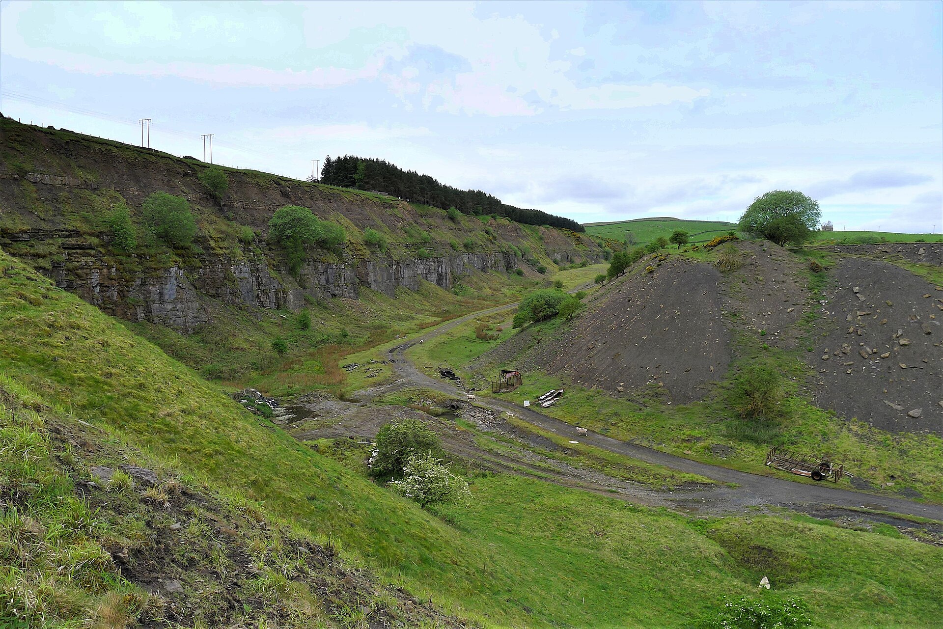
Parson Byers was the second of the two great limestone quarries on the hillside south of Stanhope. It adjoined Newlandside, and between them they formed one continuous face three miles long, in a bed of limestone about 60 feet thick some 900 feet above sea level. In 1896 and 1897 it employed 177 people, and in 1897 it raised ganister as well as limestone. Bell Brothers Ltd owned it; by 1905 the workforce had grown to 207, and by 1922 it was down to 95.
The accident returns record a truck brakesman crushed between a wagon and the quarry side in 1896, a quarryman who fell 40 feet while levering stone in 1899, and a labourer who died of blood poisoning in 1900 after a scratch from frozen dirt he was shovelling out of a truck. A young brakesman injured in January 1902 died that October, though the doctor certified tuberculosis and said the accident had nothing to do with it.
By 1937, when the trade press described the Stanhope quarries, Parson Byers had its own self-acting incline, with balanced drums 12 feet across, lowering loaded 10-ton trucks to the LNER. Saddle-tank locomotives worked between the incline head and the face, and a Ruston-Bucyrus steam excavator cleared the overburden.
Geology
A bed of limestone about 60 feet thick; ganister was also raised in 1897.
Workings
An open face continuous with Newlandside's, worked on standard-gauge track, with a self-acting incline and 12-foot balanced drums down to the railway.
Closure
Photographers' notes of 2007 and 2022 give the quarry as closed in the late 1950s; the earlier adds that it was opened in 1872.
Related mines
- Newlandside Quarry — The workings of Parson Byers and Newlandside joined, forming one continuous limestone quarry face three miles long (Durham Mining Museum, 1937 description).
Nearby mines
- Newlandside Quarry — 0.8 miles (1.2 km) NW
- Rogerley Mine — 1.2 miles (1.9 km) E
- Harehope Gill Mine — 1.5 miles (2.4 km) E
- Ashes Quarry — 1.6 miles (2.5 km) N
- Frosterley Marble Quarries — 1.7 miles (2.7 km) E
Straight-line distance, within 9 miles (15 km).
Further reading
The museum's page: owner, output and workforce from 1896 to 1922, the 1937 description of the Stanhope quarries and the men killed there.
View sourceSources
- (primary) Parson Byers Quarry (Durham Mining Museum) — Durham Mining Museum
- (secondary) NMRS deaths and injuries database: Parson Byers Quarry, 1902 — Northern Mine Research Society
- (observational) Parson Byers Quarry: the south eastern end (Geograph, 2007) — Geograph
- (observational) Parson Byers Quarry (Geograph, 2022) — Geograph
Record created: 20 November 2026 · Last researched: 20 November 2026