 MineArchive
Nethercroy Colliery
| Location | Croy Hill, Croy, near Kilsyth, North Lanarkshire — 55.9664, -4.0348 (exact) |
|---|---|
| Commodities | Coal, Ironstone |
| Type | Coal |
| Worked | c.1890–1914 |
| Maximum depth | 80 fathoms (146 m), No. 1 Pit |
| Operators | Carron Company |
Overview
The Carron Company's ironstone and coking-coal colliery on Croy Hill, near Kilsyth, reopening old ironstone pits around 1890; nearly 500 men in 1896, ironstone given up by 1905 and the coking coal abandoned in 1914.
History
Nethercroy lies on Croy Hill, south of the Forth and Clyde Canal near Kilsyth. Ironstone had been mined there before 1859: the first edition Ordnance Survey map marks an 'Old Pit (Ironstone)'. Around 1890 the old workings were taken up again as Nethercroy Colliery, owned by the Carron Company, which worked No. 1, No. 2 and No. 3 Pits, joined underground by cross-cut mine levels. Longwall ironstone workings ran through several seams south of the canal, mostly in the Banton Blackband Ironstone, with lesser workings in the Garibaldi Clayband and No. 9 Clayband ironstones, which were abandoned in 1893 and 1894; the Banton workings, about a kilometre from end to end, were abandoned in 1903. No. 1 Pit reached the No. 9 Clayband Ironstone at 58 fathoms and the Kilsyth Coking Coal at 80 fathoms (146 metres).
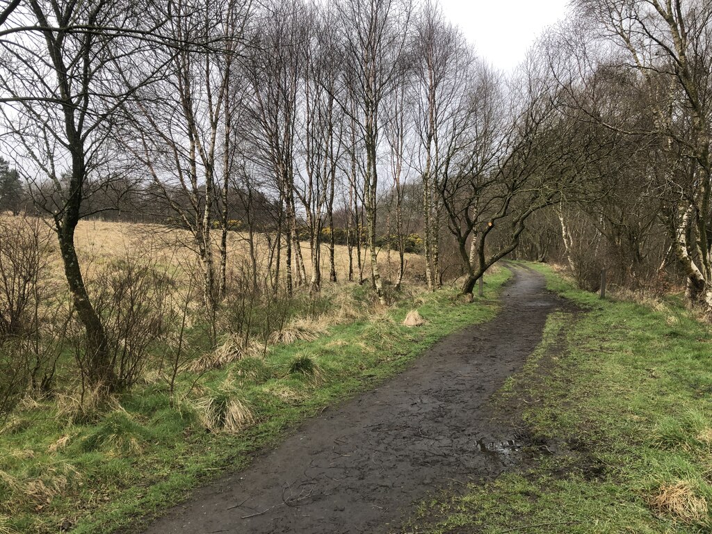
The colliery raised coking coal and ironstone in the 1890s, with 394 men in 1894 and 494 in 1896, but by 1905 only coal, with 286 men, and 274 in 1910. The ironstone and coking coal were finally abandoned in 1914. In 1898 a firedamp explosion, caused when a miner's son unlocked his safety lamp and struck a match to relight it, killed his father and injured four other men. The trackbed of a mineral railway that served the colliery is now a path on Croy Hill, and the No. 1 Pit site lies under woodland.
Geology
Banton Blackband, Garibaldi Clayband and No. 9 Clayband ironstones, and the Kilsyth Coking Coal.
Workings
Nos 1, 2 and 3 Pits linked by cross-cut mine levels; longwall ironstone workings; a mineral railway.
Closure
Clayband ironstones abandoned 1893-94, the Banton Blackband in 1903, and the ironstone and coking coal in 1914.
What remains
The No. 1 Pit site is under woodland and the shaft is probably blocked or buried; the mineral railway's trackbed is a path.
The trackbed and cutting of the mineral railway that served the colliery.
Redevelopment
Woodland.
Nearby mines
- Dullatur Colliery — 1.3 miles (2.1 km) E
- Dumbreck Colliery — 1.9 miles (3.0 km) W
- Auchinreoch Colliery — 3.4 miles (5.5 km) W, East Dunbartonshire
- Banknock Colliery — 3.7 miles (5.9 km) NE, Falkirk
- Gartshore Colliery — 3.7 miles (6.0 km) W, East Dunbartonshire
Straight-line distance, within 9 miles (15 km). Show on the map.
Recorded claims
Individual factual claims, each attached to the source(s) that support it below. Where sources disagree, both are kept.
- Ironstone was mined before 1859; the pits were probably reopened as Nethercroy Colliery, which raised ironstone and coal in 1894 and 1900 and only coal in 1905 and 1910. 1,2
- Longwall workings in the Banton Blackband Ironstone were abandoned in 1903, and in the Garibaldi and No. 9 Clayband ironstones in 1893 and 1894. 2,3
- No. 1 Pit reached the Kilsyth Coking Coal at 80 fathoms (146 metres). 2
- Owned by the Carron Company, employing 394 in 1894, 494 in 1896 and 274 in 1910. 1
- The coking coal was abandoned in 1914. 4
- A firedamp explosion in 1898, caused by a miner's son relighting his unlocked lamp with a match, killed his father and injured four other men. 1
- The trackbed of a mineral railway that served Nethercroy Colliery is now a path on Croy Hill. 5
Sources
- (primary) Nethercroy Colliery — Durham Mining Museum
- (secondary) Nethercroy No.1 Pit — Scottish Cave and Mine Database (Grampian Speleological Group)
- (primary) BGS mine plan: Nethercroy No. 3 Pit, Banton Blackband Ironstone (abandoned 1903) — British Geological Survey / Mining Remediation Authority
- (primary) BGS mine plan: Nethercroy, coking coal (abandoned 1914) — British Geological Survey / Mining Remediation Authority
- (observational) Path on Croy Hill (Geograph 8005991) — Geograph
Record created: 17 October 2026 · Last researched: 17 October 2026