 MineArchive
Nanty Mine
| Also known as | Pantmawr Mine, Nanty Goch Fawr Mine |
|---|---|
| Location | Beside the Aberystwyth to Llanidloes road, near the ninth milestone from Llanidloes, Llangurig, Powys — 52.4248, -3.6889 (exact) |
| Commodities | Lead, Silver |
| Type | Metal |
| Worked | By 1845–1871 |
| Maximum depth | About 20 fathoms below the deep adit (about 37 m) |
| Operators | George Brace (1853–1860, lessee) — Licensed the sett on Nanty farm in 1853, underlet Nanty to Lefeaux and worked Nanty Goch Fawr himself until his death. William Lefeaux (1854–1860, lessee) — Held Nanty under Brace from 1854 and sold it to James Kingsford in 1860 for £750. Nanty Mines Company Limited (1860–?) — Formed by James Kingsford in 1860 to work Nanty and Nanty Goch Fawr together; the best returns followed. |
Nanty was a lead mine beside the Aberystwyth to Llanidloes road in the upper Wye valley, near the ninth milestone from Llanidloes. Its lode runs nearly north and south, the only productive one in the district to do so. It was highly productive for a short time, returning 1,781 tons of lead ore between 1856 and 1871, of which 632 tons came in 1863 alone.
Location
Recorded location. The large pin is this mine; the small round markers are the nearest mines on record. Click one for its page. View on full map
History
Old adits were at work here before 1845. The mine's documented life begins in August 1853, when Anne Warburton Owen of Glansevern licensed a sett of some 75 acres on Nanty farm to George Brace, of Surrey Street in the Strand. A year later Brace underlet it to William Lefeaux of Dollys, near Llanidloes, and himself worked the neighbouring ground with four partners as Nanty Goch Fawr. The two fell out over the way Lefeaux ran his workings, and in July 1859 Brace took him to the Court of Chancery.
Brace died in February 1860 with the case still open. His partner James Kingsford then bought Nanty from Lefeaux for £750, buildings and machinery included, the suit was dropped, and that year Kingsford formed the Nanty Mines Company Limited to work both mines as one.
The good years followed. By 1861 there were a deep adit and two levels; ore was returned every year from 1861 to 1866, with 632 tons in 1863, and in 1864 a shaft was sunk near the road with a horizontal steam engine to pump and wind. The whole return was 1,781 tons of lead ore, giving 1,390 tons of lead and 9,482 ounces of silver. By 1867 the mine was for sale. A last return was made in 1871.
Geology
A single vein in Silurian mudstones near the top of the Frongoch formation, with massive beds of grit at surface, carries galena. It strikes nearly north and south, a little east of north, and probably dips steeply west. Most of the ore lay near the main road; the lode has been traced for more than half a mile to the north without being productive there.
Geological setting: Veins and Lodes (well documented example)
Workings
The mine was first worked by several old adits, then by a deep adit driven from near the River Wye at about 1,020 feet above sea level, and by an engine shaft on the slope above, sunk about 20 fathoms below the adit. The shaft of 1864, near the road, had a horizontal steam engine with a 14-inch cylinder for pumping and drawing and a 25-foot boiler house beside it. A 20-foot waterwheel and two smaller wheels drove the dressing floors. A watercourse across Nanty and Pantmawr farms was authorised in 1855 to bring water to the mines.
Closure
The mine was offered for sale in 1867; the last return of ore is for 1871.
What remains
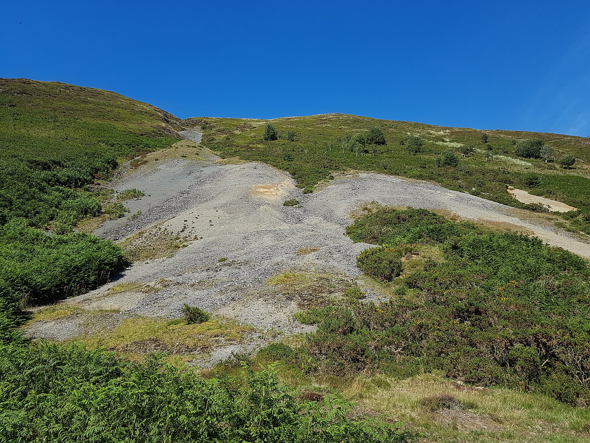
The remains are badly preserved. The shaft and the levels above the road have been filled in, and the masonry of the engine house, crusher house and dressing floors was carted away as hardcore for farm roads and for filling the workings.
The base of the crusher house, washing and jigging platforms, traces of round buddles and the spoil tips on the hillside.
Related mines
- Wye Valley Mine — The eastern Wye Valley mine was first worked as West Nanty, a company of that name sharing a director and secretary with the Nanty company in 1863, and the two mines were offered for sale together in 1867.
Nearby mines
- Siglenlas Mine — 1.4 miles (2.2 km) NE
- Wye Valley Mine — 2.5 miles (4.0 km) NW
- Cwm Ricket Mine — 2.8 miles (4.6 km) N
- Geufron Mine — 3.0 miles (4.9 km) NE
- Nantyricket Mine — 3.0 miles (4.9 km) N
Straight-line distance, within 9 miles (15 km). Show on the map.
Further reading
The archaeological trust's field survey of 1992-93 of what is left of the shaft, engine house and dressing floors.
View sourceA short article from the mine's leases and deeds, covering the Brace and Lefeaux years, the Chancery suit and the forming of the Nanty Mines Company.
View sourceSources
- (primary) Lead and Zinc: The Mining District of North Cardiganshire and West Montgomeryshire (Special Reports on the Mineral Resources of Great Britain, vol. XX), O. T. Jones, 1922 — Memoirs of the Geological Survey
- (secondary) Vignette on Nanty Mine, by R. von Arx (British Mining No. 45, 1992, pp. 37-40) — Northern Mine Research Society
- (secondary) Powys Metal Mines Survey: Nanty, also known as Pantmawr (HER 3673) — Clwyd-Powys Archaeological Trust, Powys Metal Mines Survey
- (secondary) The Wye Valley and Nantiago mines: historical account in Cambrian Archaeological Projects report 424 (archive document cap424_071) — Coflein, Royal Commission on the Ancient and Historical Monuments of Wales
- (primary) Mine plan: Nanty Mine, SN88SE 1 (KP17100) — British Geological Survey
Record created: 18 November 2026 · Last researched: 18 November 2026