 MineArchive
Geufron Mine
| Location | Severn valley, about 4 miles above Llanidloes, Llanidloes Without, Powys — 52.4579, -3.6412 (exact) |
|---|---|
| Commodity | Copper |
| Type | Metal |
| Worked | 18th century–1855 |
Geufron was a copper mine on the Van lode where it drops into the Severn valley, about four miles above Llanidloes, worked in the eighteenth century and again in the early 1850s. In the eighteenth century its ore went out by packhorse to the River Dovey; in the 1850s it returned some 360 tons of copper ore in five years. It never yielded lead or zinc. One shaft and one level are still open.
Location
Recorded location. The large pin is this mine; the small round markers are the nearest mines on record. Click one for its page. View on full map
History
Geufron looked ancient to the geologists, and it was certainly at work in the eighteenth century. Its copper ore was then carried by packhorse to Garreg, on the River Dovey.
The only recorded returns are from its last years. Copper ore was sold in 1851 and from 1852 to 1855, about 363 tons altogether, of which 212 tons came in 1852. A 30-foot waterwheel pumped the mine, and the dressing floors of this period are thought to have stood where Geufron farm is now. Cummings' engine shaft is the latest work on the ground. The mine is dated to 1852, though the returns run on for three years after that.
Geology
The Van lode here runs east-north-east between the Upper Van mudstones and the Gwestyn shales and dips south at about 70 degrees. It carries chalcopyrite in quartz and calcite, with iron pyrites, chalybite and nests of small quartz crystals, and only a little galena. There is no sign that galena or blende was ever recovered.
Geological setting: Veins and Lodes (well documented example)
Workings
An adit cross-cut, at about 950 feet above sea level, was driven east on the lode, and a vertical shaft was sunk in the Gwestyn shales; a deep adit, at about 800 feet, is said to enter the lode near Geufron farm. A cross-cut and the deep adit connect by levels with the shaft, and there are trials and opencuts along the outcrop. How far the workings go is not known.
Closure
The last return of copper ore is for 1855.
What remains
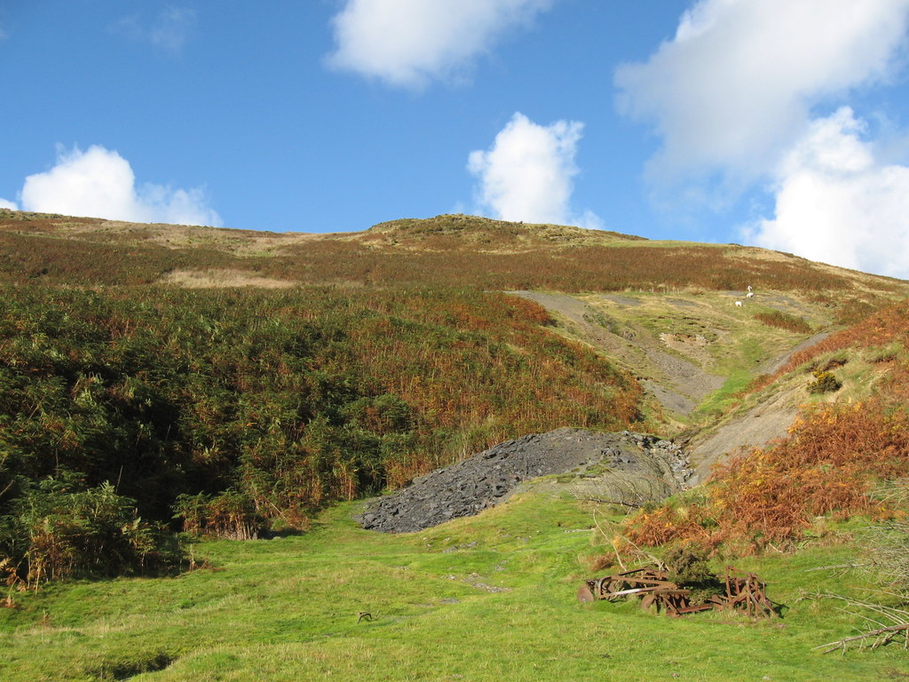
Cummings' engine shaft and one of the levels above it stand open. In 2012 a grey spoil tip at the shallow adit showed plainly on a bracken-covered hillside.
The open shaft and level, the trials and opencuts on the outcrop, and the spoil tips. Nothing obvious is left of the dressing floors.
Nearby mines
- Gwestyn Mine — 0.6 miles (0.9 km) NE
- Nantyricket Mine — 1.4 miles (2.3 km) NW
- Siglenlas Mine — 1.7 miles (2.7 km) SW
- Bryntail Lead Mine — 1.9 miles (3.0 km) NE
- Nantmelin Mine — 2.0 miles (3.3 km) NW
Straight-line distance, within 9 miles (15 km). Show on the map.
Further reading
The archaeological trust's field survey of 1992-93: the shaft, adits, levels and the packhorse trade to the Dovey.
View sourceSources
- (secondary) Powys Metal Mines Survey: Geufron (HER 8479) — Clwyd-Powys Archaeological Trust, Powys Metal Mines Survey
- (primary) Lead and Zinc: The Mining District of North Cardiganshire and West Montgomeryshire (Special Reports on the Mineral Resources of Great Britain, vol. XX), O. T. Jones, 1922 — Memoirs of the Geological Survey
- (observational) Geufron Mine (Geograph photograph 3183042, 2012) — Geograph
Record created: 18 November 2026 · Last researched: 18 November 2026