 MineArchive
Moira Collieries
| Also known as | Moira Colliery, The Moira Collieries |
|---|---|
| Location | Moira, Ashby Woulds, near Ashby-de-la-Zouch, Leicestershire — 52.7310, -1.5390 (approximate) |
| Commodities | Coal, Fireclay |
| Type | Coal |
| Worked | 1804–1990 |
| Maximum depth | About 215 m (705 ft) to the Moira Main Coal in the three pits sunk 1804–1813 |
| Operators | The Moira Colliery Company Limited (1895–1947), National Coal Board (1947–1987) |
Overview
Moira is not one colliery but a succession of them, sunk on the Leicestershire coalfield to feed an ironworks and then a canal. The Earl of Moira made trials for coal in 1796 and built his blast furnace at Moira in 1804; shafts were sunk beside it from 1800 to supply coal for the blast engine, and between 1804 and 1813 three large pits about 215 metres deep were driven to the Moira Main Coal, a seam up to five metres thick in places, with a colliery village built to house part of the workforce. As the workings moved further from the shafts it became cheaper to sink new ones, and these acquired separate names of their own. The Hastings family owned the lot until the death of Lord Donington in 1895, when the Moira Colliery Company Ltd was formed. Rawdon Pit, sunk in 1821 as a third shaft of Bath Pit, outlasted all of them and closed in 1990.
History
The pits at Moira have never been easy to keep straight, and the museum on the site says so plainly: they were named sometimes after places and sometimes after people, especially the Earl of Moira and his family, and the same shaft could be known by two names in different decades. The recorded sequence runs Double or Spinney Pits (1804), Furnace or Harvey’s Pit (1806), Bath Pit (1813), Marquis Pit (1816, originally a second shaft of Bath Pit), Rawdon Pit (1821, originally a third shaft of the same), Hastings and Grey or Newfield Pit (1831), and Reservoir, Canal Head or Cut End Pit (1851). Working dates are often uncertain; in some cases only the year full production began is known.
What the pits looked like from below is unusually well recorded for 1842, the year of the Royal Commission on Children’s Employment. The day began around two in the morning, with miners leaving the two rows of stone-built houses facing each other across the Measham road to walk the dark lanes to the pit. Work at the face was by holing — undercutting the coal with a pick so that it could be brought down — with horses hauling underground and children employed alongside the men. Payment ran through the little butty system, a subcontracting arrangement in which a middleman took the contract for a district and hired and paid the men himself.
The Hastings interest ended with the death of Lord Donington in 1895 and the formation of The Moira Colliery Company Ltd. After the First World War the company joined the Donisthorpe Colliery Company and the Donington Sanitary Pipe & Fire Brick Company in erecting an obelisk on Bath Lane to their employees who had been killed, with a separate plinth face for each works; it passed later to Ashby Woulds Town Council, which upgraded and re-dedicated it as the village war memorial and added the names of the Second World War dead. The collieries passed to the National Coal Board on nationalisation in 1947. Rawdon was the last survivor and produced coal until 1990.
Geology
Moira sits on the Leicestershire and South Derbyshire coalfield. The pits were sunk to the Moira Main Coal, a seam reaching up to five metres thick in places and lying about 215 metres down, along with the ironstone and fireclay that made an ironworks worth building here in the first place. The coal was prone to spontaneous combustion: exposed to air in the waste behind the face it would heat and ignite of its own accord, and these gob fires were, in the museum’s words, very frequent at Moira. Firedamp was the other constant. Men would take off their shirts and wave them to disperse the gas, and if they were in too much of a hurry to wait, lighting a candle did the rest.
Geological setting: Sedimentary Beds and Seams (well documented example)
Workings
Shaft mining throughout, the shafts sunk progressively northward and eastward as the face retreated from the older ones. Coal was cut by hand until black powder came into use after 1874; because the powder burned slowly and kept reigniting after it appeared to have gone out, miners lighting their own shots ran for cover into other parts of the workings and straight into each other, and deputies were appointed to take charge of blasting across the whole pit — one of the clearer cases of a working practice being created by the accidents it was meant to stop. High explosive, which detonated instantaneously, came later. Coal for the furnace went the short distance overland; the wider trade went by the Ashby Canal, whose terminus and lock sit beside the furnace, and the colliery village grew up between the two.
Closure
The pits closed one by one over the twentieth century as their districts worked out, leaving Rawdon as the last in the area; it produced coal until 1990. The Moira Main Coal had been worked for the best part of two centuries by then, and the workings had long since moved miles from the shafts that started them.
What remains
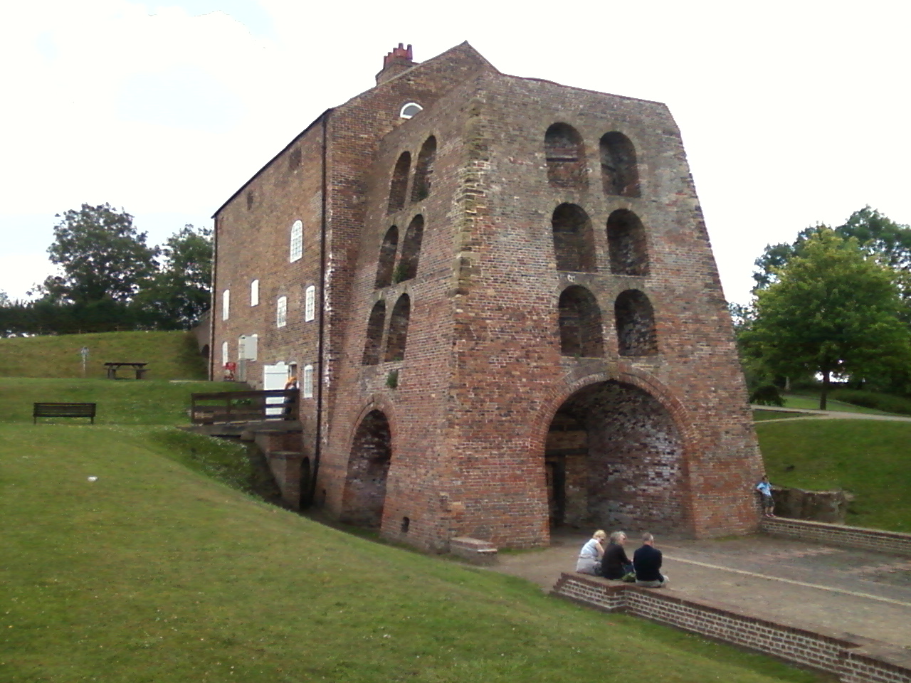
The colliery landscape has been comprehensively reclaimed and is now part of the National Forest. Moira Furnace, the blast furnace the first pits were sunk to supply, survives as one of the best-preserved early nineteenth-century iron-making furnaces in Europe and is run as a museum by the Moira Furnace Museum Trust, with restored lime kilns, woodland and a restored section of the Ashby Canal complete with narrowboat. A photograph from 2011 shows the furnace building intact with the canal running past it.
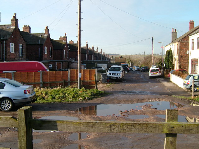
The furnace, its lime kilns and the Ashby Canal lock; the two rows of colliery cottages built for the workforce, some of them famously built back to front, facing away from the road; and the collieries’ war memorial obelisk on Bath Lane, a two-stepped square base carrying a tapering obelisk with inscription faces for each of the companies that paid for it.
Redevelopment
The reclaimed colliery ground at Moira now carries Conkers, a National Forest visitor attraction, and the Ashby Canal has been partly restored through the site. The furnace museum and the canal together make the industrial history the point of the place rather than an obstacle to reusing it.
Related mines
- Church Gresley Colliery — Both owned by the Marquis of Hastings and then the Moira Colliery Company (Picture the Past; DMM).
- Donisthorpe Colliery — The Donisthorpe Colliery Company became part of the Moira Colliery Company combine, the two firms joined in erecting the Bath Lane war memorial to their employees, and in 1980 a drift 2,200 m long was driven from Donisthorpe to bring its coal out at the surface of Rawdon, the last of the Moira pits.
- Oakthorpe Colliery — The Moira Collieries owned and worked Oakthorpe from 1857 to 1885.
- Reservoir Colliery — Moira Colliery Company pits.
Nearby mines
- Donisthorpe Colliery — 0.6 miles (1.0 km) SE
- Oakthorpe Colliery — 1.3 miles (2.1 km) SE
- Measham Colliery — 1.9 miles (3.1 km) SE
- Church Gresley Colliery — 2.3 miles (3.6 km) NW, Derbyshire
- Netherseal Colliery — 2.3 miles (3.7 km) W, Derbyshire
Straight-line distance, within 9 miles (15 km). Show on the map.
Recorded claims
Individual factual claims, each attached to the source(s) that support it below. Where sources disagree, both are kept.
- The Earl of Moira made trials for coal in 1796, and shafts were sunk near the furnace from 1800 onwards to supply coal for the blast engine; between 1804 and 1813 three large mines about 215 m deep were sunk to the Moira Main Coal, a seam up to 5 m thick in places. 1
- Seven pits are recorded in sequence: Double or Spinney (1804), Furnace or Harvey’s (1806), Bath (1813), Marquis (1816), Rawdon (1821), Hastings and Grey or Newfield (1831) and Reservoir, Canal Head or Cut End (1851); Marquis and Rawdon began as the second and third shafts of Bath Pit. 1
- The collieries at Moira were owned by members of the Hastings family until the death of Lord Donington in 1895, when The Moira Colliery Company Ltd was formed. 1
- Spontaneous combustion of coal exposed to air — gob fires — was very frequent at Moira. 1
- Rawdon Pit continued to produce coal until 1990 and was the last colliery to close in the Moira area. 1
- The obelisk on Bath Lane was erected by the Moira Colliery Company Ltd, the Donisthorpe Colliery Company Ltd and the Donington Sanitary Pipe & Fire Brick Company Ltd to their employees killed in the First World War, and was later upgraded and re-dedicated as the village war memorial by Ashby Woulds Town Council. 2
Photographs & further reading
A 64-page pack from the museum on the furnace site, with the clearest published list of the Moira pits and their sinking dates, a reconstruction of a mining day at Moira in 1842 drawing on the Children’s Employment report, and sections on gob fires, black powder and the little butty system.
View sourceThe register entry for the obelisk on Bath Lane, with a full transcription of the inscriptions on all four plinth faces and both angled tablets, and the plaque recording its transfer to Ashby Woulds Town Council.
View sourceSources
- (secondary) Moira Furnace Museum Education Pack — The Moira Furnace Museum Trust Limited
- (primary) Moira Colliery Company Ltd — WW1 memorial (WMR-37866) — Imperial War Museums, War Memorials Register
- (observational) Moira Furnace (photographed 9 July 2011) — Oliver Mills, Geograph Britain and Ireland
Record created: 6 September 2026 · Last researched: 6 September 2026