 MineArchive
Llanberis Copper Mine
| Also known as | Llyn Peris Mine, Llanberis Mine, Clogwyn Copper Mine |
|---|---|
| Location | South shore of Llyn Peris, below Clogwyn Mawr, Nant Peris, Llanberis, Gwynedd — 53.1080, -4.1002 (approximate) |
| Commodity | Copper |
| Type | Metal |
| Worked | Mid-18th century–1873 |
| Maximum depth | Unknown. |
Overview
The copper mine on the south shore of Llyn Peris at the head of the Llanberis valley, worked from the mid-eighteenth century and producing over 7,300 tons of ore between 1822 and 1850; its lakeside mill was lost to the Dinorwig pumped-storage scheme.
History
The Llanberis copper mine, also known as the Llyn Peris mine, lies on the southern side of the upper lake, Llyn Peris, near its head, below the crags of Clogwyn Mawr. Copper was worked here from at least the middle of the eighteenth century, and the size of the old workings suggests the mine was productive in its early years. Samuel Lewis described it as the principal of the two copper mines of Llanberis parish, regularly worked for about a century until its original vein could be considered exhausted, with a stamping mill to crush the ore before it was washed. He gave the ore as found in a matrix of quartz in hard whinstone and hornstone schist.
The best-recorded period is the first half of the nineteenth century: between 1822 and 1850 the mine produced 7,353 tons of copper ore, which yielded 499 tons of copper worth £38,040. Work slowed sharply after 1850, and apart from a small revival in 1868-70 little was done after the middle of the century; the mine is recorded as working until 1873. There were two sets of workings, east and west. The western one had a mill near the lake, which was obliterated by the Dinorwig pumped-storage power scheme; blocked adits climb the hillside to a large, deep open stope, and the eastern workings have a gated deep adit joined to adits above.
Geology
Copper lodes with chalcopyrite and pyrite and a little galena, in a quartz and calcite gangue, cutting Ordovician slates and volcanic rocks.
Workings
Two sets of workings: in the east a deep adit joined to adits higher on the hillside; in the west adits climbing the slope to a large, deep open stope.
Closure
Work fell away after 1850; a small revival in 1868-70 raised a few tons, and the mine is recorded as working until 1873.
What remains
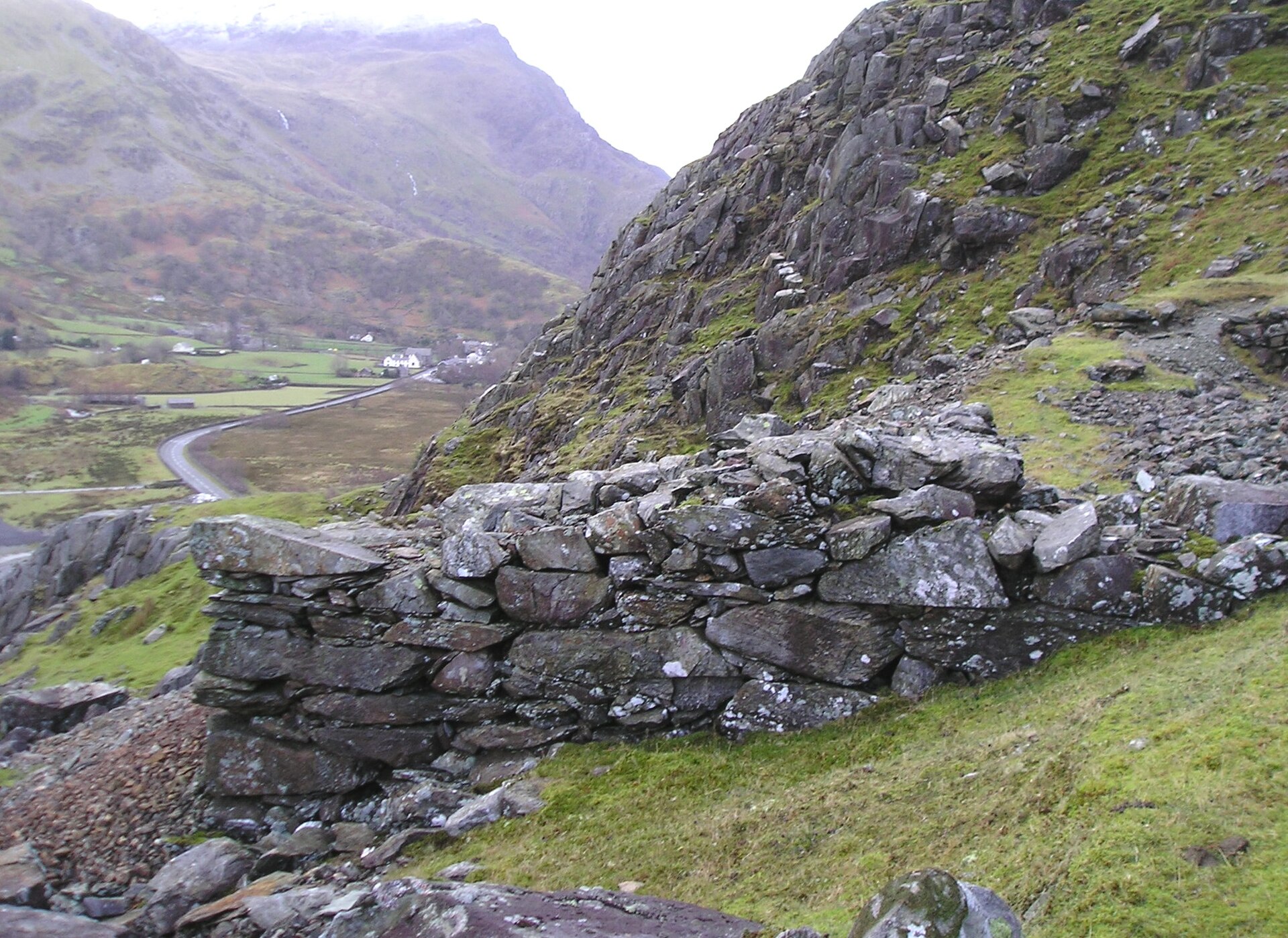
The lakeside mill was destroyed by the Dinorwig pumped-storage scheme; the adits on the hillside are mostly blocked, and the eastern deep adit is gated.
Dressing-floor walls and spoil on the hillside above the A4086, adits, and the open stope.
Redevelopment
The lakeside mill site lies under the works and road of the Dinorwig pumped-storage power station.
Related mines
- Clogwyn Coch Copper Mine — Worked together: miners spent summer at Clogwyn Coch and winter at Llanberis.
Nearby mines
- Vivian Quarry — 1.2 miles (1.9 km) NW
- Dinorwig Slate Quarry — 1.3 miles (2.0 km) N
- Clogwyn Coch Copper Mine — 2.0 miles (3.2 km) S
- Glynrhonwy Quarry — 2.1 miles (3.3 km) NW
- Marchlyn Quarry — 2.5 miles (4.0 km) N
Straight-line distance, within 9 miles (15 km). Show on the map.
Recorded claims
Individual factual claims, each attached to the source(s) that support it below. Where sources disagree, both are kept.
- Between 1822 and 1850 the Llanberis mine produced 7,353 tons of copper ore, yielding 499 tons of copper worth £38,040. 1
- The Llyn Peris mine was regularly worked for about a century, had a stamping mill, and by the 1840s its original vein was considered exhausted. 2
- Copper was worked at Llanberis from at least the middle of the eighteenth century. 1,3
- Work slowed sharply after 1850, with a small revival in 1868-70. 1
- The mill near the lake was obliterated by the pumped-storage power scheme. 1,3
- The ore was found in a matrix of quartz in hard whinstone and hornstone schist. 2
Sources
- (secondary) Llanberis Mine - East (Buddlepit Mine Database) — Buddlepit Mine Database
- (primary) A Topographical Dictionary of Wales (Samuel Lewis, 1849): Llanberis — British History Online
- (secondary) Llanberis Mine - West (Buddlepit Mine Database) — Buddlepit Mine Database
Record created: 19 October 2026 · Last researched: 19 October 2026