 MineArchive
Lead Mines Clough
| Location | Anglezarke Moor, near Chorley, Lancashire — 53.6499, -2.5748 (approximate) |
|---|---|
| Commodities | Lead, Barite, Witherite |
| Type | Metal |
| Worked | c.680-1000–1837 (mines sealed 1930) |
| Maximum depth | Shafts recorded up to 240ft (73m) deep |
| Operators | Sir Richard Standish (1692–1694), John Thompson (1824–1837) |
Overview
The largest and most productive of Anglezarke Moor's old lead workings, mined on and off from the first millennium AD to 1837 and now recognised as the true type locality for the mineral witherite — a discovery that, according to a 2022 re-examination of the evidence, had for two centuries been wrongly credited to Alston Moor in Cumbria instead.
History
Archaeological and isotopic evidence points to lead being extracted from Anglezarke Moor as early as the late 7th to late 10th centuries AD, most plausibly from the same veins later worked at Lead Mines Clough, though centuries of subsequent mining have destroyed most physical evidence of that first-millennium activity and the case rests on indirect evidence rather than excavated workings. The place names Anglezarke and neighbouring Rivington are themselves usually read as Norse in origin, consistent with early medieval Scandinavian settlement and resource use in the area.
Documented mining resumed in 1692, when Sir Richard Standish partnered with two local farmers and a mining engineer to work the vein after earlier attempts had failed. The venture was troubled from early on: in 1694 Standish told the Court of Chancery he could not transfer his interest in the mine to his wife because he held it only as a tenant, and after his death his widow's own attempt to claim the mine's profits failed in court — a defeat she answered, according to local tradition, by deliberately flooding the workings by diverting a stream into them. Mining nonetheless continued intermittently through the 18th century: production reached 73 tons of lead in 1788-89, and by the 1790s the mine was also yielding copper and galena. The last phase of working began in 1824, when landowner Frank Hall Standish leased the mine to John Thompson, a Wigan ironmaster; that lease was relinquished in 1837 and the mine was abandoned for good, its remaining shafts eventually sealed in 1930.
The mine's lasting scientific significance, though, comes from what miners initially treated as worthless waste. A heavy white mineral turning up in the spoil was for years dismissed as valueless — local tradition holds it was even used as rat poison — until it was recognised as witherite, barium carbonate, distinguished from ordinary barite by containing ordinarily above two per cent strontium carbonate. Josiah Wedgwood found a use for it in Jasperware, and after a visit by two French mineralogists in 1782, local farmer James Smithells began exporting Anglezarke witherite to Germany at five guineas a ton. For over two centuries the mineral's official type locality was recorded as Alston Moor in Cumbria, but a detailed 2022 re-examination of the original evidence by Cotterell concluded that Alston Moor's claim had effectively been fabricated, and that Lead Mines Clough, Anglezarke, was the real original source — restoring the discovery to the mine where it actually happened.
Geology
The lead-zinc-copper mineralisation at Lead Mines Clough fills fractures along a fault line cutting the Fletcher Bank Grit, part of the Millstone Grit sequence of the West Pennine Moors, with baryte and witherite forming much of the vein's gangue material alongside the ore minerals themselves. Marine Band shale containing goniatite fossils is exposed nearby in the clough, and the presence of witherite in unusually high, economically workable concentration is what ultimately made this particular vein scientifically significant well beyond its modest lead output.
Workings
The clough preserves evidence of successive phases of working: earlier bell pits survive on the higher ground above the main workings, while the main clough itself holds numerous shafts recorded up to 240ft deep alongside the remains of a smelting mill, a smithy and a waterwheel that once powered the site; a water-wheel shaft and an ore-dressing slime pit have also been identified among the surface remains.
Closure
The mine's last commercial lease was relinquished in 1837 after the venture proved unprofitable, and the remaining open shafts were sealed in 1930; local tradition holds that some further, unofficial working may have taken place around 1940, though this is unconfirmed.
What remains
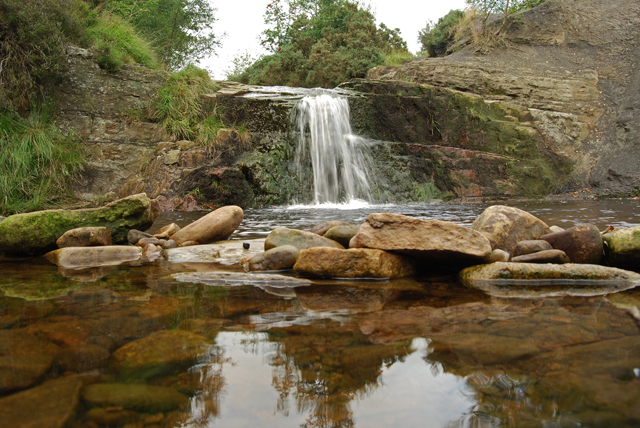
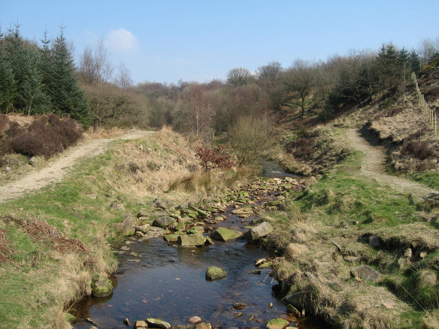
Lead Mines Clough is a well-known landmark on Anglezarke Moor and a junction for several popular walking routes, its brook dropping over a series of small waterfalls past exposed Marine Band shale. Surface traces of the mine — bell pits, shaft mounds, spoil heaps showing baryte, calcite and galena, and the waterwheel shaft and slime pit — remain visible along the clough.
Bell pits, shaft mounds and mineral-rich spoil heaps line the clough, along with the identified remains of the mine's waterwheel shaft and ore-dressing slime pit.
Nearby mines
- Duxbury Park Colliery — 3.0 miles (4.8 km) SW
- Ellerbeck Colliery — 3.1 miles (5.0 km) SW
- Blackrod Colliery — 3.9 miles (6.3 km) S, Greater Manchester
- Coppull Colliery — 4.1 miles (6.6 km) SW
- Blainscough Colliery — 4.3 miles (7.0 km) SW
Straight-line distance, within 9 miles (15 km). Show on the map.
The old shafts were sealed in 1930 but the surrounding ground is uneven and the spoil heaps unstable in places — this entry describes history and general location only, not an access guide.
What's uncertain
Points where sources disagree or the record could not be settled; both accounts are kept. All open questions in the archive.
- Archaeological and isotopic evidence indicates lead was being extracted on Anglezarke Moor c.680-1000 AD, most likely from the veins later worked at Lead Mines Clough, though later mining has destroyed most direct physical evidence of this early activity. (uncertain) 1
Recorded claims
Individual factual claims, each attached to the source(s) that support it below. Where sources disagree, both are kept.
- Archaeological and isotopic evidence indicates lead was being extracted on Anglezarke Moor c.680-1000 AD, most likely from the veins later worked at Lead Mines Clough, though later mining has destroyed most direct physical evidence of this early activity. (uncertain) 1
- Sir Richard Standish began working the mine in 1692 with two farmers and a mining engineer; after his death, his widow's court claim to the mine's profits failed, and she is recorded as having flooded the workings by diverting a stream in response. 1,2
- The mine produced 73 tons of lead in 1788-89 and also yielded copper and galena from the 1790s; its last lease, granted to Wigan ironmaster John Thompson in 1824, was relinquished in 1837, and the remaining shafts were sealed in 1930. 1,2
- Witherite from the mine's spoil, initially dismissed as worthless, was being exported to Germany by the 1780s; a 2022 re-examination of the evidence (Cotterell) concluded the mineral's true type locality is Lead Mines Clough, Anglezarke, correcting a two-century-old misattribution to Alston Moor, Cumbria. 1
- A waterwheel shaft and an ore-dressing slime pit associated with the mine's surface plant have been identified along Limestone Brook in the clough. 3
Sources
- (secondary) Anglezarke — Wikipedia
- (secondary) Lead Clough Mines - Anglezarke — Chorley, Duxbury, Adlington Local History
- (observational) Lead Mines Clough (geograph) — Geograph Britain and Ireland (Sue Adair)
Record created: 26 August 2026 · Last researched: 26 August 2026