 MineArchive
Kepwick Colliery
| Location | The escarpment above Kepwick, Cowesby, Hambleton Hills, North Yorkshire — 54.3075, -1.2631 (exact) |
|---|---|
| Commodity | Coal |
| Type | Coal |
| Worked | 1762–1763 |
| Maximum depth | 117 feet (the 1762 shaft) |
| Operators | William Mothersill (1762–1763), Lord Fauconberg (1762–?) |
Overview
A lime-coal pit on the Hambleton escarpment above Kepwick, where the limeburner William Mothersill found a seam of 16 to 17 inches in a shaft 117 feet deep in 1762 and bargained with Lord Fauconberg's agent for a lease at £6 a year, the men fearing the seam would run out by 1763; no later record of it is known.
History
William Mothersill was already quarrying and burning limestone on the escarpment at Kepwick, under the Hambleton Hills, when in 1762 he found a seam of lime coal between 16 and 17 inches thick in a shaft 117 feet deep. Lord Fauconberg's agent Richard Chapman reported that Mothersill, who proposed a partnership with another man, wanted to lease the coal for five or seven years at £6 a year, with leave to bore or sink anywhere on his lordship's ground, and that Fauconberg was to give them four or five ash or oak trees to make a gin for drawing the coals. The partners believed a better and deeper coal lay below and proposed boring for it, but as the negotiations went on Chapman found that Mothersill was poor and in debt and his partner had perhaps £100 to spend.
The matter was still unsettled in April 1763, when the men working the first pit told Chapman they were afraid the seam would run out. They had agreed to get 400 chaldrons a year at about six shillings a chaldron, with a further three shillings a chaldron to carry the coal up the hill to the kilns, where it sold at ten shillings; the surplus of about £20 a year had to pay Fauconberg's £6, the tenant for damage, and the corves, framing wood and props. The fear was probably justified, for no further record of the pit has been found. The colliery lists give it as opened in 1762 and closed in 1763, with Mothersill as owner.
Geology
A thin Jurassic lime coal of the Hambleton escarpment, 16 to 17 inches thick at 117 feet in the 1762 shaft, with a better coal believed to lie deeper.
Geological setting: Sedimentary Beds and Seams (historical documentary reference)
Workings
A single shaft of 117 feet with a horse gin, worked by a few men getting about 400 chaldrons a year for the lime kilns.
Closure
The men feared the seam running out in April 1763 and nothing more is recorded; the lists close it in 1763.
What remains
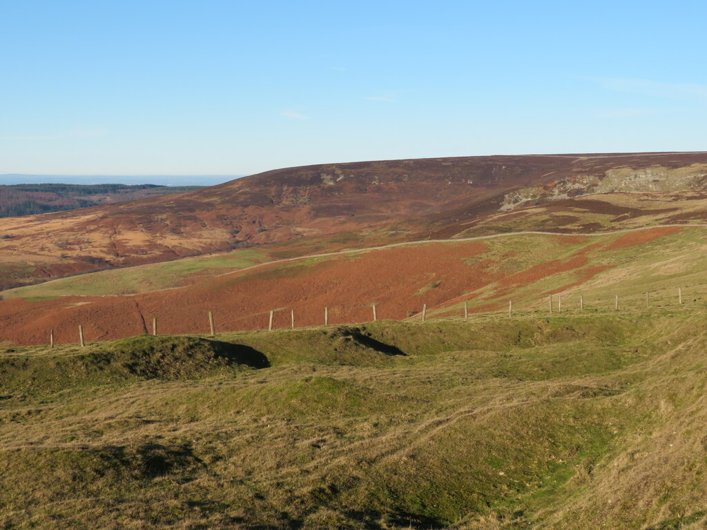
Shallow pits and quarries lie along the escarpment at the head of Kepwick Bank.
Shallow pits and old limestone quarries on the escarpment; the site of the shaft is not identified.
Redevelopment
None.
Nearby mines
- Weather Cote Colliery — 5.1 miles (8.2 km) E
Straight-line distance, within 9 miles (15 km). Show on the map.
Recorded claims
Individual factual claims, each attached to the source(s) that support it below. Where sources disagree, both are kept.
- In 1762 William Mothersill, who was quarrying and burning limestone on the escarpment at Kepwick, found a seam of lime coal 16 to 17 inches thick in a shaft 117 feet deep. 1,2
- Mothersill sought a lease of five or seven years at £6 a year from Lord Fauconberg, who was to give four or five trees for a gin. 1,2
- In April 1763 the men working the first pit feared the seam was running out; they had agreed to get 400 chaldrons a year at about six shillings a chaldron, sold at the kilns for ten. 1
- Kepwick Colliery opened in 1762 and closed in 1763, with William Mothersill as owner. 3
- The colliery is placed at SE 448045 490460 in Cowesby. 2
Photographs & further reading
The Northern Mine Research Society's page, from the Fauconberg papers.
View sourceGill's survey of the moorland coal pits, with a gazetteer of grid references.
View sourceSources
- (secondary) Kepwick Colliery, Cowesby — Northern Mine Research Society
- (secondary) The North Yorkshire Moors Coalfields (M. C. Gill, Mining History vol. 17 no. 6, 2010) — Peak District Mines Historical Society
- (secondary) Kepwick Colliery, Hambleton, North Yorkshire — Mindat
- (observational) Old quarries at the head of Kepwick Bank (photograph, 2022) — Geograph
Record created: 16 October 2026 · Last researched: 21 October 2026