 MineArchive
Fordel Mains Colliery
| Also known as | Bryan's Splint Mine, Fordel Mine, Fordel Coal Mine |
|---|---|
| Location | Fordel Mains, near Dalkeith, Midlothian — 55.8910, -3.0201 (approximate) |
| Commodity | Coal |
| Type | Coal |
| Worked | Returned from 1920; sinking date not established–Last return 1940; closure date not established |
| Operators | Fordel Mains (Midlothian) Colliery Co., Ltd. |
Overview
Fordel Mains, beside the Fordel Mains farm outside Dalkeith, was a small Midlothian pit working Bryan's Splint, the Five Feet and the Kailblades for household coal. It grew slowly from 67 people in 1920 to 219 by 1940. Bryan's Splint is a seam name rather than a place: it was first got at Bryans on the edge of Newtongrange and followed east to here.
History
The colliery appears in the Mines Inspectors' returns from 1920 under the Fordel Mains (Midlothian) Colliery Co. Ltd, sending out household coal from Bryan's Splint, the Five Feet and the Kailblades. It was small and growing: 67 people in 1920, 35 of them below ground, then 145 in 1923, 180 in 1933 and 219 by 1940. Bryan's Splint, the seam that gave the workings their alternative name, was one of the most extensively worked seams of the Limestone Coal Formation in the Midlothian coalfield. It takes its name from the village of Bryans, some way west on the outskirts of Newtongrange, where it was presumably first got; the same vein was followed here. The nineteenth-century accounts of the ground are vaguer: two seams had been seen at Fordel, dipping east, the lower said to be three feet thick and the other two feet eight inches with a parting of fireclay, but their outcrop was not well enough established to be mapped and neither could be matched with a named seam. Two deaths are recorded here in the inspectors' reports, and both turn on haulage. Walter Brown, a repairer of 62, was working in a main heading at one in 8.5 on 19 May 1924 when a loaded tub ran away from the highest of four branches above him, travelled 144 feet and struck him before he could clear. His skull was fractured against the side and he died an hour later. The fireman told the inquiry the repair was not urgent, and that had it been left to a less busy time of day the accident might not have happened. Patrick Gillespie, a brusher of 26, was killed by a fall of material at the coal face on 29 September 1933. The same company later held Edgehead colliery nearby, and also worked Easterlees near Dalkeith.
Geology
Fordel Mains worked the Limestone Coal Formation of the Midlothian coalfield. The seams returned are Bryan's Splint, the Five Feet and the Kailblades. Bryan's Splint was among the most extensively worked seams of that formation and is named for the village of Bryans near Newtongrange rather than for anything at Fordel. Nineteenth-century accounts of the ground here describe two seams dipping east, the lower about three feet thick and the upper two feet eight inches with a parting of fireclay, neither traceable to a named seam.
Geological setting: Sedimentary Beds and Seams (well documented example)
Workings
A main heading at a gradient of one in 8.5 served four branches of a machine run above the point where a repairer was killed by a runaway tub in 1924, which is the clearest description of the underground layout in anything read. The site of No. 1 shaft has been placed between the filling station at Fordel and the Cowden Bog woods, with a nineteenth-century shaft marked on historic Ordnance Survey maps on the other side of the road. Shaft depths have not been found.
Closure
No closure date has been established. The colliery's last appearance in the returns read for this record is 1940.
What remains
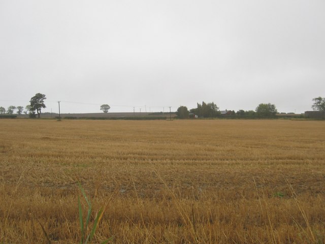
The colliery has been demolished. The Fordel filling station stands beside its former grounds, with the site of No. 1 shaft between the station and the Cowden Bog woods. The ground around is farmland.
Nearby mines
- Smeaton Colliery — 1.6 km N
- Carberry Colliery — 3.1 km N, East Lothian
- Easthouses Pit — 3.1 km SW
- Monktonhall Colliery — 3.7 km NW
- Limeylands Colliery — 3.8 km NE, East Lothian
Straight-line distance, within 15 km. Show on the map.
Recorded claims
Individual factual claims, each attached to the source(s) that support it below. Where sources disagree, both are kept.
- The Scottish Cave and Mine Database places the colliery at NT 363 669 beside Fordel Mains outside Dalkeith, with the site of No. 1 shaft between the Fordel filling station and the Cowden Bog woods. The Durham Mining Museum gives the location as Dalkeith but prints a grid reference, NT159894, which falls in Fife near Crossgates, some twenty miles away and close to the separate Fordell estate. The Dalkeith location is the one the company name and every other detail support. (disputed) 1,2
- Bryan's Splint is the type of coal, not the name of the mine. The village of Bryans lies some distance west of Fordel on the outskirts of Newtongrange, and the seam was presumably first extracted at Bryans' coal mine, the same vein then being worked here. 2
- Walter Brown, a repairer of 62, was killed on 19 May 1924 in a main heading of gradient one in 8.5 serving four branches of a machine run. A loaded tub ran away from the highest branch, travelled 144 feet and struck him; his skull was fractured against the side and he died an hour later. The fireman said the repair was not urgent and that had it been left to a less busy time of day the accident might not have occurred. 1
Photographs & further reading
The Grampian Speleological Group's site record: the grid reference, the alternative names, the site of No. 1 shaft against the modern landmarks, and a nineteenth-century description of the two seams seen at Fordel.
View sourceThe owner, output and employment from 1920 to 1940, the three seams worked, and the inspectors’ accounts of the two recorded deaths.
View sourceSources
- (secondary) Fordel Mains Colliery — Durham Mining Museum
- (secondary) Fordel Coal Mine — Scottish Cave and Mine Database, Grampian Speleological Group
- (observational) Stubble field at Fordel Mains (Geograph 2079566) — Geograph Britain and Ireland, James Denham
Record created: 11 September 2026 · Last researched: 11 September 2026