 MineArchive
Dyneley Colliery
| Also known as | Dyneley Knoll, Dyneley Knoll Colliery |
|---|---|
| Location | Cliviger, south-east of Burnley, beside the Burnley to Bacup road, Lancashire — 53.7540, -2.2130 (exact) |
| Commodity | Coal |
| Type | Coal |
| Worked | Late 1800s–1987 |
| Maximum depth | Unknown. |
| Operators | Deerplay Colliery Co. Ltd (?–1947), Teak Flow Ltd (1984–1987), Towneley Coal Co. |
Overview
A small drift colliery at Cliviger, south-east of Burnley, working the Upper Mountain mine for the Towneley and Deerplay companies until 1947 and briefly reopened in the 1980s.
History
Dyneley Colliery, also called Dyneley Knoll, lay at Cliviger beside the Burnley to Bacup road, its drift running into the hillside beneath the road. The Towneley Coal Company opened it, and it was one of the three satellite pits of the company's Towneley Colliery; for most of its working life it was sold to and run by the Deerplay Colliery Company. It worked the Upper Mountain mine. Coal was carried along a tramway in small trucks to a staithe above an old sandstone quarry, where it was tipped through a metal hopper into wagons waiting below.
The colliery closed in 1947, its Upper Mountain workings abandoned that year. In 1984 a private venture, Teak Flow Ltd, reopened it, driving a new drift into the remaining pillars of the Upper Mountain; geological problems and inexperience soon ended that, and the company reopened the original drift intending to extend it down into the Union seam below. Short of money and experience, the whole project was abandoned in 1987. The mine proved almost worked out.
Geology
The Lower Coal Measures of the Burnley coalfield: the Upper Mountain mine, with the Union seam beneath it.
Workings
A drift into the hillside, with a tramway to a coal staithe and hopper above a former sandstone quarry; a second drift driven into the old pillars in 1984.
Closure
Closed in 1947 before nationalisation; the 1980s reworking was abandoned in 1987.
What remains
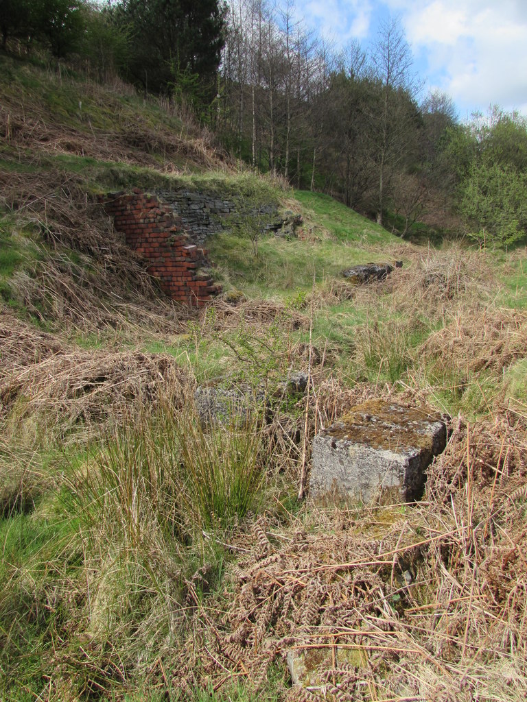
Scant remains of the winding house and boiler house stand on the hillside, and the drift has been deliberately blocked. The concrete and steel of the coal staithe survive among trees above the old quarry.
Brick and stone walls of the winding house and boiler house; the concrete and steel coal staithe and hopper.
Related mines
- Deerplay Colliery — Both were worked by the Deerplay Colliery Company.
- Towneley Colliery — Dyneley Knoll was one of Towneley Colliery's three satellite pits, both opened by the Towneley company.
Nearby mines
- Railway Pit — 0.8 miles (1.3 km) NE
- Thieveley Lead Mine — 1.0 miles (1.5 km) SE
- Union Pit — 0.9 miles (1.5 km) N
- Deerplay Colliery — 1.5 miles (2.4 km) SE
- Nabb Colliery — 1.6 miles (2.6 km) S
Straight-line distance, within 9 miles (15 km). Show on the map.
What's uncertain
Points where sources disagree or the record could not be settled; both accounts are kept. All open questions in the archive.
- The Towneley Coal Company opened Dyneley Colliery in the late 1800s. (disputed) 1
- Dyneley is listed as working from 1930. (disputed) 2
- The mine was reworked for a short time in the late 1970s and early 1980s. (disputed) 6
Recorded claims
Individual factual claims, each attached to the source(s) that support it below. Where sources disagree, both are kept.
- The Towneley Coal Company opened Dyneley Colliery in the late 1800s. (disputed) 1
- Dyneley is listed as working from 1930. (disputed) 2
- For most of its life the colliery was run by the Deerplay Colliery Company. 1
- Dyneley Knoll was one of the three satellite pits of Towneley Colliery. 3
- It worked the Upper Mountain mine, abandoned in 1947. 1,4
- Teak Flow Ltd reopened the mine in 1984 and abandoned the project in 1987. 1,5
- The mine was reworked for a short time in the late 1970s and early 1980s. (disputed) 6
Sources
- (secondary) The Fringe Collieries of the Towneley Coal Company, Cliviger — Northern Mine Research Society
- (secondary) NCB Collieries - England (Northern Mine Research Society) — Northern Mine Research Society
- (secondary) Burnley Coalfield — Wikipedia — Wikipedia
- (primary) BGS mine plan: DYNELEY, Upper Mountain, abandoned 1947 — British Geological Survey / Mining Remediation Authority
- (primary) BGS mine plan: DYNELEY, adits only, 1985 — British Geological Survey / Mining Remediation Authority
- (observational) Winding House & Boiler House (Matthew Hatton, 2017) — Geograph
Record created: 24 October 2026 · Last researched: 24 October 2026