 MineArchive
Crossgreen Mines
| Location | Crossgreen, Uphall parish, West Lothian — 55.9348, -3.5124 (approximate) |
|---|---|
| Commodity | Oil Shale |
| Type | Mineral |
| Worked | c. 1885–1895–1910 |
| Operators | Broxburn Oil Company Ltd (?–1910, owner) — Owned the mines and the Broxburn oil works they supplied |
Three inclined shale mines of the Broxburn Oil Company at Crossgreen, also called the Binny Mines, driven steeply into a shallow anticline from about 1885 and abandoned between 1895 and 1910.
Location
Approximate location. The large pin is this mine; the small round markers are the nearest mines on record. Click one for its page. View on full map
History
The Crossgreen Mines, sometimes called the Binny Mines, were three inclined mines of the Broxburn Oil Company, opened about 1885 at the centre of a shallow anticline in the Broxburn Shales. From Crossgreen No. 1 adits were driven to the south at a gradient of 1 in 3.9 and to the south-east at 1 in 2.3; from No. 2 to the north at 1 in 4; and from No. 3 to the north-west at 1 in 2. Haulages brought the output of all three to Crossgreen, where the shale was loaded onto standard-gauge wagons and taken by mineral railway to the company's works at Broxburn.
No. 2's workings in the Broxburn Shale were abandoned in 1895 and No. 3's in the Broxburn Curly Shale in 1899. No. 1 lasted longest, working the Broxburn, Grey, Upper Grey and Curly Shales until 1910. A waste bing and the course of the railway remain, and south of No. 1 the ground has subsided in a pattern that traces the stoop and room workings below.
Geology
The Broxburn Shales (Broxburn, Curly, Grey and Upper Grey) at the centre of a shallow anticline.
Workings
Three inclined mines: adits from No. 1 south at 1 in 3.9 and south-east at 1 in 2.3, from No. 2 north at 1 in 4 and from No. 3 north-west at 1 in 2; haulages to a loading point at Crossgreen and a standard-gauge mineral railway to Broxburn; stoop and room.
Closure
No. 2 was abandoned in 1895, No. 3 in 1899 and No. 1 in 1910.
What remains
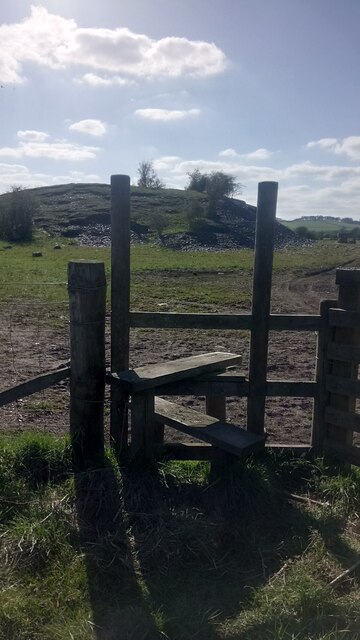
A waste bing and the course of the mineral railway are still apparent, with an area of considerable subsidence south of No. 1.
A waste bing and the course of the mineral railway.
Related mines
- Broxburn Oil Works — The Crossgreen Mines supplied shale by mineral railway to the Broxburn Oil Company's works.
Nearby mines
- Carledubs Mine — 0.4 miles (0.7 km) NE
- Roman Camp No. 4 Pit — 0.9 miles (1.4 km) SE
- Pyothall No. 5 Pit — 1.4 miles (2.2 km) E
- Holmes Mine — 1.5 miles (2.5 km) SE
- Roman Camp No. 3 Mine — 1.6 miles (2.5 km) SE
Straight-line distance, within 9 miles (15 km). Show on the map.
Recorded claims
Individual factual claims, each attached to the source(s) that support it below. Where sources disagree, both are kept.
- The Crossgreen Mines, sometimes called the Binny Mines, were three inclined mines of the Broxburn Oil Company opened about 1885. 1
- Adits were driven from No. 1 at 1 in 3.9 and 1 in 2.3, from No. 2 at 1 in 4 and from No. 3 at 1 in 2. 1
- Haulages brought the output of all three mines to Crossgreen, where it was loaded onto standard-gauge wagons for Broxburn. 1
- No. 2 was abandoned in 1895, No. 3 in 1899 and No. 1 in 1910. 1,2,3,4
Photographs & further reading
The Museum of the Scottish Shale Oil Industry's page for the mines, with a workings map, photographs of the bing, railway and subsidence, and the abandonment references.
View sourceSources
- (secondary) Crossgreen No.1, 2 & 3 mines (Scottish Shale) — Scottish Shale (Museum of the Scottish Shale Oil Industry)
- (primary) BGS mine plan: CROSSGREEN, Broxburn, Grey and Curly seams, abandoned 1910 — British Geological Survey
- (primary) BGS mine plan: CROSSGREEN NO.2, Broxburn seam, abandoned 1895 — British Geological Survey
- (primary) BGS mine plan: CROSSGREEN NO.3, Broxburn and Curly seams, abandoned 1899 — British Geological Survey
Record created: 26 October 2026 · Last researched: 3 November 2026