 MineArchive
Carledubs Mine
| Location | Near Uphall Church, between Uphall and Ecclesmachan, West Lothian — 55.9396, -3.5051 (approximate) |
|---|---|
| Commodity | Oil Shale |
| Type | Mineral |
| Worked | c. 1885–1922 |
| Operators | Broxburn Oil Company Ltd (owner) — Owner (Scottish Shale; DMM b332) Scottish Oils Ltd (owner) — The combine that took in the Broxburn company; its managing director decided against reopening in 1924 (Scottish Shale) |
Overview
A Broxburn Oil Company shale mine near Uphall Church, opened about 1885 at the western edge of the company's field and joined to Broxburn Oil Works by its own railway, which worked the Broxburn Shales until 1922.
History
Carledubs Mine, near Uphall Church, was opened by the Broxburn Oil Company about 1885 at the extreme west of its mineral field. The company's eleventh annual meeting, in May 1888, heard that its recent expenditure had gone chiefly on opening up the Carledubs mines and on making a railway a mile and a half long to connect them with the works. Two adits were driven into the Broxburn Shale, heading to the south and east of the mine head, and the shale ran to Broxburn Oil Works on the standard-gauge mineral railway. An Ordnance Survey map of about 1926 appears to show a tramway running north from Carledubs towards Wyndford, where sketch maps show an adit dipping east into the Broxburn Shale, probably an extension of the Carledubs workings.
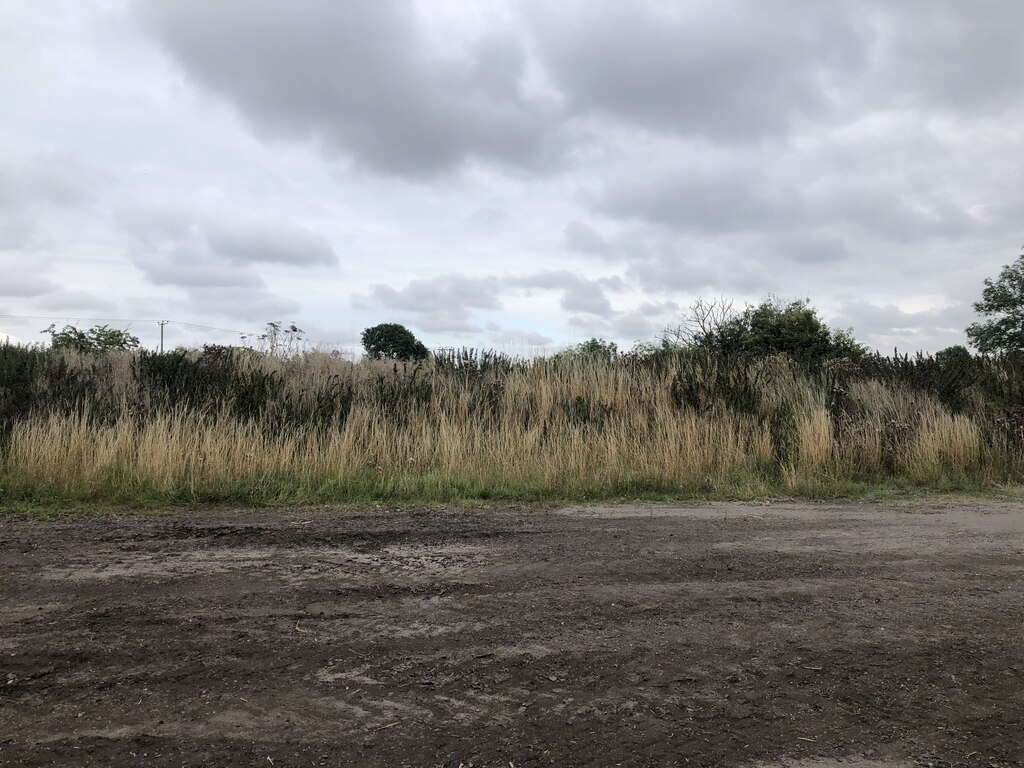
Carledubs employed 117 people in 1915, 133 in 1920 and 132 in 1923. Its workings in the Curly, Broxburn and Grey shales were abandoned in 1922, and in May 1924 Scottish Oils' managing director reported that reopening the mine would not pay and that its plant was being removed for use elsewhere. The site has since been levelled and is waste ground with shrubs; nothing remains of the surface buildings.
Geology
The Broxburn Shales (Curly, Broxburn and Grey) at the western edge of the Broxburn district.
Workings
Two inclined adits heading south and east from the mine head; a mile-and-a-half standard-gauge mineral railway to Broxburn Oil Works; probably an adit at Wyndford reached by a tramway.
Closure
The workings were abandoned in 1922; in 1924 Scottish Oils judged that reopening would not pay and removed the plant.
What remains
Levelled waste ground with shrubs.
No trace of the surface buildings; an area of hard standing marks the site.
Related mines
- Broxburn Oil Works — Carledubs sent its shale to Broxburn Oil Works by its own mile-and-a-half railway.
Nearby mines
- Roman Camp No. 4 Pit — 1.0 miles (1.7 km) S
- Haycraigs Mines — 1.2 miles (1.9 km) NE
- Broxburn Oil Works — 1.4 miles (2.3 km) E
- Hopetoun No. 5 Pit — 1.4 miles (2.3 km) NE
- Hopetoun No. 35 Pit — 1.6 miles (2.5 km) N
Straight-line distance, within 9 miles (15 km). Show on the map.
Recorded claims
Individual factual claims, each attached to the source(s) that support it below. Where sources disagree, both are kept.
- Carledubs was opened up by the Broxburn Oil Company in the 1880s, with a railway a mile and a half long connecting it to the works, reported in 1888. 1
- Two adits were driven into the Broxburn Shale, heading south and east of the mine head. 1
- Carledubs employed 117 in 1915, 133 in 1920 and 132 in 1923. 2
- The workings were abandoned in 1922, and in 1924 the plant was removed as reopening would not pay. 1,3
Photographs & further reading
The Museum of the Scottish Shale Oil Industry's page for this mine, with maps, plans, site photographs and newspaper extracts.
View sourceSources
- (secondary) Carledubs mine (Scottish Shale, Museum of the Scottish Shale Oil Industry) — Almond Valley Heritage Trust
- (primary) Broxburn (Oil Shale) (Durham Mining Museum) — Durham Mining Museum
- (primary) BGS mine plan: CARLEDUBS, Broxburn Shale, abandoned 1922 — British Geological Survey / Mining Remediation Authority
Record created: 26 October 2026 · Last researched: 26 October 2026