 MineArchive
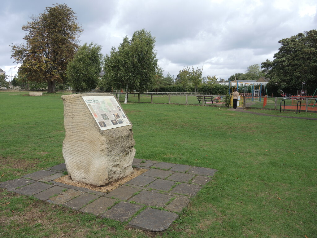
Combe Down Stone Mines
| Location | Combe Down, Bath, Somerset — 51.3597, -2.3564 (approximate) |
|---|---|
| Commodity | Limestone |
| Type | Stone |
| Worked | By 1730–1860s |
| Maximum depth | workings up to c. 20m deep, extending under the whole village |
| Operators | Ralph Allen, Philip Nowell |
Overview
A vast network of underground Bath stone workings beneath the village of Combe Down, developed by Ralph Allen from the 1720s to supply the stone that rebuilt Georgian Bath — later left so unstable by 19th-century pillar-robbing that Bath & North East Somerset Council spent ten years and over 400,000 cubic metres of foamed concrete backfilling the mines to save the houses above them.
History
Ralph Allen began buying land on Combe Down in 1726 and had acquired quarrying rights across the hill by 1729, developing what became four merging workings — Firs Quarry, Byfield Mine, Allotments Quarry and Coxe's Quarry — collectively known as Combe Down Quarry, eventually covering more than 10 hectares underground. Allen built a horse-drawn tramway down to the Kennet & Avon Canal to move stone into Bath, and used his own product to build Prior Park, Queen Square and the Royal Mineral Water Hospital, proving Bath stone's quality to the architects rebuilding the city. He also built De Montalt Place, a terrace of eleven cottages designed by John Wood the Elder, to house his quarrymen. Oxford Archaeology's recording found that stone was certainly being quarried here in the early 18th century — a graffito of 1730 in the far eastern Firs workings points to a pre-Allen date there — and perhaps as far back as the Roman period, but that the first large-scale exploitation was Allen's, between about 1730 and his death in 1764, bringing new techniques and an industrial organisation to the work. After his death his heir, the Earl de Montalt, sold off the tramway and cranes and turned Combe Down into a health resort rather than continuing to work the stone commercially, and the quarrying passed to a number of independent quarrymasters or freemasons. It revived strongly in the 19th century, much of it in the Byfield Mine to the west under the entrepreneur Philip Nowell, who built himself Rock Hall in the village and worked with John Nash, the Wyatts and Sir Jeffry Wyatville; Combe Down stone went into parts of Longleat and Windsor Castle, the west front of Buckingham Palace, the cladding of Apsley House and the Duke of York's Column. The cutting of the Box railway tunnel in the 1830s exposed the larger freestone beds of Wiltshire, and with rail-served quarries there taking the trade the major underground workings at Combe Down ceased in the 1860s, though small workings on the fringes of the parish, above and below ground, went on into the 1930s. No records of the workings were made before the 1872 Mining Act. The Irvings Incline, a slope entry into the West Byfield workings made early in the 19th century, was used for storage and as an air-raid shelter after quarrying finished. William Smith, the father of English geology, was living at Tucking Mill on the southern edge of the village, as surveyor to the Somerset Coal Canal, when he produced one of the first geological maps. By the late 20th century, decades of unrecorded and often reckless extraction — stone quarrymen routinely 'robbing' the pillars left to support the roof — had left the workings dangerously unstable; when roof falls at Firs Quarry began causing subsidence above ground, a 1994 survey found some 80% of the underground workings had less than 6m of rock cover, in places as little as 2m, directly beneath occupied housing. Oxford Archaeology was called in to record the workings before and during a ten-year council stabilisation project (1999–2009) that backfilled 25.6 hectares of mine with foamed concrete, protecting 649 properties above: between November 2000 and August 2008 its archaeologists kept a watching brief as a network of supported roadways was driven through the quarries, first for safe access and then for the filling, recording by drawing, photography, laser scanning and video — the first time in Britain that a professional archaeological body had examined underground quarries on such a scale.
Geology
The mines work the fine-grained oolitic limestone known as Bath stone, part of the Great Oolite Group, quarried both as a building freestone and, at Combe Down, mined entirely underground rather than opened at the surface. Fracture patterns in the rock played a direct part in the site's later instability: where natural fractures ran parallel to the long axis of a mined chamber, a greater span of unsupported stone was left along the joint, making roof collapse more likely.
Workings
Stone was worked by the room-and-pillar ('pillar and stall') method — parallel chambers cut with hand saws and picks, leaving regularly spaced pillars of unmined stone to hold up the roof — with blocks hauled out along underground tramways to Allen's surface railway. Later working was far less disciplined than Allen's own operation: smaller 19th-century quarrymen frequently cut pillars back for extra stone, weakening the very supports the whole system depended on.
Closure
The central underground quarries were worked out and undercut by the Wiltshire freestone opened up by the Box Tunnel in the 1830s; the major workings stopped in the 1860s and the last small fringe quarries in the 1930s. The stone was, in the Heritage Society's words, gradually depleted.
What remains
No public access to the underground workings, which are now almost entirely backfilled with foamed concrete; the stabilisation is considered permanent. The Museum of Bath Stone, opened in 2014 as the stabilisation project's legacy, tells the mines' story and is open to the public on a limited weekly schedule. The wider mine complex is a Site of Special Scientific Interest for its bat population — the constant temperature and darkness of the remaining voids provide winter hibernation roosts for greater and lesser horseshoe bats.
De Montalt Place, Ralph Allen's terrace of quarrymen's cottages, still stands above ground, along with scattered blocked and gated mine entrances around the village; almost everything underground is now sealed beneath concrete fill.
Nearby mines
- Dunkerton Colliery — 2.9 miles (4.6 km) SW
- Browns Folly Mine — 3.5 miles (5.6 km) NE
- Monkton Farleigh Quarry — 3.9 miles (6.2 km) NE, Wiltshire
- Braysdown Colliery — 4.5 miles (7.2 km) SW
- Camerton Colliery — 4.8 miles (7.8 km) SW
Straight-line distance, within 9 miles (15 km). Show on the map.
Recorded claims
Individual factual claims, each attached to the source(s) that support it below. Where sources disagree, both are kept.
- A 1994 survey found around 80% of the underground workings had less than 6m of rock cover above them, as little as 2m in places, directly beneath the village; the resulting stabilisation project (1999-2009) backfilled 25.6 hectares of mine with foamed concrete to protect 649 properties. 1
- James Cottle, a quarryman working for a later operator, was killed when a stone block set on edge toppled onto him after being struck by another stone being moved by crane — a single-fatality accident, not treated here as a qualifying mining disaster given the significance bar this site applies. 2
- The four merging workings that make up Combe Down Quarry — Firs Quarry, Byfield Mine, Allotments Quarry and Coxe's Quarry — together cover more than 10 hectares underground. 3
- Stone was certainly being quarried at Combe Down in the early 18th century, but the first large-scale exploitation was under Ralph Allen between about 1730 and 1764. 4
- Underground quarrying in central Combe Down continued until the 1860s, and surface and underground quarrying on the fringes of the parish until the 1930s. 4
- The 19th-century revival of the Byfield Mine was led by the entrepreneur Philip Nowell, who built Rock Hall in the village and supplied stone for Buckingham Palace's west front and Apsley House. 5
- The cutting of the Box railway tunnel in the 1830s revealed new sources of oolitic freestone and brought about the decline of the Combe Down underground workings. 5
Photographs & further reading
The full archaeological monograph on the Combe Down stone mines, free to download from Oxford Archaeology's library.
View sourceThe society's account of the mines, Ralph Allen, Philip Nowell's Byfield Mine and the stabilisation project, with its publications.
View sourceSources
- (secondary) The Stabilisation of Combe Down Stone Mines — Museum of Bath Stone
- (secondary) Hollowed Ground: the archaeology of Bath's stone mines — The Past / Current Archaeology
- (secondary) Building Bath with the best stone from Combe Down quarries — Prior to Now on Combe Down
- (primary) 'Finished Labour of a Thousand Hands': The archaeology of the Combe Down Stone Mines, Bath, Somerset (Oxford Archaeology Monograph 13, prelims and summary) — Oxford Archaeology
- (secondary) The Story of the Stone Mines — Combe Down Heritage Society
- (primary) Abandoned mine plan catalogue entry: MINES AT MONKTON COMBE — FIRS, BYFIELD, COMBE DOWN MINES — British Geological Survey
- (secondary) Combe Down and Bathampton Down Mines — Wikipedia
- (secondary) Our story — Museum of Bath Stone
Record created: 21 August 2026 · Last researched: 22 September 2026