 MineArchive
Chellaston Alabaster Mines
| Location | Chellaston, Derby, Derbyshire — 52.8686, -1.4494 (approximate) |
|---|---|
| Commodity | Gypsum |
| Type | Mineral |
| Worked | early 14th century–1978 |
| Maximum depth | shallow adits and shafts |
Overview
Medieval England's principal source of alabaster, mined at Chellaston from the early 14th century to supply the Nottingham workshops whose small religious carvings were exported across Europe — a trade that collapsed almost overnight when the Reformation outlawed the imagery it depicted.
History
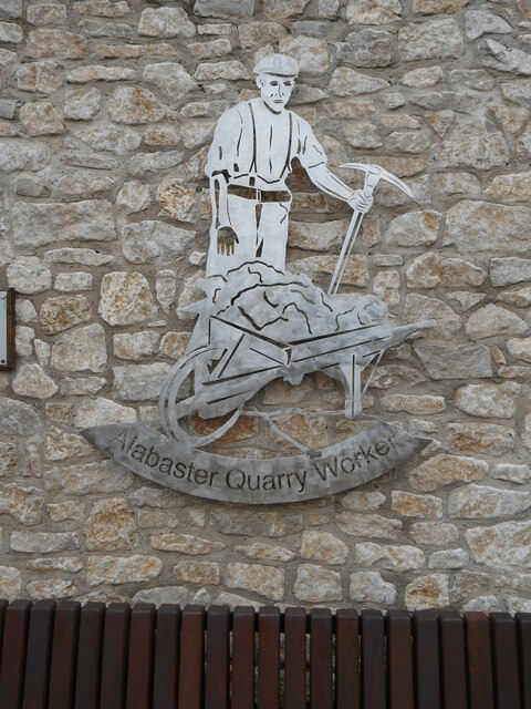
Alabaster was being quarried and mined at Chellaston by the early 14th century, and the settlement — alongside Tutbury in neighbouring Staffordshire — became one of the two principal sources of the material used in England's medieval alabaster carving industry. Blocks were hauled to the River Trent and shipped out via Hull to buyers across continental Europe. Chellaston stone itself was generally sent to nearby Nottingham to be carved, where workshops turned out small, mass-produced devotional panels and figures — 'Nottingham alabaster' — while the finest blocks, destined for royal or otherwise prestigious tombs, went to the large London workshops instead. The trade was at its height between about 1360 and 1460; more than 3,000 surviving carvings have since been identified overseas, with a substantial collection, much of it originally Chellaston stone, now held by the Victoria and Albert Museum. Output fell sharply after a 1550 Act ordered the removal of Catholic religious imagery from English churches, destroying the industry's main market almost overnight; a modest Victorian revival followed, but good-quality alabaster became increasingly hard to find after the Second World War. Later working shifted toward plain gypsum rather than ornamental alabaster, alongside clay dug locally for brickmaking — by 1953 the associated brickworks was turning out some 120,000 bricks a week — until all commercial extraction at Chellaston finally ceased in 1978.
Geology
The alabaster is the fine-grained, translucent ornamental form of gypsum, part of the Tutbury Gypsum bed — laid down as thick evaporite deposits where ancient seawater dried out, reaching up to 8.4m thick across the wider district. The purest white alabaster lay closest to the surface, which is what made it comparatively easy to reach; coloured alabaster, less prized but still worked, occurred at greater depth.
Geological setting: Evaporite Deposits (well documented example)
Workings
Access to the workings was by adits and shafts driven into the hillside or into the face of what became Woodlands Quarry, following the gypsum bed at whatever depth the best material lay. Aston No. 1 Mine, one of the district's other gypsum workings, was largely worked out by 1870 and was formally abandoned — with an abandonment plan lodged under the 1872 Mines Act, as the law required — in 1937.
Closure
The alabaster and gypsum workings were exhausted, later working shifting to plain gypsum and to clay dug for brickmaking.
What remains
Chellaston's exhausted alabaster and gypsum workings have not survived as open or visitable mine voids; the former quarry ground and the associated brickworks site have instead been reclaimed as a nature reserve and wildlife habitat.
No workings or structures survive above ground associated with the medieval mining itself; what remains is the reclaimed quarry landscape rather than any built heritage.
Nearby mines
- New Lount Colliery — 7.2 miles (11.5 km) S, Leicestershire
- Granville Colliery — 8.0 miles (12.9 km) SW
- Wollaton Colliery — 8.0 miles (12.9 km) NE, Nottinghamshire
- Swadlincote Colliery — 8.4 miles (13.5 km) SW
- Califat Coal Mine — 8.5 miles (13.7 km) S, Leicestershire
Straight-line distance, within 9 miles (15 km). Show on the map.
Recorded claims
Individual factual claims, each attached to the source(s) that support it below. Where sources disagree, both are kept.
- The alabaster of the Nottingham carving industry was quarried largely around Tutbury and Chellaston; the industry flourished from the fourteenth century until the early sixteenth, exporting religious carvings across Europe, above all to France. 1
- The purest white alabaster at Chellaston's Woodlands Quarry lay close to the surface, with coloured deposits deeper down worked until new white layers were found; the trade peaked between about 1360 and 1460 and died away after the Act of 1550 banned images. 2
- Centuries of extracting alabaster and gypsum at the Woodlands Quarry meant removing great quantities of clay, little used until brickmaking began in the later nineteenth century. 2
- The Mining Remediation Authority holds abandonment plan OM923 for the gypsum workings at Chellaston, with a second Chellaston plan and one for Chellaston Glebe beside it. 3
- A British Geological Survey report on the gypsum geology, quarrying and mining of the Chellaston and Aston-on-Trent area maps the old mines, one of them lying beside the houses of Marsh Flatts Farm. 4
Photographs & further reading
A local account of the Woodlands Quarry, the medieval alabaster trade and the later brickworks.
View sourceSources
- (secondary) Nottingham alabaster — Wikipedia
- (secondary) Chellaston | Alabaster Industry — Discover Derby
- (primary) CHELLASTON (Mine Remediation Authority abandonment plan OM923, BGS mine plans catalogue) — British Geological Survey / Mining Remediation Authority
- (observational) The Gypsum Mines of Chellaston — Marsh Flatts Farm Self Build Diary
- (primary) Gypsum: geology, quarrying, mining and geological hazards in the Chellaston and Aston-on-Trent areas — British Geological Survey
Record created: 22 August 2026 · Last researched: 24 September 2026