 MineArchive
Blaenceulan Mine
| Also known as | Blaen Ceulan Mine |
|---|---|
| Location | Head of Cwm Ceulan, east of Talybont, Ceredigion — 52.4973, -3.8928 (exact) |
| Commodities | Lead, Copper |
| Type | Metal |
| Worked | from 18th century |
Blaenceulan was a small lead mine at the head of Cwm Ceulan, in the hills east of Talybont, with an adit driven 120 fathoms into the Gwestyn shales to an engine shaft. The shaft was on what is probably the most northerly branch of the Esgairhir lode. It worked one rather rich bunch of ore, returning 438 tons of lead ore over eight years, of which 250 tons came in 1871.
Location
Recorded location. The large pin is this mine; the small round markers are the nearest mines on record. Click one for its page. View on full map
History
There are eighteenth-century workings at Blaenceulan, and an old shaft and adit near the farm that seem never to have found anything. The mine proper is a nineteenth-century one and a small one. Its adit was driven about 120 fathoms west to an engine shaft, and everything that was done underground kept close to a single bunch of lead ore, a rich one, with a good deal of copper pyrites and some blende beside the galena.
Lead ore was returned for eight years. The total was 438 tons, with 18 tons of copper ore and 7 of blende, and more than half of it, 250 tons, was raised in the single year 1871. A steam engine was put up at some stage, and its site can still be made out among the wheelpits and dressing floors.
Geology
The lode appears to be the most northerly branch of the split-up Esgairhir lode. In the engine shaft it dips steeply north and runs about west 30 degrees north, through Gwestyn shales. Its lead ore comes with a considerable amount of copper pyrites and some blende, as is usual in lodes that cross those rocks.
Geological setting: Veins and Lodes (well documented example)
Workings
An adit at about 1,000 feet above sea level runs about 120 fathoms west into the Gwestyn shales to an engine shaft sunk in the same rocks. Near Blaenceulan farm there is an old shaft and an adit on another branch of the lode.
Closure
The best year was 1871; the last of the eight years of returns is not recorded.
What remains
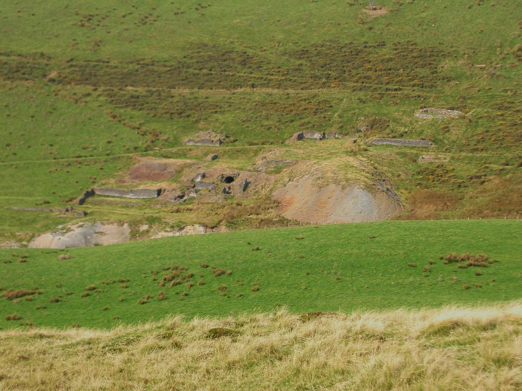
In 2011 an adit mouth stood open in the hillside above a bank of pale spoil, with the low footings of walls on the grass around it.
The site of a steam engine, dressing floors, wheelpits, shafts and levels.
Nearby mines
- Bwlch Glas Mine — 1.2 miles (1.9 km) SW
- Esgair Hir and Esgair Fraith Mines — 1.2 miles (1.9 km) NE, Powys
- Eaglebrook Mine — 1.4 miles (2.3 km) SE
- Hafan Mine — 1.8 miles (2.9 km) SE
- Rhyd Fach Mine — 1.8 miles (2.9 km) SE
Straight-line distance, within 9 miles (15 km). Show on the map.
Further reading
The Royal Commission's site record, with photographs of the workings from 1967 onward.
View sourceSources
- (primary) Blaen Ceulan Lead Mine (NPRN 33803) — Coflein, Royal Commission on the Ancient and Historical Monuments of Wales
- (primary) Lead and Zinc: The Mining District of North Cardiganshire and West Montgomeryshire (Special Reports on the Mineral Resources of Great Britain, vol. XX), O. T. Jones, 1922 — Memoirs of the Geological Survey
- (observational) Blaen Ceulan Mine (Geograph photograph 2618180, 2011) — Geograph
- (primary) Mine plan: Blaenceulan Mine, SN79SW 3, notes 1872 (KP16978) — British Geological Survey
Record created: 18 November 2026 · Last researched: 18 November 2026